While it doesn’t seem that long ago that I made my last post, I was kind of surprised when I realized it had been a month and a half. This is always the hardest time of the year to come up with interesting runs, worthy of description on a trail running blog. The trails are usually a crusty, icy mess, and the snow has receded to the point where skiing is no longer an option. So, I was forced to the roads (or worse still, to the treadmill), and frankly, I don’t feel any need to bother writing about our intermittently muddy or icy roads in March. After last week’s “Late April Fool” snowstorm, I was beginning to wonder if I would ever get back to the trails! However, a few slightly warmer days, and some Saturday afternoon sun on the day before Easter brought hope of a real spring, and set me out in search of a good long run. While significant mud was a given, I was more concerned that I might find ice and snow at higher altitudes, especially in shady hollows, so I headed to one of my favorite lower altitude starting points, the Falls of Lana trailhead just south of Branbury State Park on the Lake Dunmore Road (Rt 53). En route to the trailhead, I was amazed how fast the ice on Lake Dunmore had melted – six weeks ago, the ice was two feet thick, and trucks were driving on the ice, but now, there was not an ice floe to be seen.
I started up the steep climb to Silver Lake on the heavily used trail (really a 4WD road, although not open to motor vehicles) which starts on Rt 53, and even at the lower sections, there were a few icy patches remaining on the trail, but most of the route was open, and not even that muddy. As I neared Silver Lake, I met up with my colleagues Molly and AJ, along with Molly’s kids out for a Sunday afternoon hike, and after exchanging pleasantries, continued up to Silver Lake, reaching it after about a mile and a half. At first glance, Silver Lake also appeared to be free of ice. I headed right over the dam, and followed the lakeside trail for about a half mile, at which point the trail climbing to the Chandler Ridge, the scenic ridge separating Silver Lake from Lake Dunmore, diverged to the right. I did notice, however, that the last sheets of ice were clinging to the shady south shoreline of this higher elevation lake.
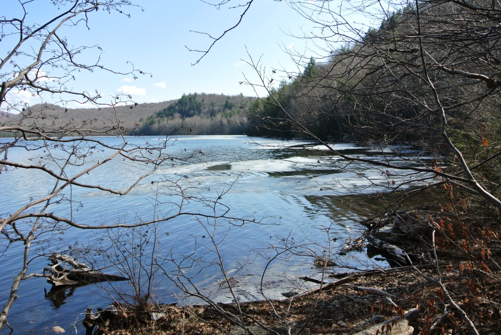
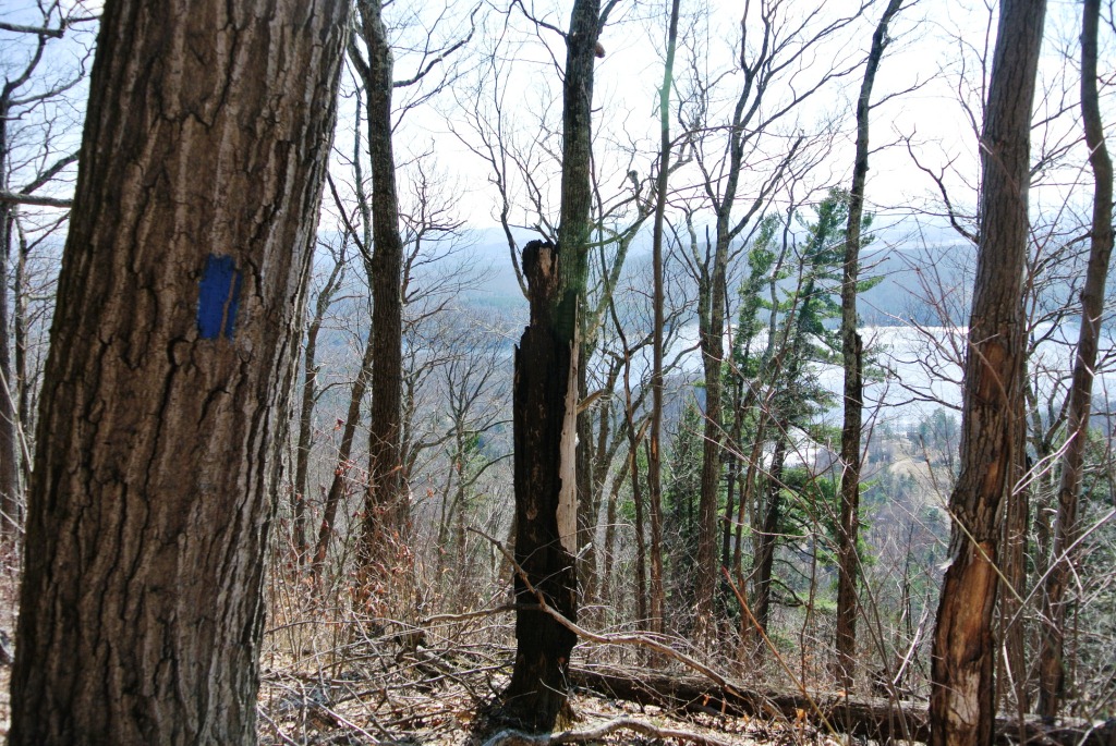
The Chandler Ridge Trail has been upgraded over the last few years to be rideable by mountain bikers, although it would probably too technical for my riding skills. On the other hand, this level of maintenance is perfect for runners who want to run true “single track” paths, without significant technical challenges to the runner. The climbs and descents are built into gently undulating switchbacks, and the trail designers did a great job of seeking the path of least resistance by weaving its way between the east and west side of the ridge. The leaves which had accumulated since last autumn did briefly obscure the trail in a few places, but every time I stopped and scratch my head, wondering whether or not I was still on the trail, a quick survey of the surroundings quickly made one of the blue blazes marking the trail apparent, and guided me on my way. Early spring is a great time to run this trail, which as hoped, was completely free of snow or ice, as the bare trees allow for views which are superior to those in the summer, when the leaves on the trees obscure most views. I stopped for a moment to take a shot of the southern end of Lake Dunmore, and as I took the shot, I noticed the remains of a charred tree, the which probably bore the brunt of a lightning strike at some time in the not-too-distant past.
A short while later along the ridge I had an even bigger treat – literally – a black bear sighting! As I came around one corner, I came face to face with a bear. OK this particular bear wasn’t showing me his face, as that was buried in a tree stump, probably rooting around for bugs or other such delectables, so “face to bearbutt” would be a more suitable description of the encounter. As soon as he saw me, he made the right decision and ran away, unlike what happened in my lucky bear sighting last summer, when the bear ran at me instead of away. Of course, this time, with my fortune, the bear ran down the trail, exactly where I was planning to go. So, I gave the bear a decent head start before continuing my route and then continued my run, sporadically breaking out into a very loud and raucous impromptu song which I will simply name “Here I come bear!”. Don’t bother looking for it on Itunes.
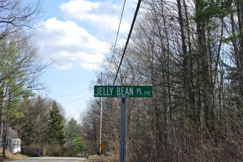
The rest of the run along the Chandler Ridge was a lovely, steady run through the hardwood forest. I also noticed a decent view to the southeast in the direction of Brandon Gap, a view which I had never noticed previously from this trail. Eventually, the trail ended at a “T” when it hit the much broader Minnie Baker trail, and here I took a right, descending down to Rt.53. Shortly before I reached the road, and when it was in sight, a snowmobile trail veered to the right, and I decided to follow it, in order to extend my time on the trails. Mistake! The run, which had not been too bad by Vermont Mud Season standards up to this point, turned into a total sneaker-sucking quagmire. Fortunately this was a short trail segment, and I quickly joined the road for the much easier last few miles back to my parked car. I did notice, however, that there was an unlooked-for talisman of Sunday’s holiday in the name of a road, which I had never noticed before. Happy Easter everyone!
At the completion of my run, my GPS watch showed that this was a slightly over 11 mile run – not bad for early spring! However, when I tried to download the complete track from the run, I was dismayed to find that I had some sort of malfunction, and thus I have no complete track to offer. I have blogged the first half of this run previously, so I can share that this route included a slightly less than 1000 vertical foot climb. Hopefully, at some point I will have the chance to repeat this route, and will have a GPS track to share.