Due to the challenges of recovery from a recent surgery, running is, for the time being, off the menu. That said, my physical therapist has been recommending walking an hour each day. As my body has recuperated, most of my walking has been confined to the roads by my home, the treadmill at Middlebury Fitness, or the indoor track at the college. A recent streak of unseasonably warm weather, and my increasing stamina inspired me to get out on the trails for the first time in too long, so I was inspired to spend an hour or so on a late afternoon to get out and enjoy some of the trails from the Robert Frost trailhead. Given the relatively thin snow cover, and the heavy usage of these trails, I assumed that I would not need my snowshoes, so I slipped on my microspikes over my hiking boots, and found that this footware combination served me perfectly.
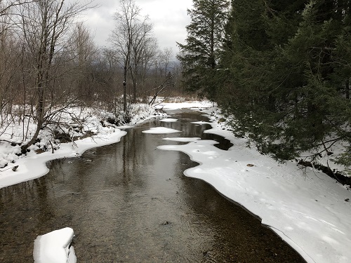
The first part of this walk was on the well-known Robert Frost trail, where a gentle walk in the woods is punctuated by signposts bearing Frost poems appropriate to the location. In a few minutes, I got to the stream crossing, which is now spanned by a handicap accessible bridge – a very nice addition. Years ago, when my daughters were young there was a much more rustic stone bridge at this crossing (which washed out a few years ago), from which we would play “Pooh Sticks” on lazy summer days.
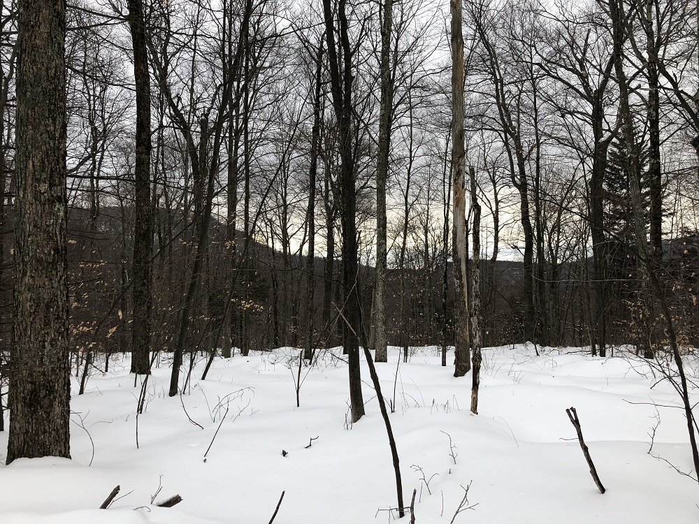
Continuing along the trail, I came to the right turn, where I turned away from the short Robert Frost trail, and headed deeper “into the wild”. I have run in the area many times during the warmer months, but I am always amazed at how different things look in the winter – it can almost be disorienting, even though one can see deep into the woods, given the bare trees. Good thing the trails here come well-signed, huh? I also found it curious that the trail sign gives 911 instructions (umm dial 911?) in an area with no cell coverage.
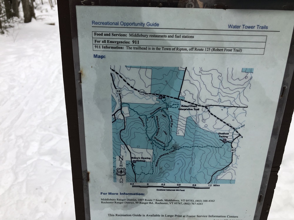
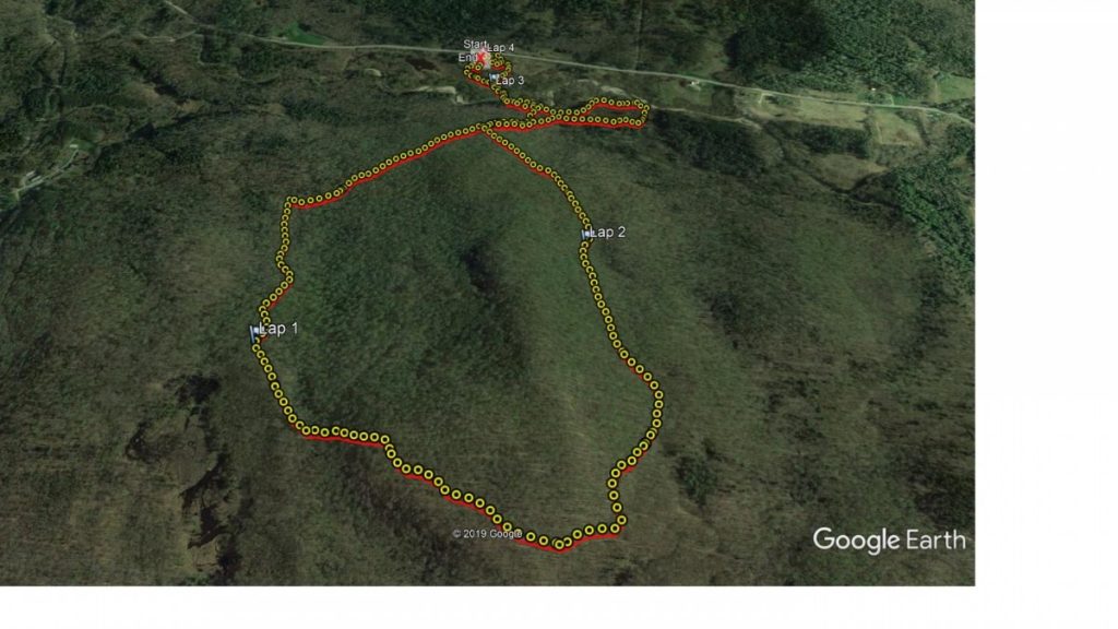
So, my memory of these trail refreshed by an actual map, I continued along Crosswalk, taking a sharp left turn on Sundown, climbing gradually until I saw the short steep incline of the trail named “Trepidation” in front of me. I must admit, the name is a bit overdone for what was basically a 0.1 mile climb, but I would imagine that novice cross country skiers looking down it might think otherwise. Getting up to the top of the hill called “Water Tower Hill, I paused for a moment, wondering if this was indeed the actual water tower at some point, since there is an entire trail network not far away on the Goshen-Ripton road also called the Water Tower trails. And they do not connect to this hill. Perhaps there were two water towers in comparably sparsely settled places, a few miles apart? I doubt it. To add to the confusion, one of the small hills behind the Rikert Ski Touring center is called Fire Tower Hill. Were the water towers there to help put out the fires found from the fire tower? I think that one of my first orders of business while running next summer will be to scout the summits (sans snow) to look for remnants of towers. While the snow was too deep to see any evidence of past towers, I did get a nice view of the Rattlesnake Cliffs on Mt Moosalomoo through the trees.
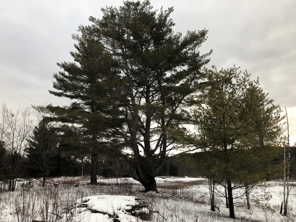
Descending from the “summit” I turned left on North Star, a trail which is seemingly always muddy with poor footing in the summer, but was quite pleasant with well trodden snow, until reaching the connecting trail to the Robert Frost loop, where I turned right and descended to the open blueberry meadow. While there were no blueberries this time of the year, I did enjoy the view of the lone pitch pine standing in the meadow, spreading its branches luxuriously wide in the absence of any competition for sunlight.
From here, it was a short walk back to my car. This ended up as a 3 mile walk, with about 500 ft of climb and descent – perfect for a winter late afternoon. It feels great to be returning to activity, and to be back in something resembling “the wilds”.
A totally unrelated Coda:
Forty years ago, to the day, in my first year of grad school at that Big Green college to the southeast in New Hampshire, I joined a friend on his 25th birthday celebration. We decided, on the evening before (over a beer or two, of course) to get up, and climb a mountain for sunrise. At first we joked about doing Mt Washington, but realized that would be pretty stupid on the 3rd of February. So, I suggested a a more modest peak nearby, Mt Cube, a lovely rocky-summited peak in central NH. So, a few hours later, we were trudging up, in the darkness and deep snow to help my friend celebrate his birthday. Upon reaching the summit, and fueling ourselves on cheap cherry brandy, and defacing the peak with snow angels, we descended, and vowed to make this a yearly tradition for the duration of grad school. Happy 65th Birthday Rudy!