I have been looking forward to my next post for some time now – Since March, the inevitable aches, pains, and nuisance injuries of middle age have kept me off the trails and out of my running shoes. While I am not back to 100% (or what delusionally passes for 100% at this point in my life), I was at the point where continued rest and inactivity seemed to hurt more than help. Contemplating a relatively short, easy run I remembered learning of a much less traveled trail up Snake Mountain, ascending from the gentler east side of the mountain. Since this side of the mountain appeared much less imposing than the west facing cliff side where most hikers and runners begin, I assumed I was in for a relatively easy run. Sometimes visual impressions can be deceiving!
The east face trailhead is much less known than the far heavier traveled east side trail on Snake Mt. The easiest way to get to this trailhead is to head out of town to the west on Rt. 125 until you get to Lemon Fair Road. Turn right onto Lemon Fair Road at the yellow house at the top of the hill about a mile and a half out of town, and stay on this road until you get to Snake Mountain Rd, where you take a right turn. Head north on Snake Mt. Rd. for 2.5 miles, until you come to a small barely marked parking lot slightly up to your left.
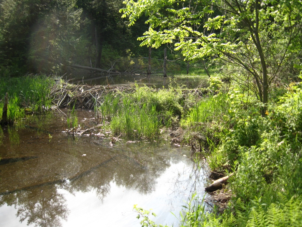
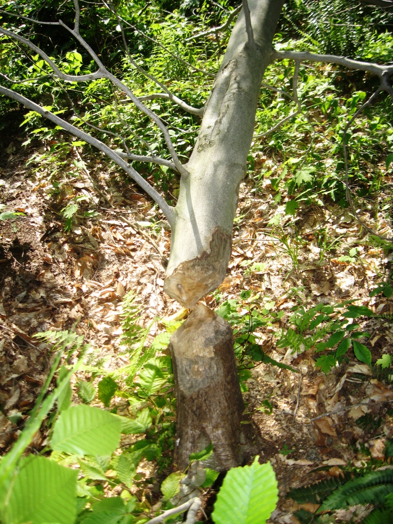
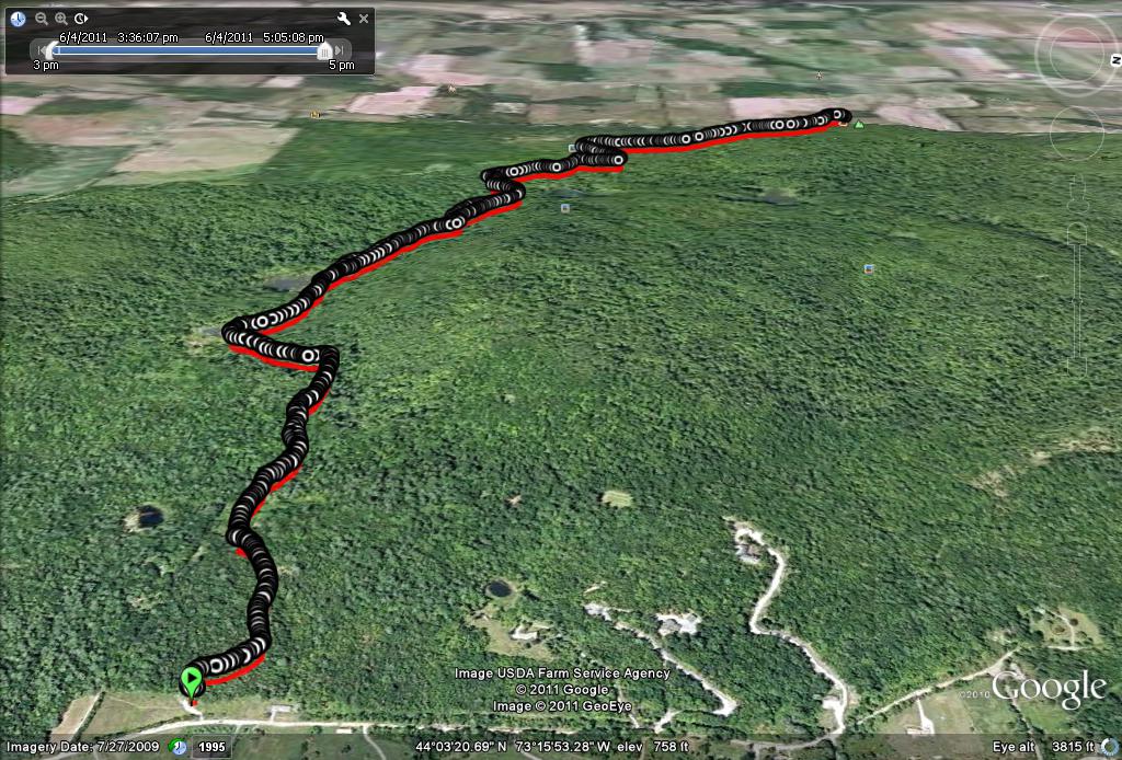
The trail begins gently enough following a broad, well maintained path through a few hillside meadows before reaching at gate about a third of a mile up the trail. After this point, the trail soon becomes a narrow, single track trail, unlike the broad former coach road which makes up the west side trail. Nonetheless, the trail was obvious to follow, and went by several pretty, boggy areas where the trail got a little bit muddy. Along the muddiest section, the source of the flooding was soon obvious – a beaver pond had started raise the water level in one of the boggy sections to the point where the trail was beginning to get slightly flooded. There were also several clearly recently felled trees (one with green leaves still on it!) indicating that the beaver in residence had been characteristically busy in the previous day or two.
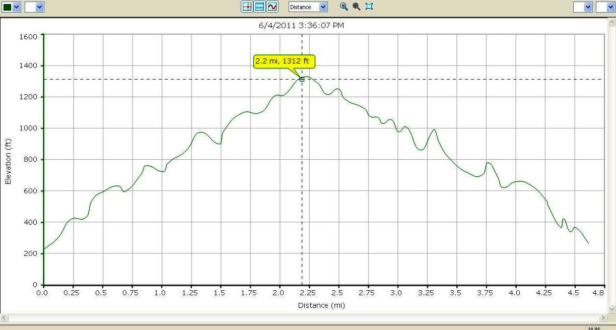
Continuing past this muddy section, the trail got significantly steeper before leveling off for a traverse to the south. I was beginning think that I must be getting nearer to the summit, but was puzzled where the trail would end up, as I had never noticed where this particular trail joined the main trail, let alone the summit. My questions were soon answered as the east side trail joined the west side trail – only about half way up the mountain – I had plenty of running yet to do! Upon reaching the summit view point, I was far more tired than usual – was this solely due to the expected loss of conditioning after 3 months off the trails? Or was the east side trail deceptively longer? I would have to wait until I got home and synced up my Garmin GPS watch to get most of the hard data.
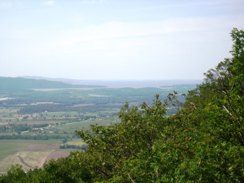
I was pretty tired at the summit, and the circling vultures did little to comfort me! Another far more ornithologically informed hiker at the summit commented that since I was so sweaty, the vultures were probably smelling me as if I was carrion. Funny – Mrs. Trailrunner seems to think the same thing when I return from a good long trail run. The return to my car was relatively uneventful, with the caveat that less traveled trails are sometimes more difficult to find on the way down than they are on the way up – I unwittingly ended up following a dry stream bed rather than the trail for a few hundred yards, but fortunately rejoined the true trail at about the point when I was beginning to realize I had taken a wrong turn.
After checking the mileage on this run, which was harder than I hoped it would be, I found that my observations were verified – the east side trail is about a half mile longer (4.6 miles), about 100 vertical feet more to climb (1000 ft total), and significantly rougher than the west side. It was also a more interesting and prettier path in my opinion – in other words, a true trail run! I am looking forward to some new and more adventurous runs as my body continues to heal.
Always hunted from the east side,Just after the first beaver pond there is a right when you reach the top there is a bike trail you can follow that top the top of the ridge pick an easterly direction and it will lead to the cranberry bog. keep going east and you hit the trail to the summit. Tomorrow I will be taking my granddaughter. Since I don’t hunt anymore I want to shair memories with her.
I agree east beats west.
Thanks for sharing your insights.
Jeff
I bushwack to the summit from this side! I usually start at the first meadow before gate and follow the ridge line in a westerly direction until I meet up with the bogs and cut up through a bunch of glacial drainage areas and small cliffs, my favorite mountain to train on! I usually throw in buck mountain as well, unfortunately they closed the trail.
Thanks Chris – I have not bushwhacked as a means of ascending Snake, but I can see how it would be pretty straightforward to do so – there is not much in the way of undergrowth, especially near the top. I have heard about the cranberry bogs part way up, and they are on my “bucket list” to explore. I had not heard that the main Buck Mountain trail was closed? I know one of the landowners on the side of the mountain (not where the Rt. 66 trailhead is ) and I will inquire about this. Also, there is another path up Buck Mt. from the east side, following a dirt road through a farm field off of Green St. If you know the topology of the mountain, it would not be hard to find.