Only two weeks ago, one of the biggest snow storms ever to hit northern New England blasted us with about two feet of snow, but the relatively mild weather which followed made me wonder whether my weekend enjoying the mountains would be in the winter, the spring, or mud season? Or all of the above perhaps? After Friday’s wonderfully springy weather, I realized that if I was going to get in any last long ski outings, I had better do them soon, as I suspected that the snow cover would be melting away quickly. With that in mind, I set out along the Ripton-Goshen road on Saturday morning. The road was fine at first, but is shortly became a series of frozen muddy ruts which made the drive rather adventurous for my low clearance front wheel drive vehicle. By the time that I reached the Blueberry Hill ski touring area, I realized that I had been fortunate to arrive with my oil pan intact. The ample snow cover was tempting, but I also realized that I needed to get onto paved roads before the frozen ruts melted into a quagmire with a high potential to suck my poor old Ford Escort into the Vermont equivalent of quicksand. Thus, I decided to head back to civilization, through the better roads heading down towards the Goshen Village, and return to Middlebury via Forestdale – definitely the long way, but the right way back considering the road conditions.
Undaunted, I headed back up to the Rikert ski touring area, which was fully accessible by paved road. While the snow cover was starting to get a little on the thin side in the field, there was a ton of VERY HARD snow in the woods. On the limited trails where the Rikert staff had groomed, the skiing was actually pretty nice, especially for skating skis, but forays off the groomed trails led to very challenging and limited skiing. As I was skiing along, however, I realized that the rather unyielding snow might be good underfoot for ….the first trail run of the year! So after skiing around a variety of loops close in to the touring center, I vowed to return to the mountains on Sunday, in running shoes rather than skis.
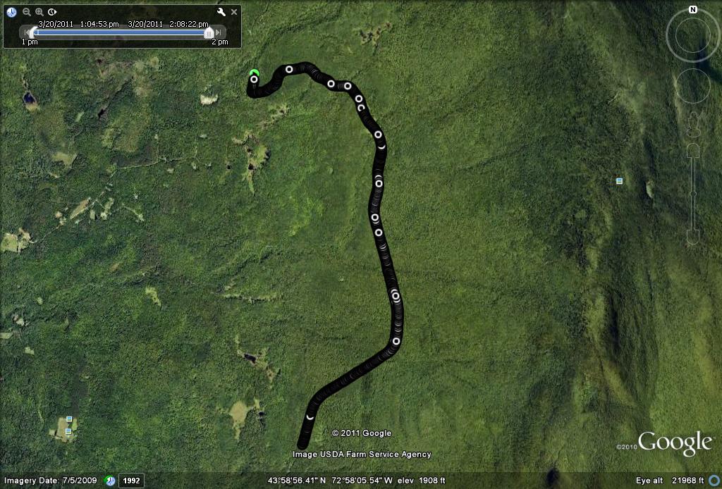
Sunday, of course, ended up as a near perfect late winter/early spring/pre-mud season day, so I headed for the wide open and well packed terrain of Forest Service 59 ( also known as Steam Mill Road). I have mentioned previous runs and skis on this road which is closed to car and truck traffic in the winter, but maintained for snowmobile use. Rather than accessing it from the Rikert side, I thought I would try and reach it from the Ripton side, and looking at maps, realized it could be accessed from the Natural Turnpike. For those who don’t know this road, it departs from Rt 125 to the left just after passing the Ripton town buildings, and weaves its way up into the decreasingly populated higher elevations. While this road passes all the way to Lincoln in the summer, a forest service gate blocks vehicular passage at a convenient parking lot. I have never seen this parking lot before, but it seemed like a good place to head into the forest.
While the footing might have otherwise proven a little slippery, given the thin veneer of corn snow on a rock hard base, my recent acquisition of the perfect running shoe for the situation made for sure-footed running. Asics makes an amazing shoe called the “Arctic” which has small spikes in the sole for just these sorts of condition, which gave me confident footing throughout the run. Joining the snowmobile trail labeled by the trailhead signage as “7A South” I quickly joined the far north end of the closed off portions of Steam Mill road.
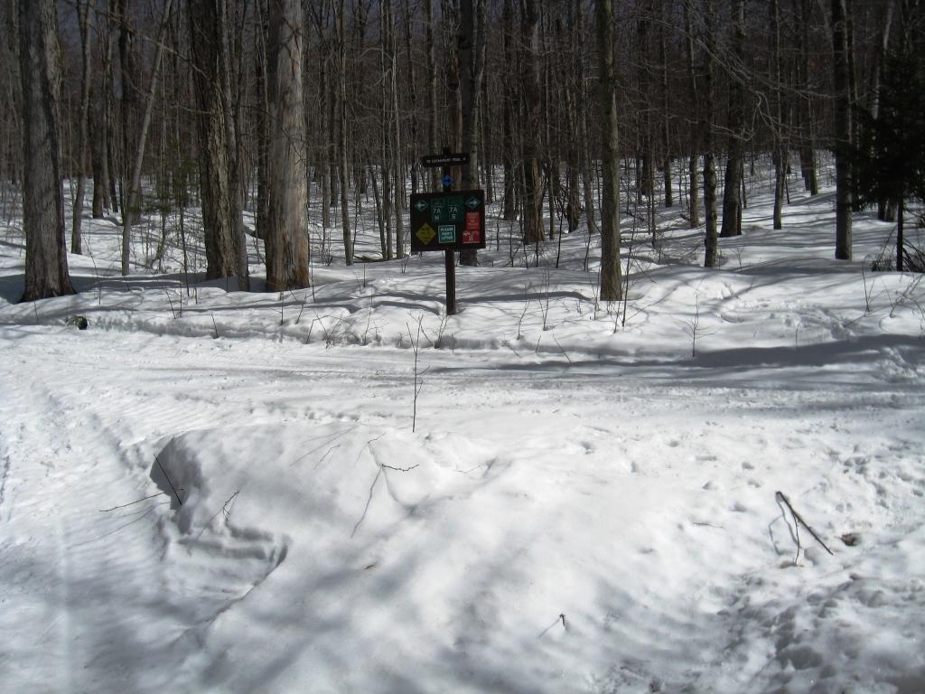
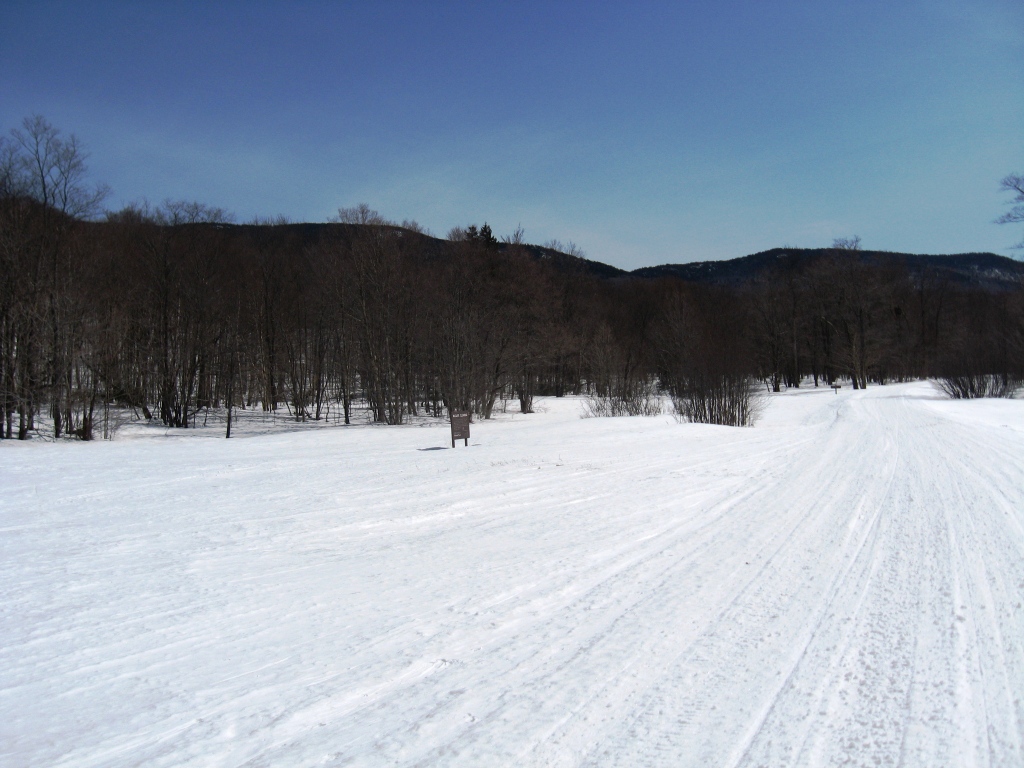
A steady climb on this wide snowy boulevard brought me to the Steam Mill clearing itself, the trailhead of the trail to Skylight Pond, and a wide open area with great views of Breadloaf Mountain to the left.
As I was running along, I realized that I was not the only person who saw the potential to enjoy this route on such a gorgeous sunny day. I saw numerous skiers, hikers, snowshoers, and snowmobilers out as well – the only thing missing was a few dogsledders! After a little over 3 miles, I reached the Forest Service gate at the Rikert end of the road, so simply retraced my path for a 6.6 mile round trip. I also noted a variety of other trails branching off from this newly discovered trailhead, and I am looking forward to exploring them this summer on foot!
I am not including my usual altitude profile for this run, as the run had only a few small climbs and descents, and my GPS actually gave some odd results, indicating a nonexistant 500 foot drop and climb in the first mile – no need to scare off other explorers with spurious data! The next question is – will there be more skiing? Is it really running season? Or will it be so much mud that attempts to take either off road will require a cleanup with the garden hose to rinse off before entering the house? We will see….