By now, readers of this blog have probably read lots of posts in which I sing the praises of the Blueberry Hill Trails, but I can’t help but wonder how many have ever heard of Blueberry Lake? I make frequent forays onto the trails in the Mad River Valley while visiting family, and had recently learned of the presence of some well maintained mountain bike trails commencing on the shores of this small lake. Where the heck is Blueberry Lake? It is a bit off the beaten path, on the plateau above the Mad River, below the Roxbury Mountains, at the south end of the Mad River Valley. To get to it, heck…..just look up Plunkton Road on Google Maps!
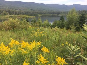
I parked my car at the obvious parking lot on west shore of the lake, and enjoyed the view. The lake itself is modest, but sits below the mountains, and while my favorite summer wildflower, the humble daisy, is long gone from everywhere except for apparently, my yard, the fields around the lake were filled with the bright yellow of Goldenrod, punctuated by Black-Eyed Susans. Despite the claims of my favorite dwarf, Sneezy, Goldenrod is not a significant allergen, although I am dreading the soon-to-come Ragweed season!
The trailhead itself was well-signed and across the street from the parking lot. So, I started running! From the start, I could see that this was a well-manicured trail that was clearly someone’s labor of love. I haven’t mountain biked much in the last few years, but I can’t wait to come back with my bike! The trail was well packed, and almost miraculously devoid of roots through its duration. A short distance onto the trail, I saw a right turn onto a trail called “Leonard’s Loop” and recognized instantly that it was honoring Leonard Robinson, an aged local icon whose extended family has long roots in this part of the Valley. I had met him briefly on a few occasions while skiing at the Blueberry Lake ski touring area a few miles away, and he always struck me as a classic old-school Vermonter. I knew that Blueberry Lake was man-made, but in writing up this blog posting learned that Leonard himself built the lake from a swampy area 35 years ago. A fascinating article on the origins and short history of the lake are posted elsewhere, and makes for a good read!
I started off the run, by staying to the right, which corresponded to the smaller, northern route. This led through a scenic mountain meadow, with great views of the Roxbury range. I also crossed paths with a few mountain bikers, and since they were on the downhill, stepped aside and let them enjoy their descents – after all it really is their trail.
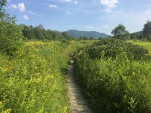
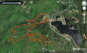
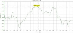
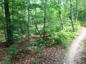
This loop ran its course in about a mile, and I followed the very ample trail signs onto the more extensive southern loops after a short descent and stream crossing. Curiously, the difference in altitude between the lowest and highest points is only about 200 ft, but it seemed like I was always climbing or descending on gentle grades – excellent running terrain! I did a “figure-8” on the southern loops, and pretty much found myself in the forest the whole way. Since this was clearly well-designed mountain biking terrain, the trails seemed to have endless switchbacks – as a result I didn’t cover much terrain, but the running was gentle and pleasant.
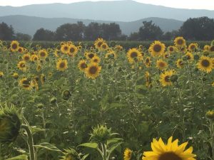
Looking at the GPS trace of my run, it might lead one to think that this is a complicated trail system. It isn’t, actually, and the trails are very well marked with ample signs, although some of them are lacking in the “you are here” notifications which might help a confused biker or runner! Completing the loop, I returned to my car to complete a 5.2 mile run – a nice way to finish a perfect August afternoon. On the way home, I drove by a field I have passed countless times, and noticed this year, that it was filled with sunflowers – a great sight to end the day.
