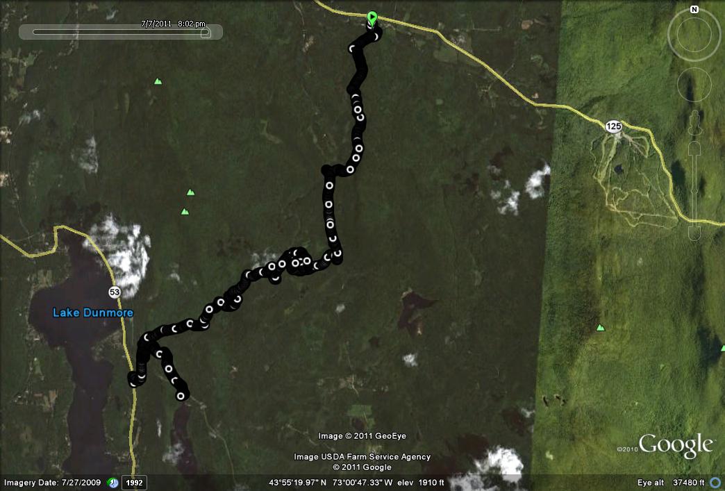
As my body continues to recover from injury down time in the spring, I thought it was about time to take on a longer run. Since a few of my eager lab assistants were looking forward to some long trail runs, and the weather was perfect, it seemed like a good day to do a point-to-point run, with a car shuttle. With this in mind, Jack, Nat, and I dropped my car off at the Falls of Lana parking lot (near Branbury State Park in Salisbury) and headed back to Rt 125, and drove up to the Robert Frost Trailhead, located about a mile west of the Breadloaf Campus of Middlebury College. The Robert Frost Trail by itself does not make for much of a trail run – it is only about a mile long, and the poetry reading stations along the way don’t lend themselves to a rapid run through. At the start of our run, I wondered if the bridge over the nearby brook would be repaired – a run through this area last year ended with a surprise wade through the river after the removal of a lovely rustic footbridge. When my kids were young, we used to play “Pooh Sticks” on this bridge, so I lamented its loss, although wet feet and legs didn’t bother me after its demise. There was both good news and bad news at this point: The good news was that a new bridge had been built – the bad news was that this footbridge had a much more utilitarian feel to it. I can take some comfort that the PVC “fake wood” used for its base probably came from recycled soda bottles.
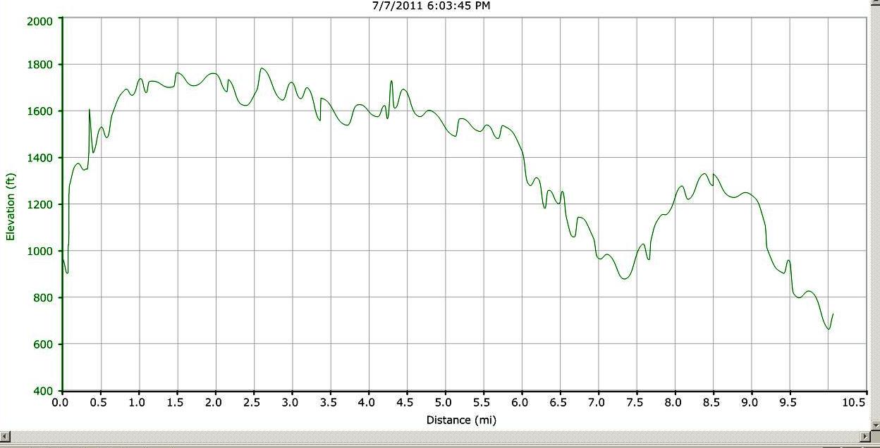
After crossing the bridge, follow the outer loop of the Robert Frost Trail, and where the trail bends to the left to begin its return, take the right onto the Crosswalk Trail, then take the second left turn on “Afternoon Delight” which angles up the side of Water Tower Hill. I have no idea how long ago this hill was shorn of its water tower – and I have lived in the area for 25 years. Any old-timers out there with memories? The descent of Water Tower Hill leads to a complex trail intersection where you basically go straight, leading to the Widows Clearing Trail. After about a mile or so on this trail (skied last winter in the “Widow Wears White” posting), pass by the first right turn (leading to the Widows Clearing parking lot on the Goshen-Ripton Road), and continue on to the next right turn, which descends quickly to the road, albeit through some prickly underbrush which did not feel good on these runners’ legs!
We had originally planned on following the trail beginning across the road, but the neck-high greenery made this a less appealing option. Instead, we turned left on the Goshen-Ripton Road and continued on this easy dirt road until we came to the entrance to the Moosalamoo Campground. The large sharp stones used on this road surface made for less comfortable running, so instead of following it all the way to the Voter Brook Overlook, we followed signs towards the Mt. Moosalamoo Trail. Somehow, we missed this right turn, and ended up doing a victory lap around the nearly empty campground, before noticing the trailhead on the left on our return. After about a quarter mile on this trail, we came to a well maintained double track trail, which we took a left on, and in eventually rejoined the same road to the Voter Brook Overlook. In other words – we added some distance to the run by running aimlessly in circles through the woods! A short run brought us to the Voter Brook Overlook, with its views to the west, peeking around the corner of Moosalamoo.

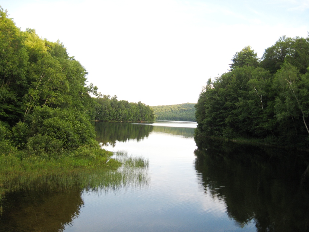
After pausing a few moments to enjoy the view and diminish the local deerfly population, we headed down a short steep trail, which is not marked on the official Moosalamoo region map available from the forest service offices in Middlebury. This trail connected us to the North Branch trail, which led to some of the sweetest trail running of the trip. This narrow but well-maintained trail leads gradually downhill for over a mile, until it joins the popular trail leading from the Falls of Lana trailhead to Silver Lake. We had originally planned on finishing the run with the short descent from here to our car, but since we were all feeling pretty peppy still, we decided to do the uphill mile run to Silver Lake. While my younger colleagues still had plenty of leg to spare, I discovered that my ambitions were not entirely reflected by my ability to carry them out, and found I had to walk a short section or two. Topping out at the earthen dam at the outlet of Silver Lake, we were treated to a great early evening view of the lake.

The last mile and a half back to the previously cached car was downhill all the way. According to my GPS, this one came in at exactly 10 miles – the longest run of the season to date! Fortunately, the run WAS mostly downhill, other than the ascent of Water Tower Hill, and the last hard climb up to Silver lake.


I have a picture that i hope you can help identify where it is. it is in addison county and i think it is silver lake, but would like to know for sure.
could you give me email address so I can send picture to you?
Sure – I will send it to you by email!