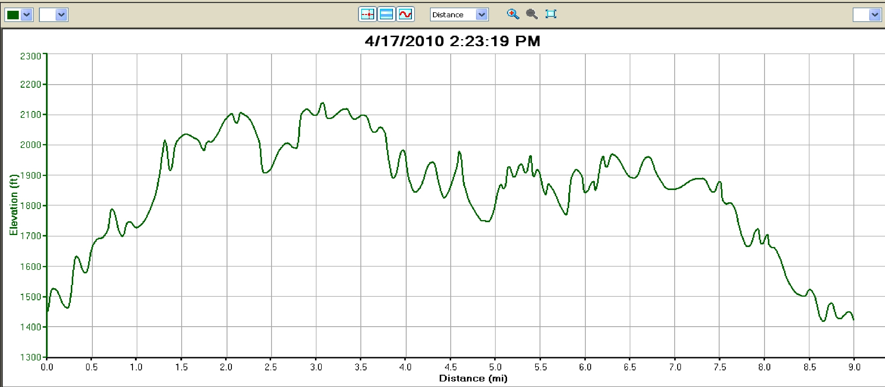
Two weekends ago, I had a great run in the mountains with the intention of writing it up for this blog. While out on the run, I discovered much to my dismay that the batteries in my camera were dead, negating the opportunity for including a few photos. Adding further to my technological woes, my other primary gadget, the GPS watch with which I map out the run, had apparently hiccup’ed at one point in the run, indicating a 500 vertical ft drop and climb in a section of the trail which I knew to be quite flat. I could have attempted to take on the challenge of creating an appropriate mental picture of the run with just the power of my words, but instead chose the easy way out, namely re-running the route with my technological crutches in better working order. This did, however, present a perfect opportunity to see the same trails from two very different perspectives, given significant differences in weather, trail conditions, and my own physical state. Thus, this description will not only describe the route, but also illustrate the differences which can occur over the course of just one week, especially one week in Vermont’s unpredictable April weather.
This run starts at one of my favorite trailheads, the Brooks Rd. parking area, which can be accessed by a short drive up Rt 125 above East Middlebury. Brooks Rd. is the dirt road heading right shortly after passing the Breadloaf Campus, before the final ascent to the Snow Bowl, and the large parking area is found about a quarter mile down the road. During the winter and spring, this parking lot is the end of the road, but when things dry out in the summer and fall, the full road is open to vehicular traffic, although I don’t remember ever seeing a vehicle on it! This trailhead is also featured on my previous posts entitled “Brooks Road” (creative, I know) and “Sugar Hill Reservoir“.
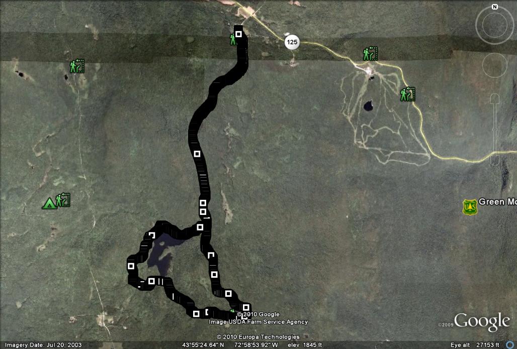
Week One: It usually takes me a few months of training each spring to start trying runs longer than 5 or 6 miles, but the continuing gorgeous weather this year encouraged me to put my middle-aged runner’s mantra of “long and slow” to an earlier than usual test. A cool but sunny Sunday afternoon tempted me to try a longer run which had been on my “to do” list for some time, connecting several sections of trail which I had previously skied or run in segments, but had never linked together in a route with a potentially fun loop around the Sugar Hill reservoir. Upon my arrival at the trailhead, I could see that the weather had beckoned others to enjoy the outdoors as well – this often quite empty lot had a surprising number of parked cars, indicating that my day’s inspiration had not been unique. I started off the run very slowly, not really knowing how my body would respond to the anticipated mileage and climb. The plan for the first 3.7 miles of the run matched the route described in my Brooks Rd. ski tour – a straightforward uphill run on a dirt road culminating at the road’s terminus. The stiffness in my legs made the first 1.5 miles consisting of the lion’s share of the climbing a little tougher than usual. It was great to see others, including walkers, fishermen, and even a family heading out for an overnight on the Long Trail, enjoying the day as well. Another family of wild turkeys crossed the road in front of me, and disappeared quickly into the woods as I trudged by. Note the trail merging from the right at the 2.4 mile mark – this is where the loop portion of the run rejoins the dirt road in a few miles. Upon reaching the end of the dirt road, I couldn’t help but reminisce on how much snow there was up here less than two months ago while crossing the footbridge over Sucker Brook. Sucker Brook cascades down from the main Green Mt. ridge at this point, and continues its descent joining, and then providing the outlet for the Sugar Hill reservoir, and continuing on until its final rush over the Falls of Lana before reaching its outlet at Lake Dunmore in Salisbury. At this point, almost all of the climbing on the route had been completed, which was fortunate, as my legs were starting to tighten up, and I had quite a few more miles to go.
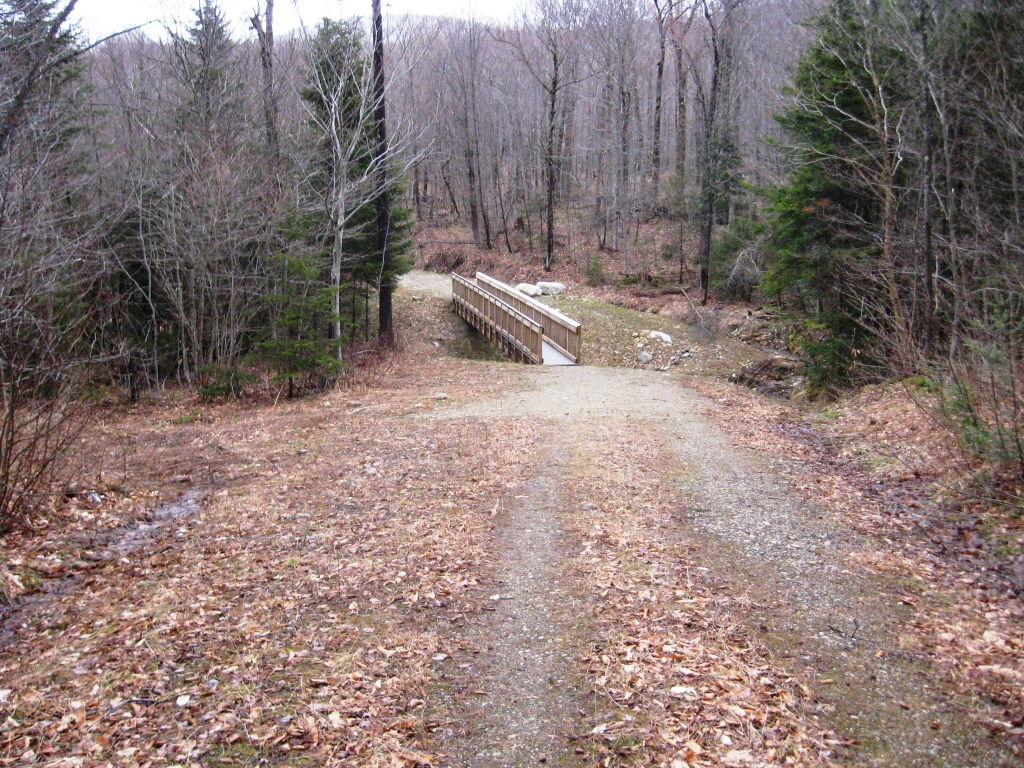
No more Snow!
Week Two: A few long runs over the last week got many of the winter’s kinks out of my legs, so I was looking forward to testing them with a more challenging workout. Pulling into the empty parking lot, I could see that the day’s blustery, unseasonably cold weather had given me complete solitude for the day’s run. Looking up towards the mountains in the distance, it was easy to make out the snow line from the previous evening’s precipitation, and I couldn’t help but wonder if my planned run would take me high enough for some running on snow-covered paths. My legs felt as loose as I had hoped they would – at least this would prove a strong workout, even if the weather was far poorer than the week before. Reaching the end of Brooks Rd., I was somewhat relieved to see that the 750 feet of altitude gain over the course of the climb had not quite brought me up to the snow zone, although I could see the rather distinct demarcation line between earlier snow and rain occurring only a few hundred vertical feet above where I was standing.
Week One: The run continued for a few yards beyond the end of the road, joining the Sucker Brook Trail in the Blueberry Hill ski touring area. A left turn here would bring you to the Long Trail, and eventually north to Middlebury Gap over Worth Mountain, but the lead in my legs necessitated taking the right turn, descending. The expected April mud was apparent, and in a few short sections it could not be avoided, but to my (pleasant) surprise, most of the trail was relatively dry with good footing. Sucker Brook is intermittently visible to the right, first at pretty much the same altitude as the trail, and eventually well below down a steep embankment. Passing several groups of hikers, and staying on the downhill trail at every trail junction gets you to the forest service road connecting the Goshen-Ripton road with the Goshen Dam and the reservoir. The last quarter mile or so of the trail corresponds to the route of the “Goshen Gallop“, but instead of turning left on the dirt road to complete the aforementioned race, take the right turn on the short uphill to get to the next landmark on this route, the reservoir. A few cars and trucks motored by, presumably bringing fisherman and other outdoor enthusiasts to and from this popular spring fishing hole. A short descent brought me around the corner to an odd looking forest service gate, and out into the open area featuring reservoir views. From the vantage of the Goshen Dam, I could see numerous groups of people fishing around the shoreline and enjoying the bright sun which made the day feel warmer than the temperature indicated.
Week Two: As I turned the corner onto the Sucker Brook trail descent, the increasingly cloudy skies finally began release the anticipated precipitation. Over the course of the next two miles or so, the trail alternated between quagmire and open stream, as the weather alternated between drizzle, heavy rain, and freezing rain. The right turn onto the Goshen dam road allowed for faster running with the improved footing, and there was no need to worry about oncoming traffic – nobody else in their right mind was out today. The short fast descent to the oddly shaped gate blocking vehicular traffic but not runners made the reasons for this gate more apparent. The gate was designed with a “crook” to allow passage, and I would guess that it was placed here for the benefit of mountain bikers, who might not have a chance to respond to a more typical gate design as they came hauling around the corner on this short steep descent. The same crook which allowed my easy passage was also just the right width for a cyclist, and this design probably has saved quite a few mountain bikers from bone-jarring and painfully sudden stops.
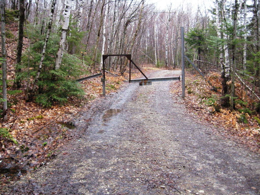
By this point the descending clouds were obscuring the surrounding peaks, and as the rain gained intensity, the lone fisherman in sight appeared to abandon his sentinel’s post on a small rocky outcropping and head back to his pickup truck.
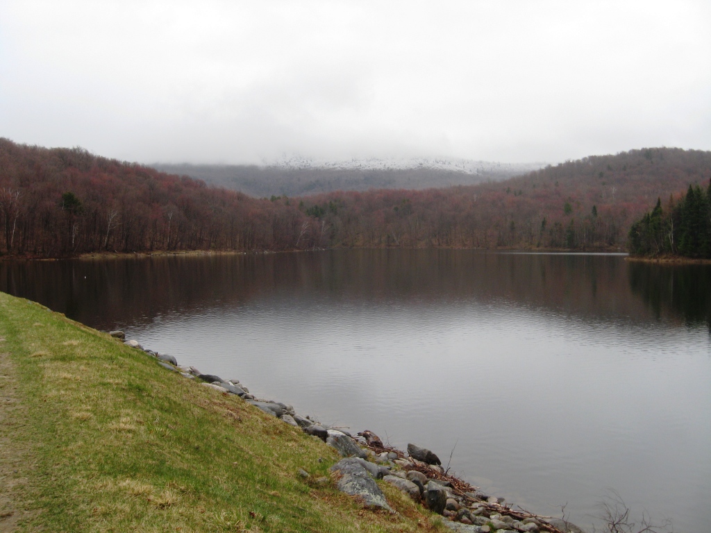
Week One: After crossing the dam, the trail headed into the woods along the far shore of the reservoir, making a series of short and steep climbs. By this point, the length and challenge of the run had taken a lot out of me, and my running was reduced to fast walking by the crest of the final hill. Fortunately, the last 2.5 miles were all downhill, but the cramping in my legs forced a slow descent. A sharp left turn back onto Brooks Road brought me back to my parked car, with my GPS registering this as an 8.8 mile run – not bad for April, but I could tell my legs would be the source of some regret for this run that evening and the next day.
Week Two: Bearing right on the trail after crossing the dam, the muddy ascent along the far shore passed more quickly than expected – I was pretty wet, and eager to complete this otherwise scenic run run under less than ideal conditions. I couldn’t help but notice a very deep set of tracks in the mud, but my modest tracking skills combined with the ill-defined tracks made it difficult to tell whether they were created by the passage of an earlier horseback rider, or a moose, as both are common here. The tracks eventually left the trail and headed into the forest, making it more obvious which of these animals had generated them! As I took the left turn onto Brooks Rd., the rain turned to snow, and left me looking like a snowman for a few minutes until the last of the run’s precipitation ceased. I enjoyed picking up the pace a little bit on this descent, and when I reached my car, I easily threw in a lap around the parking lot to make this run an even 9 miles.
2 thoughts on “A Tale of Two Weekends”