As part of our Tree Campus Higher Education Certification, we’re asked as an institution to summarize our year and activities managing our urban forest. 2023 has been, frankly, a year.
Our numbers for tree removals and plantings might seem a little off this past year, and are. The story is one echoed throughout the state, one of extreme weather events. I’d estimate in my 18 years here I’ve responded to 10-12 extreme storm events impacting our urban forest-ice, rain, wind, heavy snow, and the ilk. Of those 10 or so, 4 of them were last year, or more accurately in our reporting year, which starts roughly mid-December, when the information is due. Fortunately, we have a beautiful campus with a mostly healthy tree population, so while we lost some trees, we’re not panicking yet.
Abnormal weather always has people worrying about their trees and shrubs in the yard, and this winter is anything but normal. It’s the warm temperatures that are troubling, and many people have come up to me asking if the trees are going to be OK, or if the warm temperatures mean they are going to start growing.
Surprisingly, it’s the opposite, but this winter is a long ways from being worrying.
All temperate climate plants go through a period called dormancy, a mandated winter rest. This is triggered in the fall by not only temperatures, but by day-length. As the days get shorter the plants go through chemical and physiological changes to prepare for below normal temperatures. Once dormant, the plant needs sustained cold (500-2000 hours below about 40 degrees) to break dormancy and get ready to grow again in the spring. So, if this winter were to have stayed above about 50 all winter long the plants wouldn’t have started to grow, but the opposite, would just sitting there doing nothing.
And this makes sense. I’m always amazed at how smart and resilient plants are. While this winter is fairly unusual in the sustained warmth, we do see warm spells most winters, and plants that would start to grow at the first blush of spring wouldn’t be around very long. Breaking dormancy requires not only warm temperatures, but increasing day-lengths, longer spells of sunshine to break their winter gloom.
What can hurt a plant is freezing temperatures once dormancy is overcome. In trees, this is seen as frost cracking, long vertical fissures in the bark caused by water freezing in the xylem after warming up and moving around in the daytime. (Look at the trunk of the Sycamore in the triangle in Wilson Terrace outside McCullough)
This adaption to day-length also explains why plants with a local background (called provenance) is best. Day-length varies by latitude, with greater variation seen in northern latitudes. Take a tree from Vermont, move it down to Georgia (poor thing), and it will stop growing mid summer, as the days are a northern fall-like short. What I see quite a bit more, though, is the opposite. Plants grown in a nursery down south and moved up north don’t know when to shut down and start dormancy, and are often growing late into the fall, with their leaves and twigs freezing, unprepared for winter.
And while I’ve got your attention, let me take care of one final question I’ve been getting. No, your lilacs aren’t ‘budding’. Many people are looking at their giant buds on the ends of the lilac twigs, and think they are swelling about ready to pop and start growing. They were actually that large this fall, you just were too busy looking at fall foliage. Fear not.
The drought continues here on campus, and in the broader Champlain Valley. Our last rainfall was .4″, and after transplanting a tree afterword I saw the ground had only gotten moist about 1″ down-powder dry soil beneath.
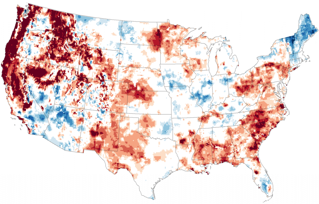
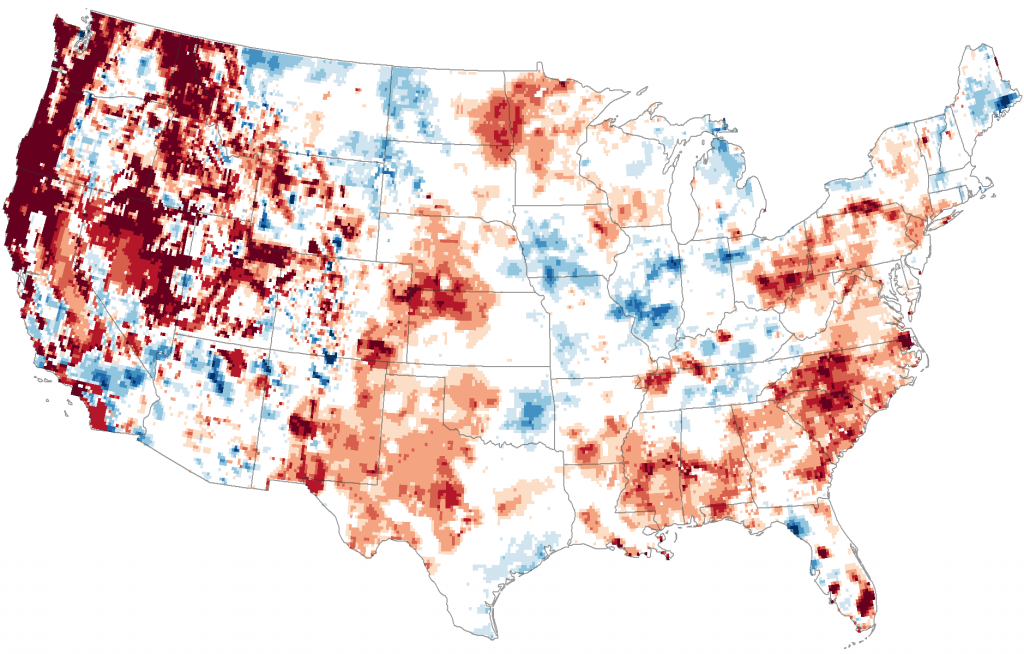
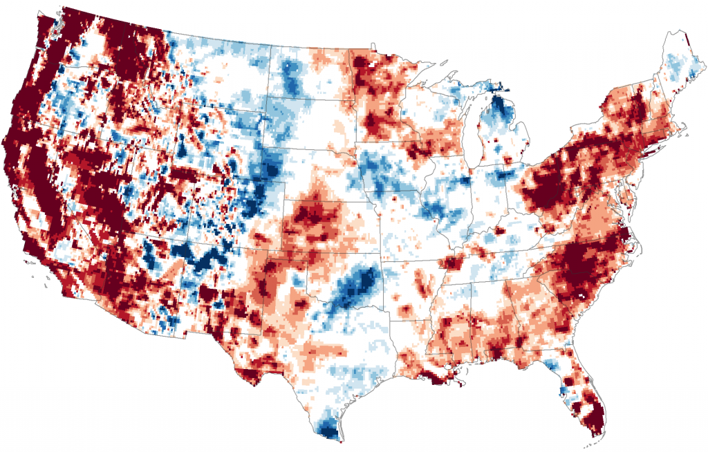
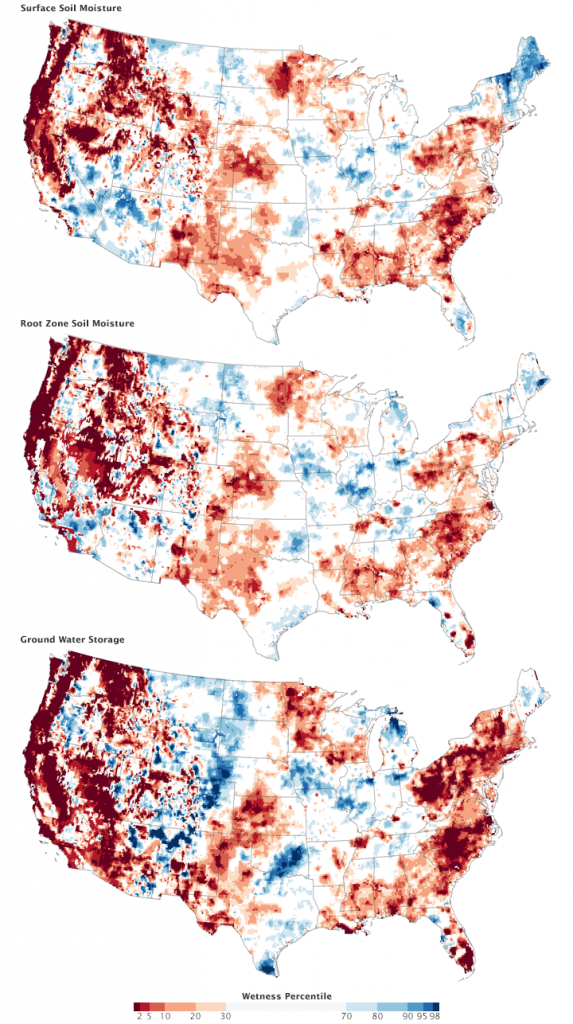
I forget where I found them (probably Lifehacker), but some recent pictures of the US taken by the Gravity Recovery and Climate Experiment satellites show in stark maps the bubble of drought we seem to find ourselves in right now. The first map shows soil surface moisture, moisture in the first centimeter of soil. Look for the little dark red blob right on top of Middlebury. (click on maps for larger view)
The next shows root zone soil moisture, the top meter (39″) of soil.
This final map shows ground water in shallow aquifers (like the well at my house!).
I’ll include the overall map of all three maps, which give a legend to the colors. The explanation is as follows (and is quite scary!)-“The maps do not show an absolute measure of wetness, or water content. Instead they show how water content in mid-September 2015 compares to the average for the same time of year between 1948 and 2012. Dark red represents areas where dry conditions have reached levels that historically occur less than 2 percent of the time (once every 50 or more years).” Note how we are in the dark red in all three maps.
If you have a little bit of time, by all means read how gravity sensing satellites can figure out how much water is in the earth. In a nutshell, it’s two satellites seperated by 139 miles, and sensing how much they move towards or away from each other as they orbit minute changes in gravity from earth can be measured. The complete explaination is at http://earthobservatory.nasa.gov/Features/GRACE/ .
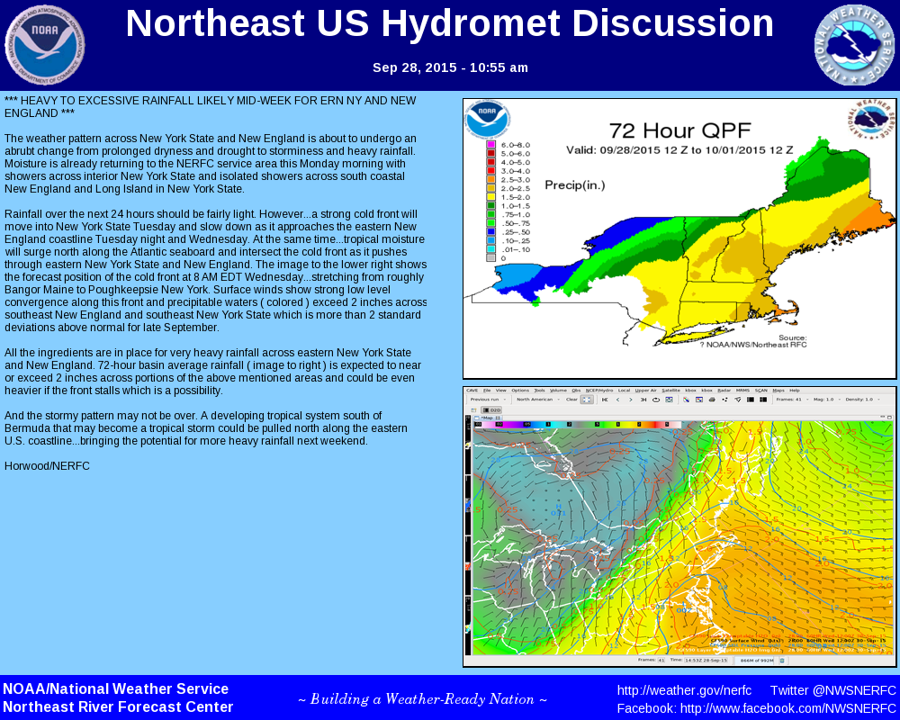
Hope is on the way, though. We’re looking at a pattern change, with a cold front moving into the area and drawing moisture into the region, possibly an inch of rain or more. That’s a good start. Here’s a good rundown from the Northeast River Forecast Center.
Our barely green lawns across campus belie a hard fact this summer-it’s been dry. Very, very dry.
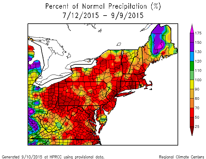
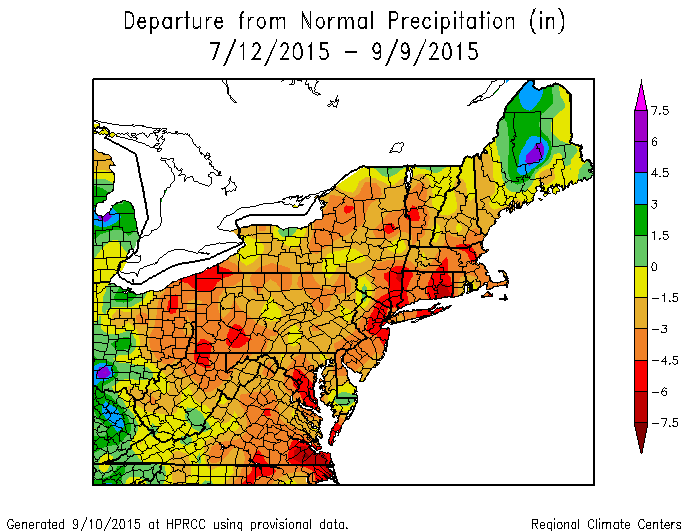
Funny, considering how wet it was in late spring, when it was almost too wet to do anything outside. The High Plains Regional Climate Center (kick ass website for weather geeks!) maps show we have 25% of the normal precipitation in the last two months, that’s a 6″ deficit of rainfall.
A general rule of thumb I can’t find a reference for but I always tell anyone is that Vermont plants need a 1/2″ of rainfall per week for optimum growth. We’ve had only about 1″ in all of August, and only 1″ in July. Most of that falling in one day, leaving our clay soils to dry out and become nearly resistant to small rainfalls.
The early leaves you see falling are signs of that. Trees in temperature zones such as ours develop wide, spreading root systems, not going too deep in search of water or nutrients. In fact, much of our campus is on ledge, with very little topsoil available, meaning plants need to go shallow and wide to root into the ground.
(My unsubstantiated theory is that Middlebury was founded where it is because of the ledge-poor soils make poor farmland, and why waste valuable agricultural soils and farmland on something as unimportant as a college? Farmland in 1825 was precious, hard earned space, so let the geeks have the hill, we’ve got crops to harvest)
These wide spreading root systems enable fast, efficient uptake of water and nutrients in poor soils and a short growing season. In ordinary years, this is ideal, but in dry years, this strategy can be costly. As you can imagine, the shallow soils dry quickly, and the plants don’t have the deep extensive root systems to find moisture in the lower soil profiles. Trees are gamblers, and they’ve got a losing hand this year.
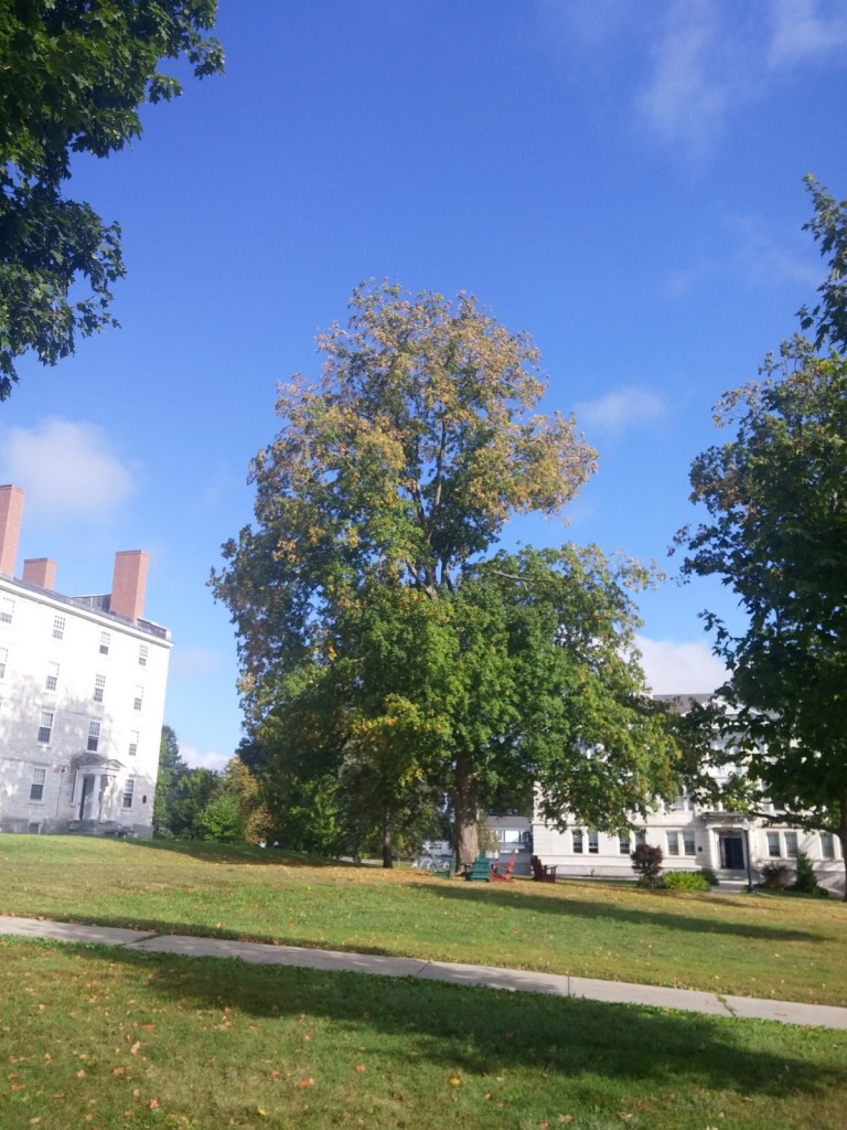
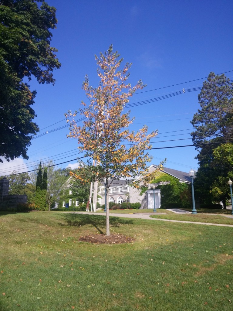
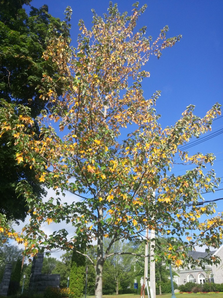
Flowers and other perennials show stress by wilting-the curling of the leaves cut down on the loss of water through the stomata (transpiration, if you want to flash back to high school biology). Trees react like that too, but also have the ability to shed leaves. We are seeing this now, and it may cause an early fall. The inner leaves on trees turn color and fall away, a survival mechanism. Inner leaves in the crown are not as efficient, they don’t photosynthesize as well, and therefore are not as “useful” to the tree as the outer, younger leaves. In desperation, the tree will shed the inefficient leaves ,brutally choosing the younger leaves to use the precious remaining water they have remaining.
We’ve had a little bit of rain this weekend, and more is coming, so luck it will come in time to prevent a wholesale dropping of leaves before your parents come up for fall family weekend. Snake Mountain above my house is starting to turn brown along the ledges, though, though, so lower expectations while you can.
January is starting out with a bang-it didn’t get above 0 degrees for several days last week, and this morning was 50 degrees and raining. Rain of biblical proportions, with the rain gauge at the track saying .88″ of rain, most of it falling between 7:30-10:30, up to a half inch an hour at times. I’m not going to answer the Middbeat question of “What’s the deal with the weather”, except to say we’ve got some lower atlantic moisture sliding up the coast on the side of the polar vortex in the middle of the country. When low pressure systems like that get squeezed on the sides by intense high pressure, all sorts of funky things happen, like lots of quick rain, or high winds. We had both.
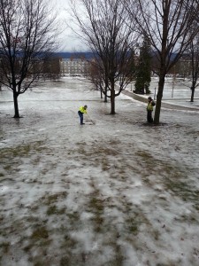
And with the deep freeze last week, storm drains were plugged, iced over, or covered in snowbanks. Rain can’t soak into frozen ground, taxing storm drains even when they are available and working. The landscape department went into overdrive, breaking up ice dams and opening storm drains. The most worrisome spot was solved quickly, that of Voter basement. You know, (or maybe you don’t), that place with all the computer servers. That would be a heck of an excuse for a banner web crash, wouldn’t it?
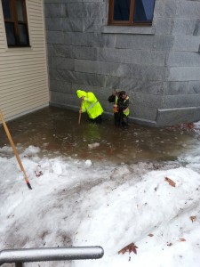
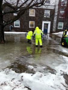
The northwest door of McCullough, the one that heads either straight towards Munroe and Mead Chapel, or head up the stairs towards Stewart, sits at the bottom of that whole slope below Mead. That entire side slope seems to drain right towards that door. There are several storm drains near there, including what turns out to be a critical one to the right of the door way. This is Jaime and Buzz, wearing hip waders, looking for the storm drain with ice picks and an iron bar. (As always, click on the picture to enlarge)
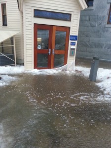
And this is the doorway in question, where water was flowing a foot deep through the doors and down the stairs. We actually got the backhoe in there and broke up the iced over snow banks around the entry, and got the water moving down. The plastic and snow was acting like a temporary dam blocking some of the water.
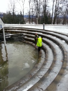
The Gamut room, in the Gifford pit, started flooding too. That’s Buzz and Jaime again, looking for the tiny little drain somewhere at their feet.
Yes, I’m the one taking all these pictures. Only barn boots, no hip waders, and I don’t know how to swim.
The drain for this pit is simply down the hill below Mead Chapel. Bet you’ve been sledding over the top of it. Broke the ice around this drain and the pit was cleared in about 15 minutes.
The last spot we’re still worrying about is on the north west alcove of Battell. This drain is frozen solid, barely flowing at all. We use bags of calcium chloride, and dump them on top of the drain. It acts like a non toxic drain cleaner, flowing down the drain and melting the ice. I’m hopeful this drain will be fixed by tomorrow. I’m not the most patient person you know.
The true heroes for the day, though, I don’t have any pictures of. There is an entire custodial team known as ‘floor crew’. I don’t even know how many of them there are, but the ones I know on it are all pretty cool. They ran around all day with wet vacs, carpet extractors, blowers, mops, and various other implements of mass destruction. Wherever water was pouring into basements or doorways, they were there, fixing the mess, saving the floors and buildings (and maybe your room!) from the water mess.
All professions seem to have their own language, most of it inscrutable. What’s impressed me about meteorology is their ability to take seemingly innocuous plain words and string them together in ways to make them terribly confusing. While doing a little digging to figure out just what’s been going on with the weather these last couple of weeks I came across the phrase “cut-off low”.
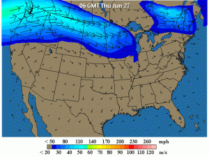
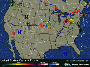
Apparently all of our moist, tropical air we’ve been (not really) enjoying is thanks to the jet stream, which has made up its mind this year to take an exceptionally strange dip southward across the plains. This leaves a path for the heat and moisture to stream northward into New England. A Weather Underground map from yesterday shows it pretty well.
Not only is the dip odd, but the fact that the jet stream is staying like this for several weeks is striking forecasters as peculiar as well. This is setting us up for what we’ve seen for the last week or two, hot muggy days with the ability to build thunderstorms, the late summer tropical kind with torrential rain only fun to play in when you’re young.
Working, not so much.
Last night’s storm, however, was a cut-off low. Cut off, it seems, from the jet stream. While it should have missed us altogether, instead it meandered up north and east, dumping an impressive amount of rain in northern New York (the forecast called for it to be over us, but it stayed a little to the west).
Now it is going to poke around Quebec for a while, probably exiting out the Saint Lawrence seaway at some point, once it gets caught back up again in the jet stream. The dip is forecast to be around for a while, so the rest of the week we’re looking at more warm, muggy, tropical August weather. We got .75″ of rain last night, bringing June up to 5.47″ of rain. Last year June had 2.3″ of rain, two years ago 3.1″. That’s why my boots aren’t drying out anytime soon.
Thanks to an Environmental Grant several years ago, the Landscape department has been running a personal weather station down at the track off of Porter Field Road, with a second more recent station up at Breadloaf campus. We depend on these stations for primarily for snow removal and IPM strategies. The data are also streamed to the Weather Underground, a weather web site that accumulates and posts data for over 10,000 stations across the US.
Any compulsive weather addicts know how tricky it is to forecast weather for a region-most people say the forecasters are “wrong”. A better interpretation would probably be to say they aren’t accurate, and Vermont is a great example of why. The National Weather Service has various offices, and ours is in Burlington at the airport. They cover a large area, from Lake Placid to Montpelier, and from the Canadian Border to Killington. The only way to accurately forecast an area this large is to break it into regions. For example, our region is number 9, Western Addison, including the cities of Vergennes and Middlebury. And here lies the problem with forecasting, particularly in the winter. Middlebury campus is under the same forecast as Lake Champlain, and Vergennes shares the forecast with Brandon. It’s a huge geographical area, and one forecast for such a space is bound to lose accuracy across the region. Addison may get an 1″ of snow, low in the valley, while East Middlebury may be getting hammered with 6 times that, under the same forecast.
The Weather Underground has been taking the National Weather Service forecast, and re-packaging it on their website, along with access to some great radar maps, blogs, photos, etc. Recently, however, they’ve starting forecasting themselves, called Best Forecast, and what makes this different is the data, not only from all of the NWS weather stations, but all of the personal weather stations such as ours. Slate just wrote a great article explaining this. Suffice it to say that Best Forecast is now taking into account microclimates, so when pulling up a Middlebury forecast on the WU, we are getting a Middlebury campus forecast.
How accurate? We’ll find out tonight and tomorrow. The NWS is forecasting a dusting to 2″ of snow tonight, with an additional 3-5″ possible tomorrow before it changes to rain. Temperatures mid 20’s tonight, mid 30’s tomorrow. Best Forecast? Lows of 28 tonight, 50% chance of snow or rain, high of 45 tomorrow, snow than rain in the afternoon, snow accumulations of 1″ possible. I’m not placing bets on who is correct here, but the Best Forecast feels right to me. I’ll post an update when all is said and done.
UPDATE 4PM: The NWS issues forecasts at fairly regular times, 3 PM or so being fairly regular. Their update for the western addison zone has changed slightly, 2-4″ during the day tomorrow, changing to rain in the afternoon, back to snow Friday night with an additional 1-3″. Mid 30’s tomorrow, mid 20’s tomorrow night. Best Forecast has changed little-snow and rain tomorrow, accumulation 1″, chance of ice pellets, snow and rain friday night, only 60% chance, no accumulation mentioned.
UPDATE 12 NOON FRIDAY: The NWS has changed their forecast, as the storm seems to have slowed down from the west. No snow last night, and only light snow now at noon, not accumulating. So do we call this a win for Best Forecast? Both forecasts now are in line with each other for snowfall tonight, 4-6″, but Best Forecast is calling for temps today around 45, with the NWS saying mid 30’s, which it is now. I’d be surprised if temps rise today.
Anyone around this summer, or past readers of this blog, will remember a large thunderstorm that ripped through Middlebury two days after Independence Day. Several trees were struck by lightning, which I wrote about after the storm.
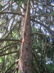
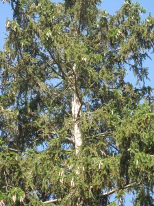
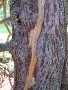
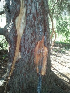
The largest tree struck was the Norway spruce in the Main Quad, one of the ones remaining after we removed part of the line. I wrote this summer how the tree was struck at the top, and exhibited a spiral shaped scar all the way down the trunk, exiting at the root flare. We didn’t know if the tree was going to make it or not, but had hopes.
It’s not the voltage that kills trees, but the water. Over 100 million volts strikes the tree, but it is the water heating quickly turning to explosive steam that causes failures. (Another blog post, on a lightning stuck Ginkgo, has much more detail) Damage in trees can be tricky, often with the worst of the damage unseen.
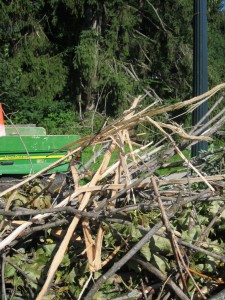
There was damage seen immediately. Long strips of bark went flying across the quad, and a scar opened up, spiral shaped, following the grain of the wood down the trunk. The high sap content of spruce makes it susceptible to such long scars.
I’d been worried about this tree all summer, and was watching it closely. All the limbs near the scar started to die, and the color of the remaining ones seemed a little off, but still green.
During a closer hazard evaluation this summer I discovered two things, one bad, the other worse. The first was the size of the scar, and while this shouldn’t have surprised me, it did.
The scar that formed in the summer seemed minimal. While very long, it only seemed an inch or so wide.
The bark hid quite a bit of damage, and another small crack that wasn’t even open this summer showed another major wound. Peeling away at the wound showed extensive damage, much larger than we’d first thought. Overall, it seems about 1/3 of the sapwood (the live wood beneath the bark that conducts water and nutrients) around the trunk has died, severely compromising the tree.
I’ve seen trees limp along with scars like this for many years, most often in a forest setting. Trees in communities are connected in several ways, relying on each other for support and nutrients. They also tend to be the best trees for the site, adapted to soil and weather conditions. Trees in an urban or landscape setting are under more stress, either from a singular status in the landscape, more exposed to wind by themselves, or stress from poor soil conditions its genetics just can’t handle gracefully.
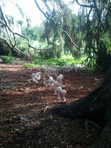
This fall was a good one for fungus, with cool moist conditions. The base of this spruce showed a colony of fungi following along one of the major roots of the tree. Later that same month the same fungus appeared following a different root. This indicates a root rot, a type of fungus eating away at the roots of the tree.
I’ve spoken with an arborist friend of mine who suggests immediate removal. He’s seen similar cases, where trees exhibiting root rot like this suffer from wind throw, heaving over in a storm. The clay soils of our quad make this species very susceptible to this, spruce not being a deep rooted tree to begin with, in clay soils even more so.
While I like this tree quite a bit, the chance this tree could suffer a catastophic failure in such a busy location on campus is too much of a chance to take. The remaining tree, the large Norway spruce with the interesting trunk, will remain.
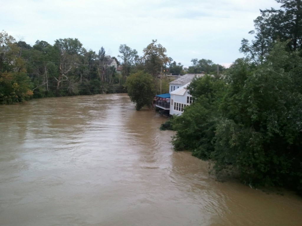
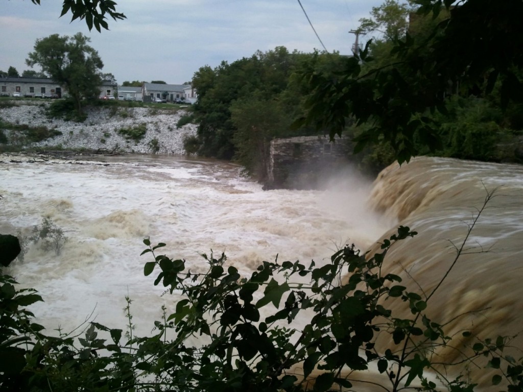
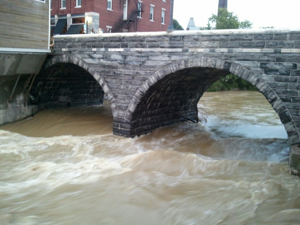
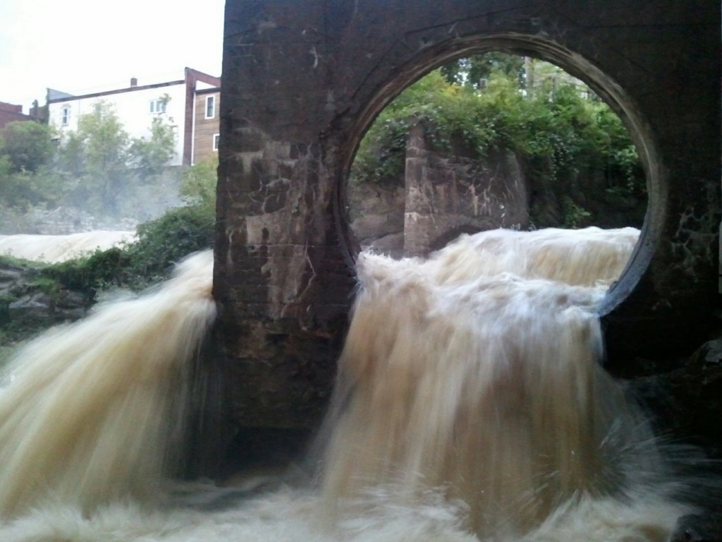
Like a guest that just won’t leave, the effects of Irene the Hurricane still seem to be around Middlebury. Primarily what we’re watching now is the Otter Creek.
It takes a while. All the headwaters that feed into the creek have been slowly dropping, like my own muddy Lemon Fair River, and so the Otter Creek is rising. How fast? The football team, at Middlebury for pre-season practice, skipped the weight lifting today and went to fill and stack sandbags at Jackson’s on the River (the old Tully and Marie’s to you alumni) ( The old Woodie’s to you older alumni). (Great little article here).
Another stream feeding the deluge is the North Branch River, the one that falls along Route 125, heading up to Breadloaf and the Snow Bowl. Last I heard, the road is still closed (picture here), although Breadloaf is still accessible by back roads.
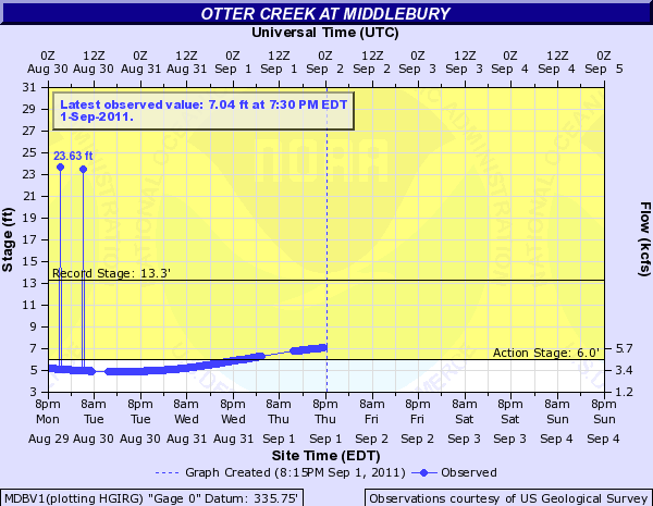
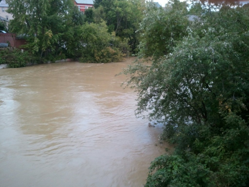
As I write, the Otter Creek in Middlebury is at 6.9′, within the top 20 crests of all time, and is thought to reach peak tonight around midnight. Not wanting to wait that long, I took some pictures downtown to try and capture the feel of a simply amazing amount of water, brown and muddy, crashing through town. One of our seasonal landscapers was a dairy farmer in Orwell for 30+ years, and in his experience he’s never seen water so muddy. Another guy in our shop is at home, an island experience, surrounded by water on all sides unable to come to work.
Given all the flooding and destruction in the state, I feel very fortunate here at Middlebury, and at my house overlooking the Lemon Fair (flooded, but looks like a normal spring). While we certainly had some damage on campus, it feels relativly minor compared to friends in East Middlebury in need of a new backyard.
Irene brought 3.21″ of rain to the main campus weather station, to bring a wet August total to about 7 3/4″ of rain. The peak wind registered was 37 mph, at about 6:30 yesterday. Breadloaf campus saw 5.13″ of rain, bringing their August rain to 11.27″. They saw a peak wind gust of 39 mph, later in the evening than down in the valley.
No major problems occured on campus. Facilities was busy with their usual leaks here and there, but it didn’t seem any more significant than another big rain. We’d spent a chunk of Friday mobilizing for the storm; gassing and sharpening chain saws, getting wet vacs ready, checking pumps.
Monday morning dawned clear and fresh, and revealed a mid September amount of fallen leaves, along with a plethora of sticks. Some large branches broke in the wind, as well as having a couple of trees topple over. Overall, however, I was pleased with the relative lack of tree damage. This late in the year weak trees are already shedding their leaves, or have thinner than usual crowns, so the more storm prone trees have less “sail” to catch the wind. A large limb heavy with black walnuts fell behind Turner house, but other fruit bearing trees did fine.
The immense rain in a short amount of time causes the most damage for trees. The soil below the tree turns to soup, roots lose their holding capability, and trees can topple in the wind. A good example is a Basswood lost right below Gifford, at the base of the ledge. All the water percolates a little ways down the soil profile, until it hits the ledge, then drains downhill right towards this tree. Combine that with the lack of roots on the ledge side of the tree, and the reason this tree fell is pretty clear.
Another tree with a compromised root system was a Poplar growing out of a stone wall behind the Hadley House Barn. One of our crew members commented how the roots went right through the wall, and this was a good reason to remove sucker trees before they get too large.
Overall, we did fine. Here’s another couple of pictures of some damage, we’ll have it cleaned up in another day or so.
This one was tricky. A Black Maple on the east side of Old Chapel lost a large limb, breaking another couple, but the limb was held up in the tree by an old cabling system, so extracting the limb from the tree involved some minor rigging and rope work.
Last picture-weeping willows always look so dramatic when broken. This one, located behind the esteemed Francois’ house, lost two major limbs, but had the good grace to avoid the power line right below. He and his dog watched it fall. No, the dog was not in the crate at the time…
You must be logged in to post a comment.