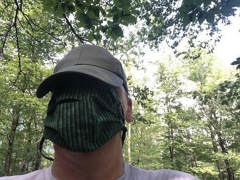
We have been quite fortunate (as well as careful) in Vermont, doing our best to keep ourselves and each other healthy. Fortunately, we have the ability to stay appropriately distanced from each other to minimize spread by doing what we do best – enjoying the outdoors. I, and most of the other hikers, mountain bikers, and runners that I have met on the trails have been either wearing a face mask, or at least (as I do) wear it around their necks, for easy wearing should another outdoor enthusiast approach. By doing this, we show our respect for each others’ wish to remain healthy.
It has been interesting to see how the Moosalamoo region’s most popular trail running events, all of them headquartered at the Blueberry Hill Inn and Ski Touring Center have dealt with it. The early summer Infinitus family of races, which are best described as “see how far you can run in up to 8 days” didn’t happen. It was just too soon, and organizers were probably unsure as to how to run it safely. The challenging, but accessible to mere mortals “Goshen Gallop” did come to be, run over the course of an entire day with runners going out in much smaller waves, rather than a mass start. While this is usually one of my “must do” events, medical recovery kept me out of it this year, but I heard from friends that it was fun, well-run, and safe. The Moosalamoo Ultra (36 miles, and I staggered through it once, eight years ago) and mini-Moose (14 miles) were held. The race director, John Izzo, aka the “Head Moose” cut down the size of the field, and did took care with countless other details, to ensure the safety of competitors and volunteers helping staff the race. I assisted with one of the feed stations, wearing my mask of course, and I was impressed that almost all the competitors pulled their masks up to their faces as they entered the station. And of course, a race as challenging as this ultra spread the runners out quite safely over the course of a very long day!
As I mentioned, my body was not up to any of these events this year, but that didn’t mean that I couldn’t enjoy a run in this beautiful region. Silver Lake, a popular local destination, is most commonly reached through a 1.5 mile climb up an old dirt road, from the Silver Lake trailhead just up the road from Branbury State Park. Not as many people know that it can be reached, somewhat more easily, from the trailhead at the end of an otherwise obscure dirt road up in Goshen. It has not escaped my attention, however, that this summer, trailheads and parking lots with access to outdoor activities have seen heavier use than I have ever seen before. This “less known” parking lot has, in the past, only had a few cars in it, but on several weekend occasions, It has been full, with cars parked up to a quarter mile up the dirt road! For readers who don’t know how to access this trailhead from Middlebury: Drive up Rt 125, and about a mile or so past Ripton, take a right turn on the forest service road heading towards Goshen. At about a mile past the Blueberry Hill Inn, you will come to a crossroads, where you take the right turn on the (surprise!) Silver Lake Road, and when you come to a fork in the road, take the right fork, following continuing signage to Silver Lake.
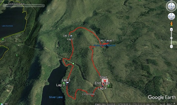
I started my run on the continuation of this forest service road, on just the other side of the gate blocking vehicular traffic. For those who don’t know the area, this is the same road that most hikers take up from the Branbury side. This road makes for an excellent ascent from the Branbury trailhead, and a run including this was actually part of the very first post I made on this blog, many years ago! Alas, my current conditioning is not up to a run quite as rigorous, and I began my run with an easy descent towards the lake. While remaining on this road is the shortest and easiest access to Silver Lake, when I came to a T in the trail, I took a right turn, rather than following the signage leading to the lake. And I wonder why friends accuse me of getting them lost?
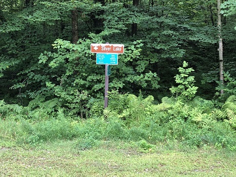
A very short way down this steep descent, which also doubles as a VAST snowmobile trail in the winter, brought me to another fork in the road. Once again, I took the counterintuitive direction – the arrow pointed right, so I went left.
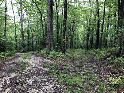
Another short distance brought me (as expected, I might add) to the earthen dam for the rarely visited Sucker Brook Reservoir. The Sucker Brook Reservoir is the second of four bodies of water, including (in descending altitude order Sugar Hill Reservoir, Sucker Brook Reservoir, Silver Lake, and Lake Dunmore, all part of an over 100-year old hydroelectric power project which is still used to create power at a power plant near to Lake Dunmore’s shores. This particular reservoir, however, tends to be very low on water by late summer, and in fact looked more like a fen than a pond or lake. As a result, it doesn’t appear to gather much recreational interest, except from curious trail runners!

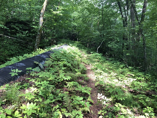
From here, I followed the obvious trail winding its way down the back of the dam, and followed the obvious open path, much of which is on a sidehill, making for challenging footing for the next half mile or so. In later summer, an obvious path through here is beaten down by the runners in the Moosalamoo Ultra, which passes this way, but it can feel a bit bushwhacky prior to this event. Eventually the wide open trail widens, and flattens, making for a nice mile or so in the forest, before rejoining the dirt road descending from the parking lot.
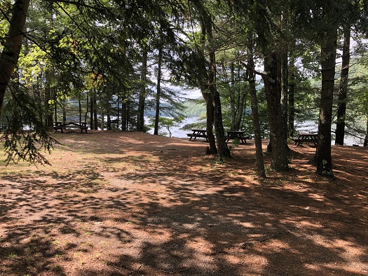
Upon reaching the road, I went right for a few hundred yards, bringing me to the dam supporting Silver Lake, and following the left turn along the shore, I stopped for a photo at the picnic area alongside the lake. Typically on pleasant midsummer days, this picnic area has been claimed by groups and families hiking up here for a day of fun, but by this point in August, the “crowds” have thinned out, making for even easier social distancing!
Again, has been the norm, as I passed other on the trail, either I or the other party would step off the trail, and everyone would put the other masks on, until we had passed each other. And yes, we made the point to exchange niceties! From the little beach area, I followed the well marked side path which brought me to the Leicester Hollow trail, and took a right. This trail, the remains of an old carriage road, was the means by which guests accessed the old Silver Lake Hotel, which burned down in the early 20th century. I went right on this for roughly a third of a mile, before I got to an obvious trail heading left, returning to the Goshen parking lot. Of course, the early part of the run had some easy descents, and alas, this is where I had to pay back the altitude with some climbing. In the past, running up this, albeit slowly, was feasible, but I was happy to do it as a mixed run/walk until I returned to my car. This run ended up being a little over 3 and a half miles, with a few hundred feet of climbing, on a mix of forest service roads, double track, single track, and a few legitimately rough sections. In other words it was fun!
