The warm weather of the Memorial Day weekend gave me a great excuse to explore some more new terrain in the vicinity of my favorite local backcountry destination, Silver Lake. Most of my trips into the Silver Lake backcountry have begun at the Falls of Lana trailhead, and have involved climbing, then finishing with a downhill. The reasons for this are pretty obvious – on a longer run, it is easier to finish on a downhill than on a climb. I had been considering starting a run into the Silver Lake environs from the uphill side, a popular trailhead in Goshen, which of course would require a significant uphill climb at the end of the run. It seemed like a good day to give it a try! To get to this trailhead, take 125 up to Ripton, but take the Ripton-Goshen road ( a right turn) shortly after passing through town. Stay on this road, passing the Blueberry Hill Inn, until you get to the right turn onto Silver Lake Road. Take a right turn here, and stay on Silver Lake Road until you get to the end of the road, where there is a pretty good sized parking lot. I decided to make my first ever run along the Ridge Trail, which follows the ridge just to the west of Silver Lake, and return by the more commonly traveled Leicester Hollow Trail, effectively mirroring a run I did last year along the Chandler Ridge, the ridge just to the east of the lake.
Reaching this parking lot in the early evening hours on the Saturday of Memorial Day Weekend, I was fortunate to sneak my compact car into the last spot in the lot! I was greeted in the lot by the gentleman who was the host at the Silver Lake Campground a mile below, who was stationed at the trailhead to inform would be campers that the campground below was full. I smiled, and pointed to my small fanny pack, and I think he understood that I was not planning to spend the night on the shores of the lake, but who knows?
I began the run with a short downhill on the Goshen Trail, the shortest route to Silver Lake. within a few yards, I passed through the power line clearing – It is kind of funny that this wonderful semi-wilderness area is also a source of hydroelectric power, using the stored water in Silver Lake, and the power station below near the shores of Lake Dunmore.
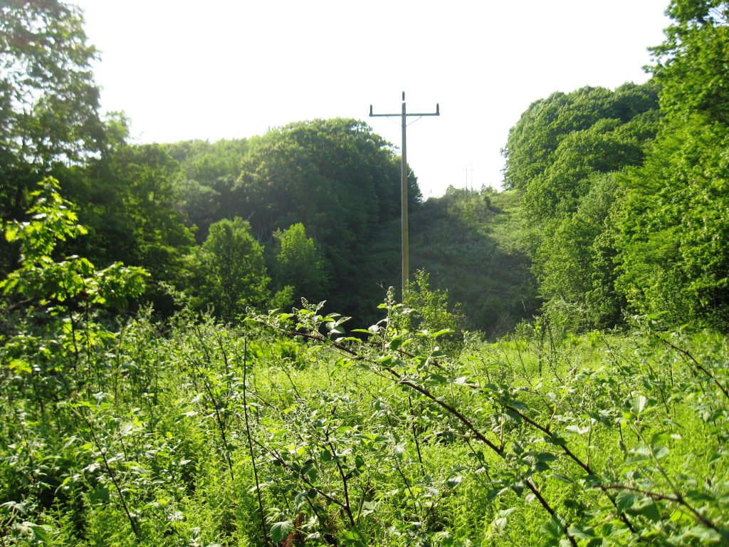
Power Line near Goshen Trail trailhead
Shortly after passing the power line, the Ridge Trail takes and obvious, well marked turn to the left, heading south along the ridge. Much of the first mile or two of this trail is slightly overgrown and muddy, a reflection of the relative rarity in which it is traveled. While it climbed some early on, and had a few small ups and downs along the way, it was generally a downhill trip in this section. I was hoping to find views comparable to those on its eastern twin, the Chandler Ridge Trail, but saw none – this was “just” a run through the woods. At about 3 and a half miles, I came across a complicated series of crossing paths, but staying on the well labeled trail, I managed to stay on course. A short, easy descent alongside a small stream brought me to a lovely quiet country lane, where I assumed (correctly) that a right turn would connect me with the Leicester Hollow trail for my return.
Taking the right turn, the country road quickly met a forest service gate, marking what is probably the official start to the Leicester Hollow Trail. The smooth running on this hardened trail, met a bridge coming in from the left (and based on previous experiences, where the crossover from Chandler Ridge joins) and stayed on the runner’s right side of the rocky stream. The easy running soon ends, as the trail gets much rougher – NOT due to Irene (the usual blame for washed out trails these days) but due to flash flooding from the summer of 2008. After about a mile of rough going, in, out and around stream beds, the trail became easier going, with only a slight uphill tilt. The trail eventually entered a clearing, where the presence of old apple trees indicated human habitation at some point in the past. Examination of an 1871 Leicester map shows this site as the former home of one Mrs F. Glynn, who I know nothing else about!

Possible Glynn Homesite
At about a mile past this homesite, as my mind was wandering with the sense of timelessness that often accompanies a long trail run, seeing the sunset over Silver Lake, I realized that I should conclude this run soon if I did not want to have to complete it after dark. I could also smell the campfires from the happy campers in the full backcountry campground.
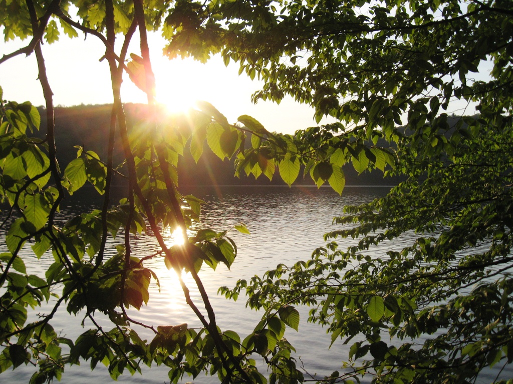
Silver Lake Sunset
Mindful of the time, I stayed on the trail along the east shore of Silver Lake, going a little faster now, until I joined the dirt road trail connecting the Falls of Lana parking lot below with the Goshen parkking lot above, aned took the right turn for one last climb to my awaiting car. This measured in at about 9.5 miles, with about a 900 foot descent and climb.
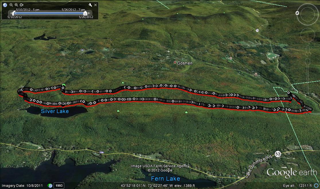
google earth of the run, from the west

Altitude Profile