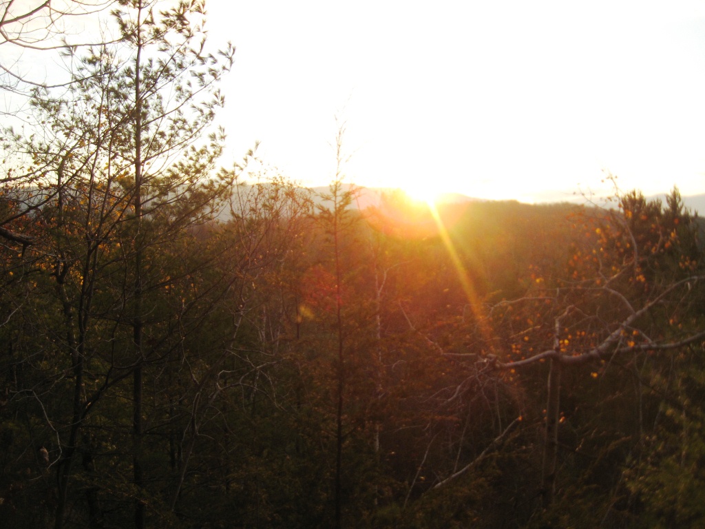
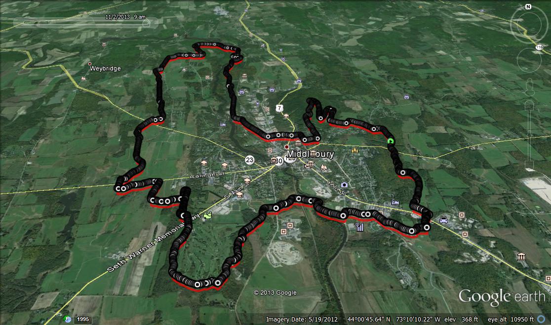
While most residents of northern New England mention mud season as the most challenging time of the year to live here, the almost equally bleak month of November, less well-known as “stick season” also has it’s challenges. It has the same bare trees and overcast sky, but never quite brings out the worst in us like mud season. Perhaps we are all still feeling good after a great fall foliage season, and are anticipating the excitement of the first snows of the season? Perhaps it is because…well…it just isn’t as muddy, and the trails are arguably at their best for running, with soft leaves underfoot, and great views through the surrounding forest? In any case, I got together with two other local runners, Josh and Ben, early on a Saturday morning to do the grand loop around Middlebury, our own beloved TAM. Bits and pieces of this convenient and scenic gem have been the frequent subject of blog posts, but it has been a few years since I last described a complete circumnavigation of the village, and that was much earlier in the fall, prior to the peak of foliage season. We met up shortly before sunrise at the parking lot by Batelle/Means Woods on Quarry Road (at about 3 o’clock on the loop shown in the Google Earth projection included below), just east of town, and I convinced my running partners that we should take the loop counterclockwise to put the most challenging part of the run, the 300+ foot ascent of Chipman Hill, early in the run. We also had the additional benefit of catching a great sunrise over the mountains from the east side of Middlebury’s downtown summit! While most of the leaves were long gone from the limbs of the deciduous trees on the flanks of the hill, I was touched by the stubbornness with which a few trees clung to their leaves and to life when other sources of warmth and the ephemeral beauty of autumn was fading.
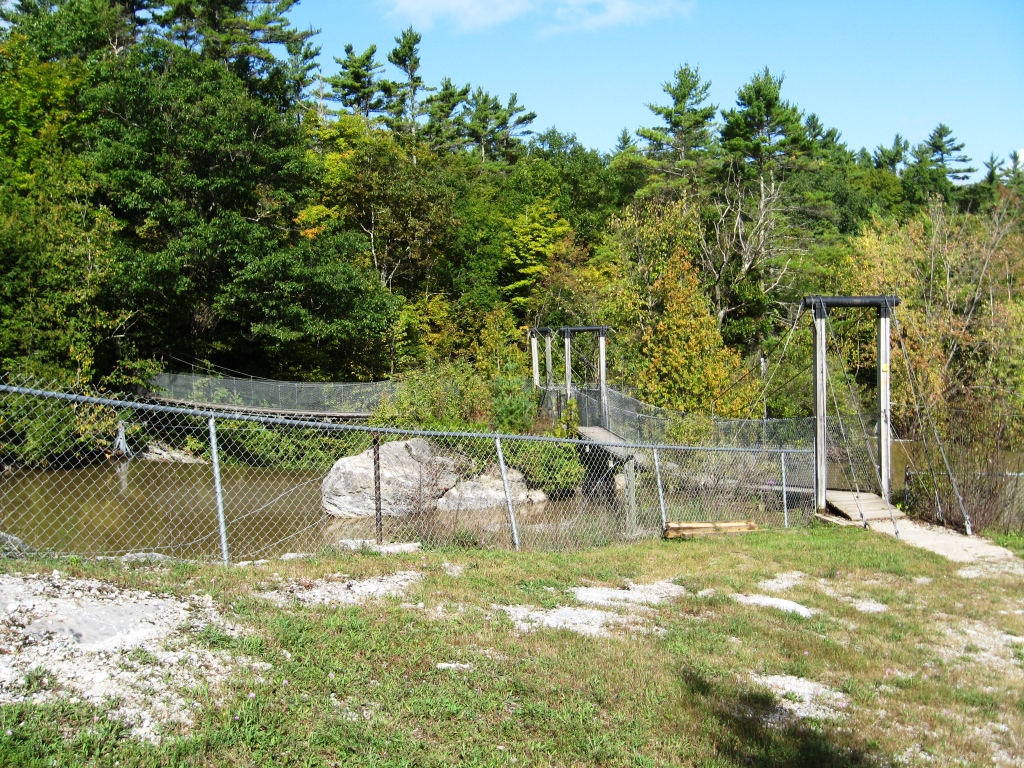
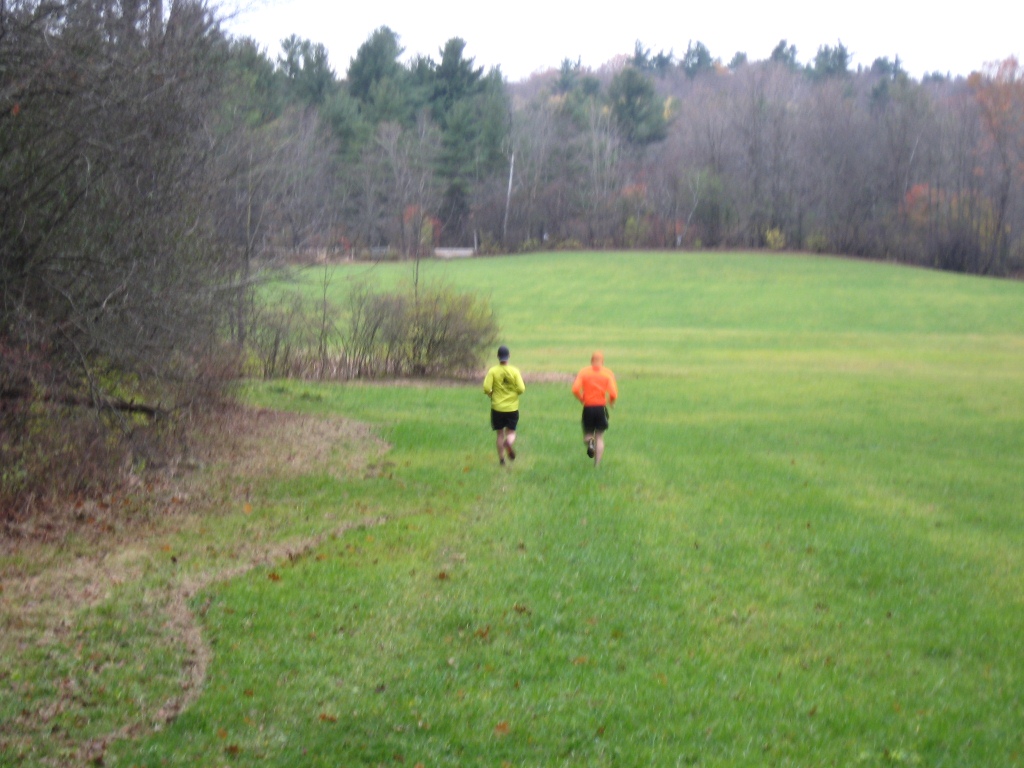
Continuing on down the west side of Chipman Hill, we wove through the village streets for a few minutes before heading north through Wright Park, and the longest contiguous section of trail not intercepted by roads. When we reached the northern suspension bridge crossing over Otter Creek, instead of taking the section of the TAM heading due west, we decided instead to take the last short loop to the north, heading into the gorge, and adding a mile or two of extra running to our proposed loop. The thick green moss alongside one particular section of trail led for Josh to christen this short passage “The Shire”. After a short section along the creek, the trail started its gradual loop back to the west, and then the south, emerging back into a meadow just to the west of Morgan Horse Farm Rd, where I managed to grab a quick photo of my fellow runners before they disappeared in the distance, forcing me to pick the pace after grabbing a photo, if I wanted to stay with them. That, and they also waited for me!
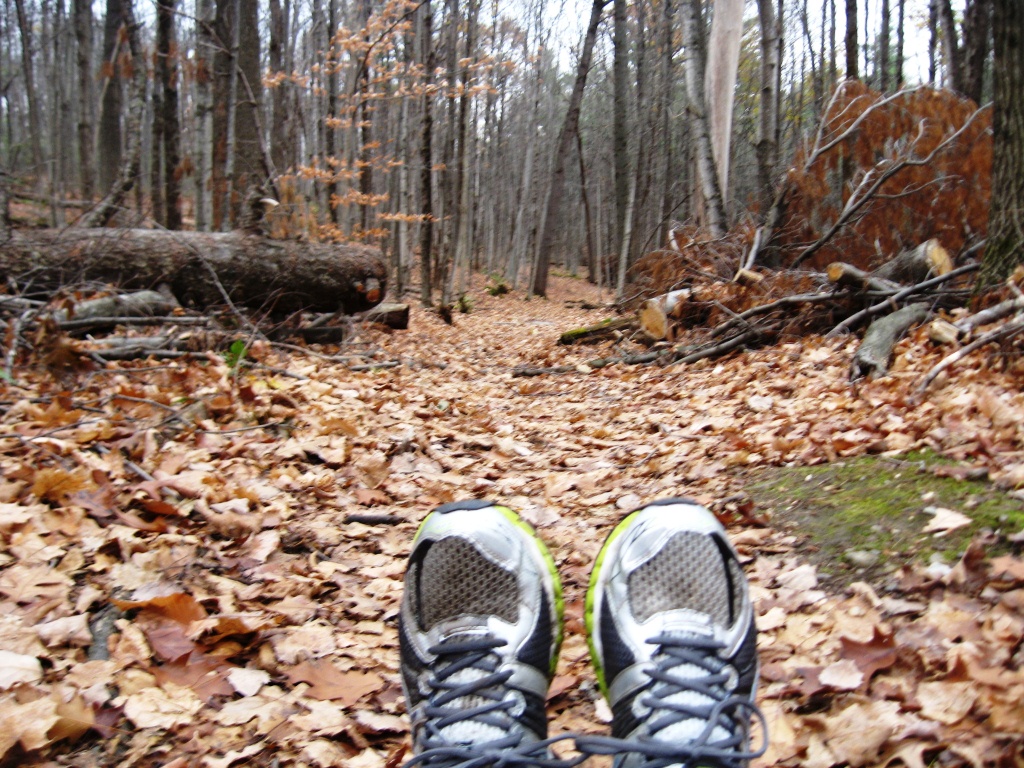
Crossing over Morgan Horse Farm Road, and veering south through another meadow and pond, we briefly considered leaving the TAM to seek out the entrance to the nearby Weybridge Cave on Cave Road, but decided against it on this day, as all of us confessed to having seeked out the cave’s entrance in the past, and all had failed. Someday we have to invite a runner who knows where exactly it is to show us. Any takers? Eventually, our counterclockwise circumnavigation brought us to the most civilized section of trail, the part circling the Middlebury College Championship Golf Course, where the TAM also serves as the running course for the college cross country races. The morning was getting a little later at this point, and we started to see other runners and walkers out for their Saturday morning strolls. The last few miles brought us back to the Batelle Woods, where I let my partners for almost 3 hours pull ahead, and I took a shot which I think exemplifies November running – grey skies, the trail softened by falling leaves, and of course, muddy sneakers.
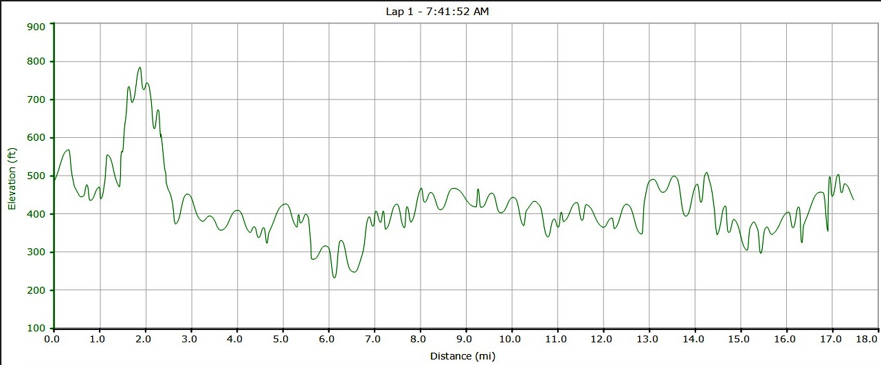
As we returned to the parking lot where my car was, we high fived on a good long (almost 18 miles!) training run, we commented on how fast the time flew by. This almost 3 hour run seemed rather timeless due to the good company, and fun terrain. As my fellow (much younger) runners headed home, on foot, I sat my tired butt down in my car, and made a beeline to Middlebury Bagel where I treated myself to a cup of coffee…..and the most sugar- encrusted donut left on their shelves.
Great post following a great run! Good luck in Philly!
…and those were new sneakers at the beginning!