The last few months have constituted my longest hiatus from blogging since beginning The Middlebury Trailrunner. I ended taking off some time from running (and hence, blogging) due to the inevitable post- marathon letdown in training, followed by hunting season (the worst time of the year for trail runners!), followed by a particularly busy end of the semester, and some minor injuries. Finally, on a clear February Saturday afternoon, the time was right for my first trail run in far too long. At the time of my last posting, long ago in October, a dusting of early season snow began to get me thinking of what I hoped would be a great cross country ski season. Well, I am still waiting – this is the time of the year for cross-country skiing, and I have yet to ski. Since, to the best of my knowledge, there wasn’t any place in Addison County with enough snow for cross- country skiing, I thought I might take advantage of the thin snow cover with an “out of season” trail run.
The Robert Frost Trail on Rt.125 in Ripton is a well known and much loved footpath for easy family walks in the mountains. It is also very short, with a total length of about a mile, and by itself a little too short for a decent run. Far fewer people have ventured on to the trails beyond, over and around the hill sometimes referred to as “Water Tower Hill”. I have always found this name somewhat confusing, as the series of trails a few miles further to the west on the other side of the Ripton-Goshen Road are also called the Water Tower Trails. To the best of my knowledge, there is no water tower to be found at either of these locales – so if anyone knows the history of these names, and the saga of the lost water tower – I would love to hear about it! In any case, a run extended beyond the confines of the Robert Frost Trail, around the Water Tower Hill, seemed like a good route for this midwinter run. A great map of this area is available from the ranger station just south of Middlebury on Rt.7.
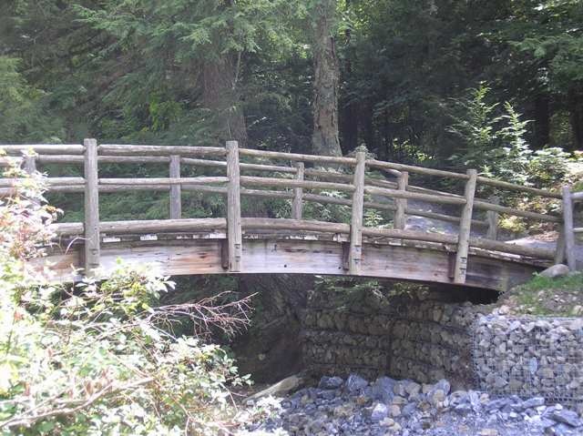
I expected the first sections of the run to be the easiest, given the flat, well trodden terrain. This ended up not being quite the case – the more heavily traveled sections were essentially blue ice hidden under a thin veneer of fresh snow. Fortunately, my winter running shoes, aka “studded snow tires for runners” did a good job of keeping me upright, but I had to chose my footing carefully. It had been a while since my last run here – two summers ago, I was surprised to find the bridge over the river weaving through this area had been washed out, necessitating a little bit of unexpected wading! I knew there had been some construction over the summer, and was curious to see the new bridge. The original bridge had been a pretty, rustic structure, where my children and I had enjoyed playing “Pooh Sticks” on some of their first walks in the woods. Looking around the web, I found a picture of this structure!
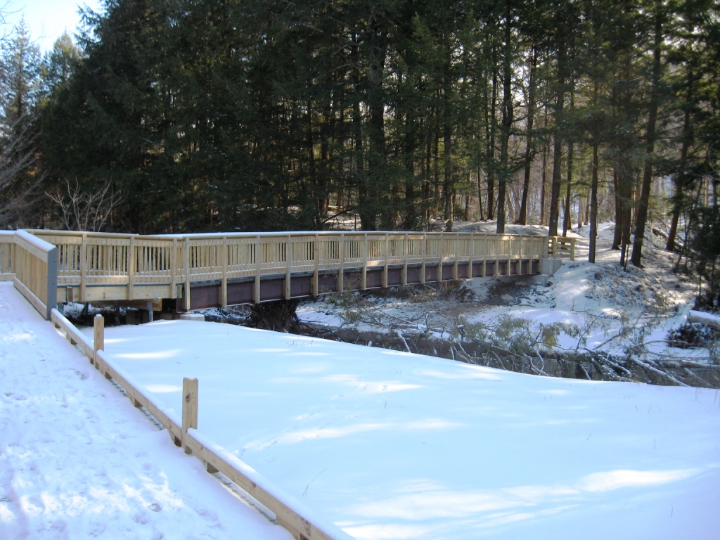
The new bridge, in contrast, while still wooden, has a much more utilitarian look about it. At first glance, it also looked almost ridiculously over built (it might double as a railroad trestle!), until I realized that it was constructed to be accessible to those confined to wheelchairs, who might otherwise have few opportunities for the quiet of the woods.
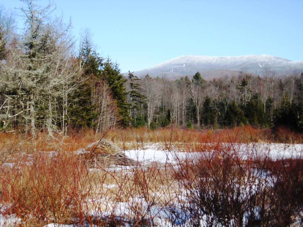
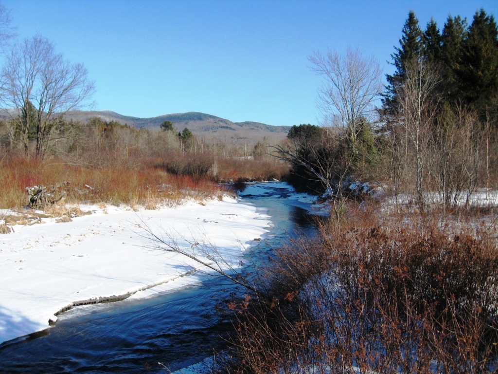
Immediately across the bridge, the combination of uneven footing, hillside trails, and blue ice led to a few moments of panic and emergency tree hugging to remain upright, but as the trail flattened out the footing improved, the rest of the run proved quite pleasant. Deeper in the woods, the main trail bears sharply to the left, and the connector to Water Tower Hill went straight up the hill. This trail also had no footprints in the snow, indicating I was the first person in some time to venture in this direction. Soon afterwards, this trail joined the Crosswalk Trail (all trails are very well signed here!) which I took to its conclusion before descending on Sundown. An easy descent eventually wound behind some of the buildings at Camp Silver Towers and crossed through a beaver meadow with great views of Breadloaf Mountain.
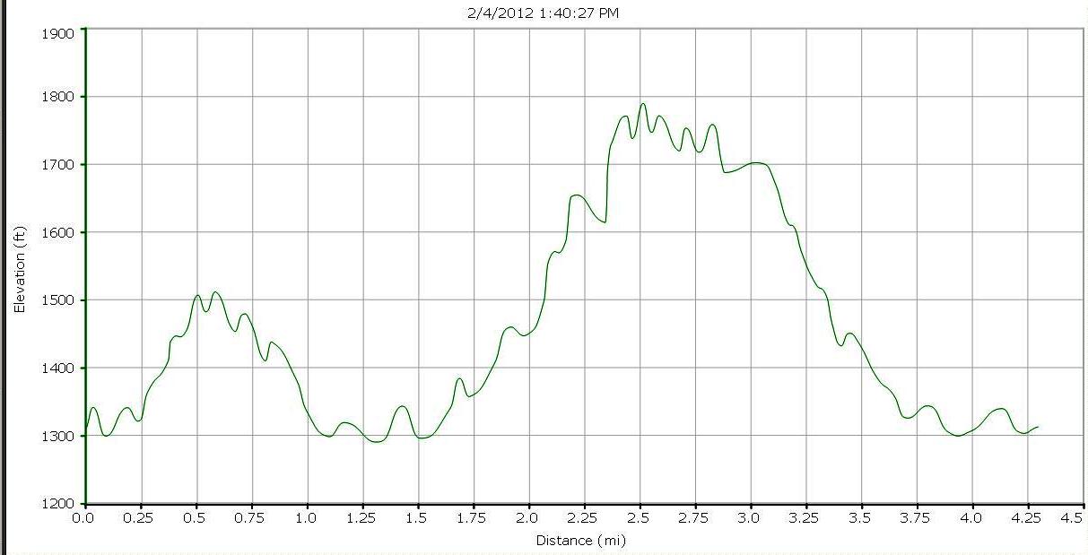
A few moments later, I reached the Ripton-Goshen Road, and reversed course, this time staying on Sundown and circling around the west side of Water Tower Hill. This section included a nice 500 ft climb, modest for a trail run, but my best climb in some time! A left turn onto Trepidation, followed by a short descent on Northstar brought me back to the Robert Frost Trail connector. The run was finished with a run through a blueberry meadow (a great place to be in July!) with more great views of the Green Mts.
Recrossing the new bridge, and a few hundred yards more on the trail brought me back to my car. The whole loop added up to about 4.6 miles with two climbs totally about 700 ft. Hopefully, the next post will be more seasonably appropriate – on skis!