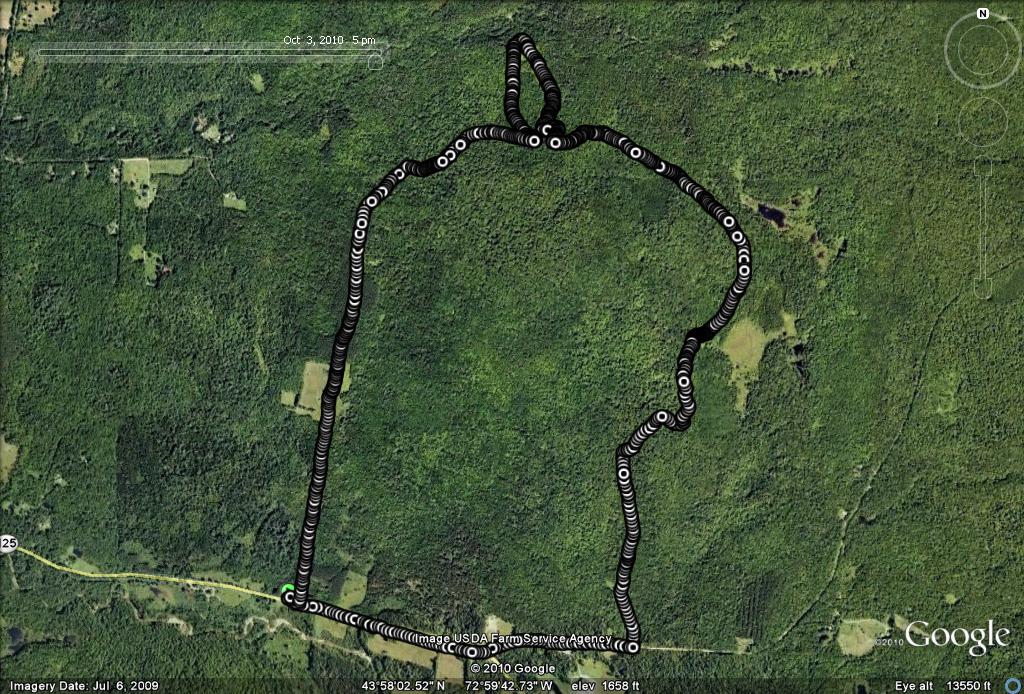
In the late 1980’s a popular “out of bounds” ski tour from the Rikert Touring Center at Breadloaf included an abandoned homestead which people referred to as “The Blue Bed House”. Mind you, there was never a blue bed in this derelict, but still partially standing home in my memory, but some more experienced skiers claimed that at one point in the not too distant past, there actually was a blue bed in the house. Over the years, some trails were rerouted and extended in other directions, and while the turnoff from the Rikert trail system towards this formerly popular destination could still be seen, I gradually noted fewer and fewer ski tracks heading in its direction. The one time I set off to visit the site several years ago, the snow cover was not sufficient for good skiing on the partially grown in trail, so I reversed direction and found another route. It has been about 20 years since my last visit to the site of the Blue Bed House, and I thought that I might follow the trails to its site to see how it had weathered the elapsed time.
This run, like the run I described in “Circumnavigating Robert Frost Country“, begins at the Robert Frost roadside rest area, and follows Frost Rd., past the Robert Frost Cabin, and beyond to the well-trodden trail directly behind the cabin. A few minutes after passing the cabin, I came to a trail split, and while in the aforementioned run, I took the left branch, on this run I stayed right, entering a gully which was actually a stream bed after the previous days’ heavy rain. The trail was in bad shape at first, with quite a few downed trees which slowed my progress on the otherwise easy climb, but after the trail leveled out, its condition improved as I approached the area where I remembered the actual house to be.
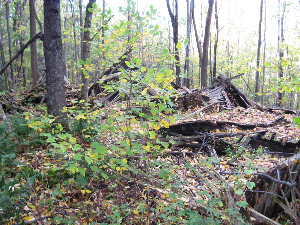
The years have not been good to this long abandoned farmhouse. All that remained of the Blue Bed House was a pile of wood. This also probably explains its diminished interest to cross country ski tourers – when the snow is deep there probably isn’t much to see. Does anyone know anything about the former residents of this site, or how long it has been left to decay?
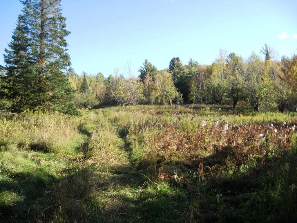
Some of my readers have mentioned that while they are interested in trying out the runs I describe, they are concerned that they will not be able to follow the actual route. My response is usually something along the lines of “do you think I really knew where I was going when I set out to do the run?” In fact, if you always know where you are going, you never discover anything new. What happened next is a great example of that. I only “sort of” knew where I was going, and decided to explore where I was not entirely confident I knew my way. I did know that the badly overgrown country lane heading downhill to the left of the blue bed house would take me to a lovely meadow, so while I briefly considered turning and heading back to my parked car, I chose instead to keep exploring. This lane, which I also remembered from ski excursions long ago, was also starting to to succumb to the encroachment of the forest. Interestingly, someone had placed blue blazes on many of the trees alongside the path, probably marking them for removal, but apparently the spray painters were not as ambitious with the chainsaw as they were with the spray paint can. After a few minutes of descent, I briefly joined the trail described in the Robert Frost run, but when it hit an obvious T, I turned right, rather than left, taking me to the base of the backcountry meadow. I presume this meadow was part of the farmland used by the former inhabitants of the Blue Bed house, and it is starting to get a little overgrown, indicating that it has probably been a few years since its last mowing. Nonetheless, the twisted old apple trees in plain sight gave evidence for its formerly domesticated use.
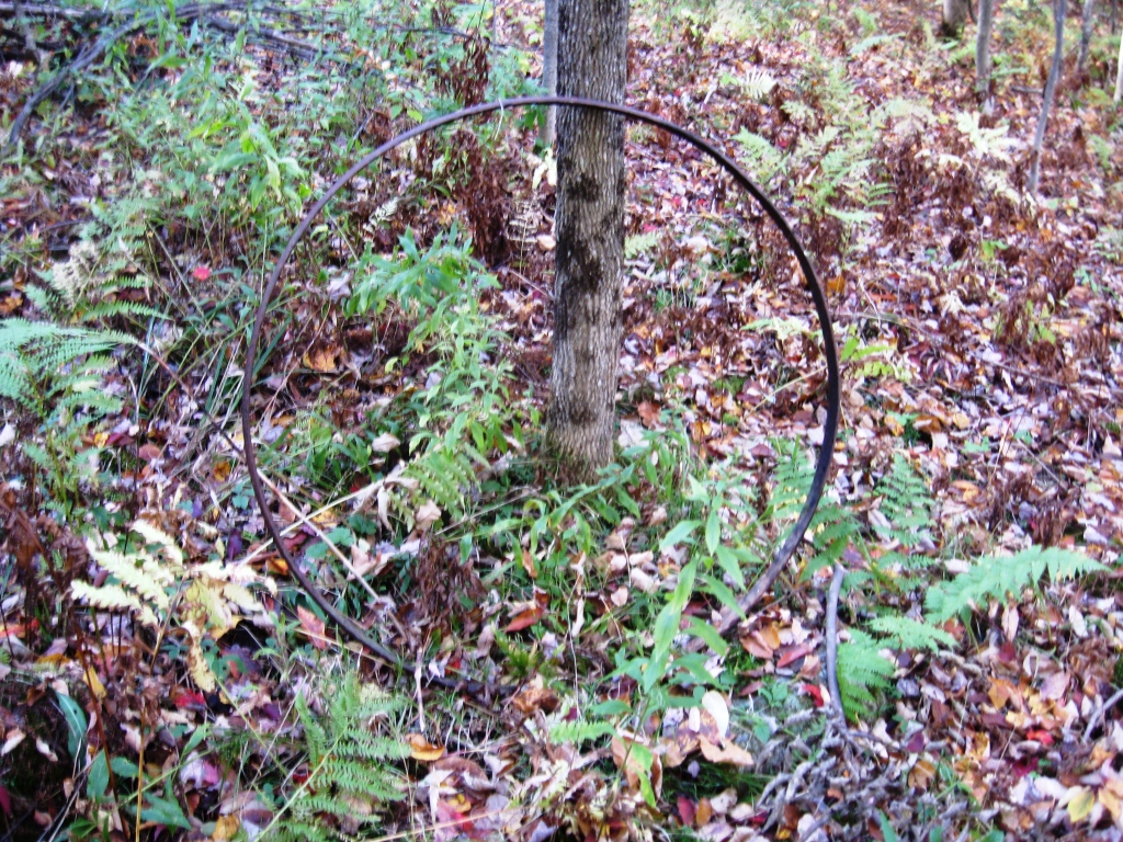
This was where curiosity got the best of me. Noting the 4WD tracks heading into the meadow, I thought that I might follow them back uphill to rejoin my original trail after it passed the house. At the top of the meadow the double track in the high grass mysteriously turned into a single track more characteristic of an animal herd path. I wonder what sort of animal ate the vehicle whose trail I had been following? As the trail reentered the forest, a huge recently fallen fir tree blocked my path, and after jogging around it, followed what looked like an overgrown road. A few yards later, the putative road disappeared, leaving me standing in the woods. Knowing that there at least USED to be a trail just a little higher up the hill, I continued through, with a few zigs and zags following false herd paths, until I stumbled upon another interesting relic of the area’s past. Laying on the ground, in the middle of the forest, was a large ring of iron or steel, which looked like the rim of a wagon wheel. I was surprised by this, as I was clearly a least a 100 yards away from the house at this point. I picked the rim off the ground, and leaned it against the tree, in case I ever wanted to search for it again.
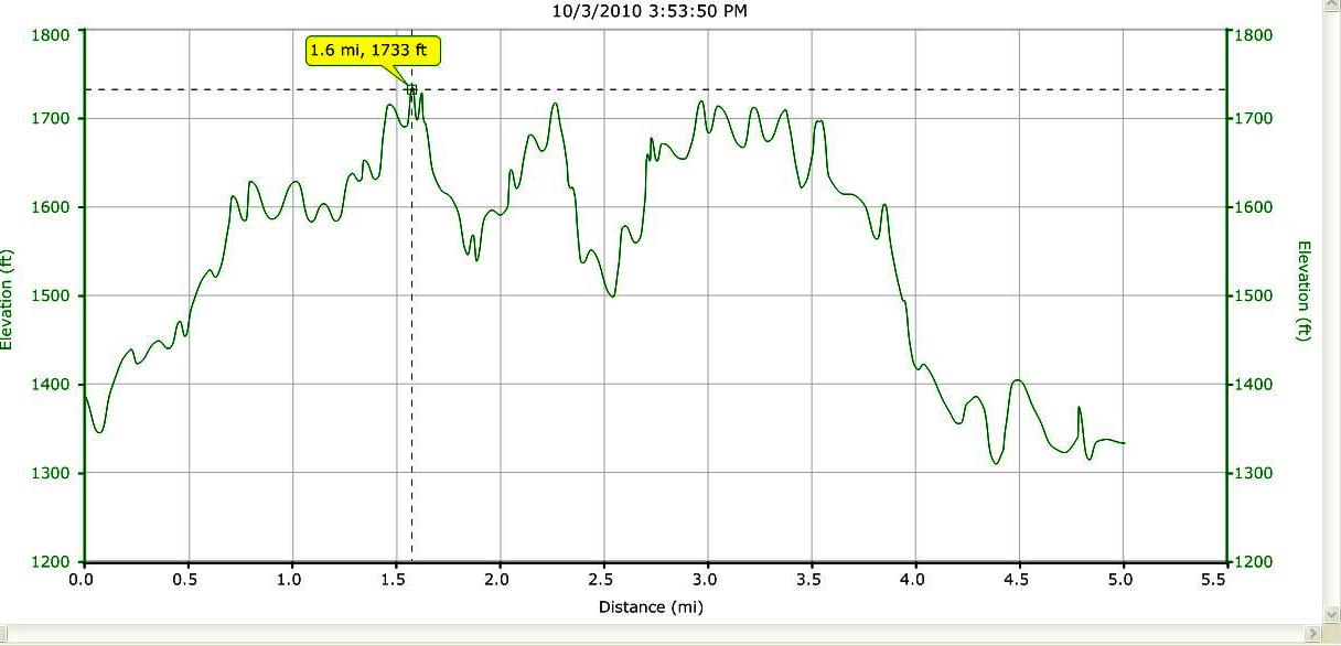
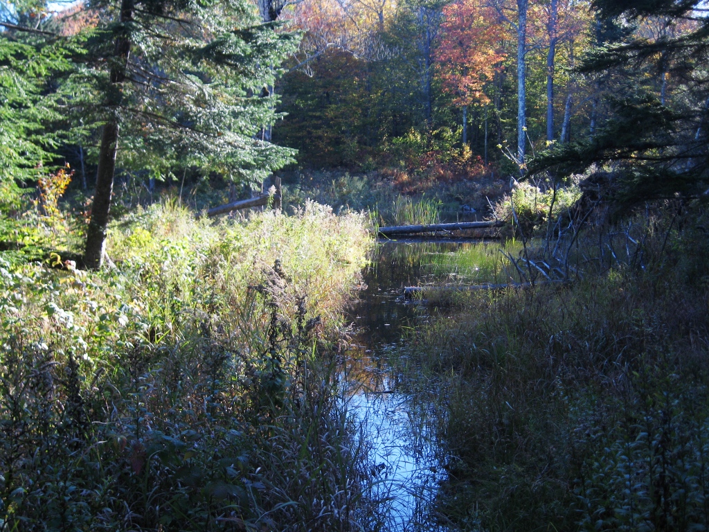
Eventually, sticking to an uphill bearing, I came to the obvious path. Presuming that a right turn here would take me back to the house in a few minutes, there was only one thing to do – go left! While the trail was easy to follow at first, it faded badly in sections, especially with all the leaves on the forest floor which made it hard to follow in places. When the trail became less obvious, there were usually a few plastic strips hanging off of branches, or colored plastic nailed to the trees, probably many years old. Eventually this rather vague trail rejoined one of the major Rikert trails, which is also part of the Catamount Trail connecting the Frost trail with the Brown gate trail. A ski tour passing by this section was described in a prior post entitled “Norske Trail to Brown Gate“. I finally knew exactly where I was, and that I was on well maintained trails. Looking forward to some easier uptempo running through Rikert trails I should have guessed there would be another hurdle in my path, and there was. The beavers who created the ponds alongside this stretch of trail have apparently been quite busy this summer, and one rather substantial section of the trail had a new purpose – beaver pond! I thought it couldn’t be too deep, but after a few steps into the pond which brought the water up to my knees, I thought better, and bushwacked to the right and managed to avoid most of the water.
Following any of the numerous obvious trails after this point will bring one to FS 59 (aka Steam Mill Rd) which runs behind the Breadloaf campus. A right turn on this road led to Rt. 125 a few minutes later, and an easy run on paved road to return to the parking lot. Not content to call it a day however, one last distraction delayed my return. Passing by the small, but maintained graveyard on the left side of the road, I thought I would stop and take a look, given that I had driven by it hundreds of times. There were a few prominent Addison County names in this small graveyard, known as the Galvin Cemetary, but the stone that caught my attention was this one:
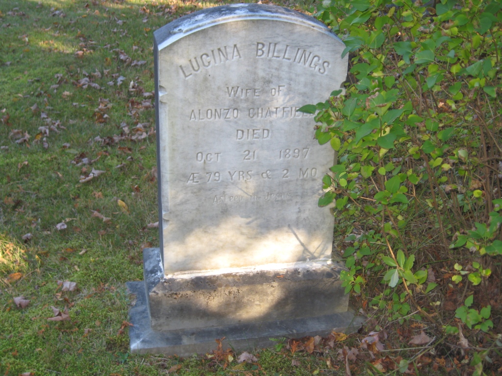
I had stumbled across the final resting place of Lucina Chatfield nee Billings, the widow whose story made up one of my earlier posts this summer. I found it amusing that she was buried with her maiden name, rather than that of her bigamist husband! Returning to my vehicle, I was surprised to see that this run was only 5 miles long- a rather short run, but this one was long on discovery and adventure.