After the last posted run, which featured running commentary on the Robert Frost Cabin and Robert Frost Trail, it only seemed fitting to continue on with the Frost theme with a run up to the summit of Robert Frost Mountain. While many Middlebury-ites know of, and have explored the former, relatively few know of his namesake summit. Where exactly is Robert Frost Mountain? When looking towards the mountains from town, Robert Frost Mountain is the rounded summit high point just a few miles north of the East Middlebury and Rt. 125. While it is not a particularly dramatic summit, it is a pleasant place to visit with good, albeit wooded views, and its paucity of hikers (or runners). I have no idea if Robert himself ever ascended to its heights, and I rather suspect not. There are several peaks in the US named Mt Washington, however, and I am quite confident that George (or Martha) never climbed any of them.
To get to my starting point for this run, head south of town on Rt. 7, east on Cady Rd. (the road bisecting Foster Motors), and then north on Rt 116 for 0.4 miles until you get to Munson Rd, where you take a right turn. Be careful not to exceed the speed limit here (25 mph) as it has been heavily patrolled as of late. Find yourself a suitable parking place anywhere alongside the road near the four-way stop sign a half mile later to begin the run. Hopefully you can park your car in one of the favorite hiding places of our well-intentioned and hard-working officers of the law, and save this author from another speeding warning!
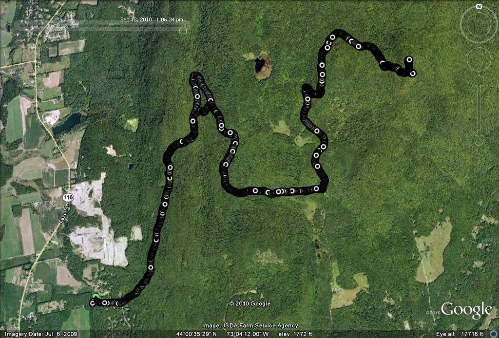
The start for this run is on the snowmobile trail paralleling Burnham Dr., the road heading east towards the mountains from the aforementioned four-way stop sign. The first 3.4 miles of this run are also described in a previous post, The Toughest Nine Miles in Addison County. This older post has now lost its title. The first two miles of the run follows a VAST snowmobile trail heading north along the west face of the Green Mts, climbing more or less steadily, first through deciduous forest, then into a coniferous forest (which you can make out from the west pretty easily), before climbing back into deciduous again. This is a very pretty section, following a brook much of the way, with a few limited views through the trees. At about 1.5 miles, the trail forks into two equally strong trails, and both will work for this run. I chose the right trail on the way up, as it is a little shorter, but if you miss the trail split and take the left fork, it will connect with the same next trail.
The snowmobile trail tops off onto FS 237 (not marked at this point), an obvious but somewhat overgrown forest service road. Take a right turn here (an earlier missed turn will have you coming up to this point from the left) and follow this road until it ends in about a mile and a half, connecting with Dragon Road. Dragon Rd. is a maintained dirt road suitable for 2WD cars, but like many of the lesser known mountain roads in Ripton, rarely driven. The run I previously described went right from this point, ending the uphill section considerably earlier. Take a left uphill until the road ends after about eight tenths of a mile. There is a small parking lot here, and if you would prefer a much shorter run, or even an easy family hike, you can drive to this point and start here. To get to this parking area, drive into East Middlebury on Rt. 125, turn left on North Branch Road (the slight left at the Rt 125 bridge), and a few miles later, when North Branch Road makes a right, continue straight on Dragon Rd. until the road ends.
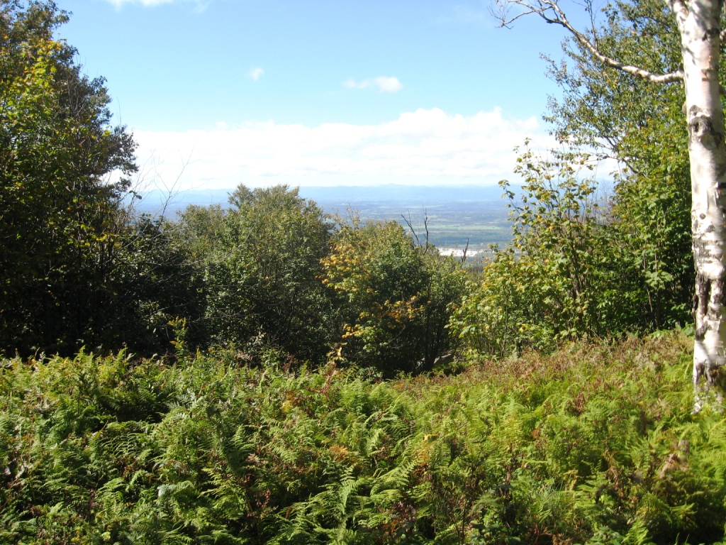
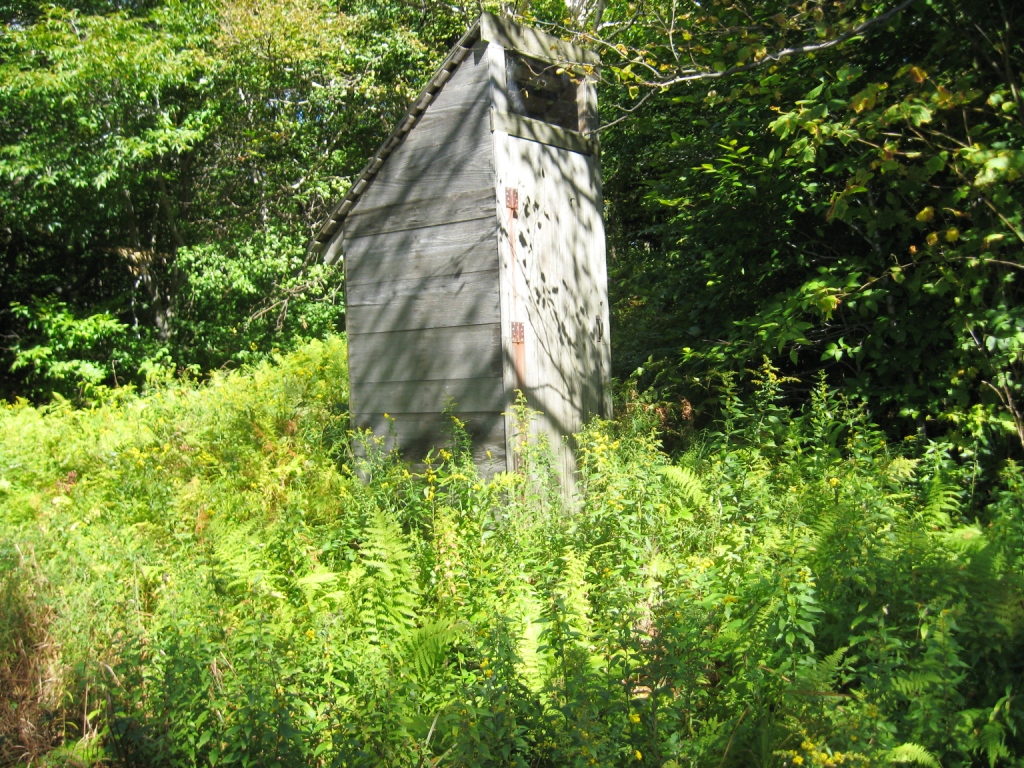
As you enter the parking lot, look carefully to the right to find the somewhat overgrown start to the trail leading to the summit of Robert Frost Mountain in 1.2 miles. This trail gets so little traffic in the summer that you have to walk through tall weeds for 20 or 30 feet before the trail becomes easy to find and follow. You will know you have gone the right way when you see a gate across the trail. From this point, the trail isn’t too bad, other than the fact that it is somewhat overgrown (hence good for resistance training for trailrunners!), and gets a little steeper as you approach the summit. Most of the traffic to this summit clearly is during the winter, when the snowmobilers apparently make it a frequent destination. The summit is wooded, but people have cleared a few nice views to make the climb worth the effort. This summit has another unexpected creature comfort – a privy at the summit, which actually appears to be in far better condition than most similarly situated sources of relief. I was somewhat amused, however, by the fact that there were a few empty liter cans of Bud Light strewn about its floor. Go figure.
The run back down mostly followed the uphill run, other than at the point where the lower shortcut from the snowmobile trail connected to FS 237. It is very difficult to see where the uphill trail connects with the Forest Service Road, so I just went to the end of the road, and followed the obvious left turn at its end where it also connected with the uphill route. As I descended, I did note the following somewhat amusing sign:
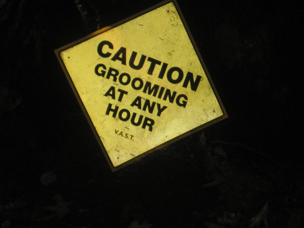
I briefly considered bringing the sign home, and posting it on the door of my teenage daughters’ bathroom, but instead decided to leave this amusing little non sequitor to be discovered by other runners and hikers.
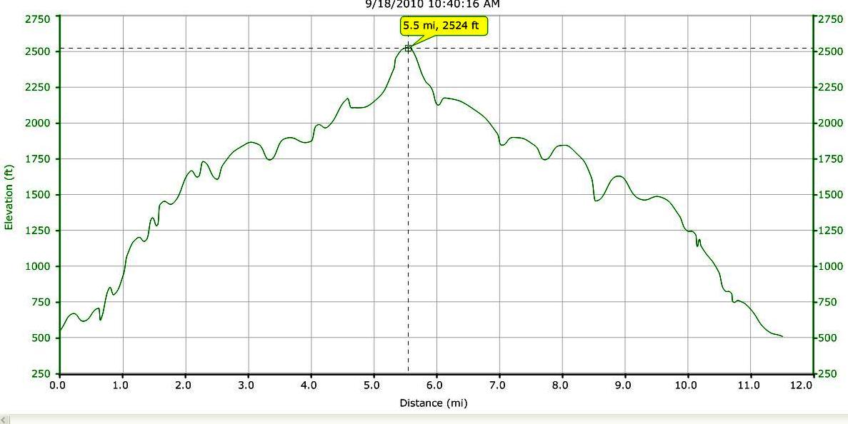
When all was said and done, this was a long hard run, with 11.5 miles of running and 2000 vertical feet of climbing. I don’t usually post my time, but this adventurous run took a while – two and a half hours. Given the relentlessly pretty woods and decent views, this route would also make a fine day hike as well, either from East Middlebury, or from the higher trailhead.
i ran to the top of robert Frost mountain today starting from 125, it was a great run and i had a fantastic time the actual trail was quite over grown and buggy but it made the experience all that more more memorable. Thanks for the Idea and i cant wait to try your other runs,
-John
Glad you enjoyed it! That top of run is usually pretty muddy year round, so I can’t imagine what it must be like now. Some of the runs from the Brooks Rd. trailhead are comparably epic, if you are looking for good ones to try. I am also jealous, as I am nursing injuries, and stuck on much mellower runs.
Jeff