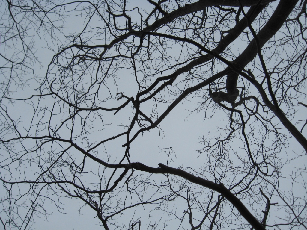
In keeping with my observation that things just look different when the trees are bare, but the weather isn’t too wintery, I decided to re-explore an area which has been the subject of two previous posts. In this case, I decided to go for a run in the terrain roughly delineated by Rt 125 to the north, and Upper Plains Rd. to the west. The small peak which emerges from this corner is known on topo maps as “Pine Hill”, a curious name for this modest bump, which seems to be entirely covered in deciduous forest. I described a run in this area as one of my first posts in this blog, entitled “Secret Meadow“, as well as in an early winter run entitled “Snowy Scenic Sauntering on a Sunny (Almost) Solstice Sunday“. The high point of both of these runs is a little-known hillside meadow with outstanding westerly views. The run described in this post was just a little bit more ambitious, covering some slightly rougher terrain with more climbing.
While there are a few appropriate places to park one’s vehicle closer to the trails, I chose to start the run on the Oak Ridge Trailhead, just above East Middlebury on Rt. 125, so that I could make it a longer workout. I headed towards East Middlebury for a few hundred yards before taking a left turn on to Upper Plains Road. This road used to have a “tree tunnel” feel to it, but recent “improvements” have involved removal of many of the trees which were encroaching on the road. Too bad! After about a mile, a Forest Service gate on the left marks the start of the trailed section. I couldn’t help but notice the rerouting of the path created by the incessant efforts of ATV-ers – earlier paths were blocked off, leading to generation of new paths. Be forwarned that the entry into this run off of Upper Plains Rd. is unposted private property, so please be particularly respectful of this, so that this lovely area can remain open to exploration. But…I didn’t need to tell you that, right?
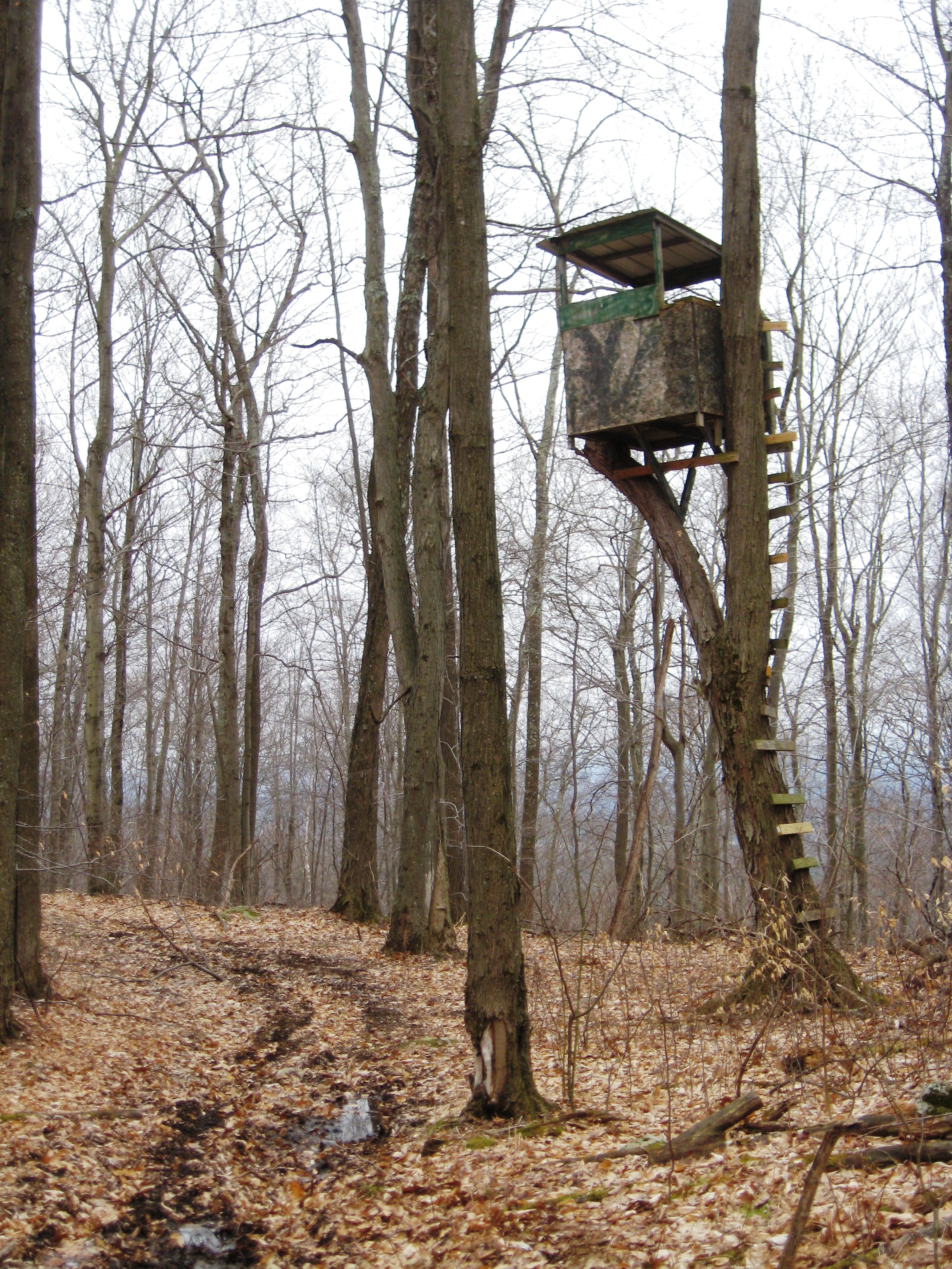
After getting past the gate, the next section of climbing was on a dirt road, which switchbacked up the hillside until it broke into the aforementioned meadow by a small pond. As soon as you pass the birch grove on your left, take a sharp left turn, and veer back towards the forest to find the true trail heading north along the west side of Pine Hill, which now stands to your right. There are quite a few other trails in this vicinity, which can be a little bit confusing. In fact, if you look at my GPS track for this run, you will notice a short diversion to the right, which the result of mistakenly following a path which disappeared after about a hundred yards, forcing me to backtrack and choose another. Not long afterwards, I reached the saddle between Pine Hill (to my right) and a lower summit to my left. I also couldn’t help but notice one of the most spectacularly situated hunter’s blinds I have seen in my explorations. It undoubtedly provides great views, and let’s face it, what kid, young or old, doesn’t love a treehouse? Even the ladder had a whimsical, Dr. Seuss-like feel to it!

From the col, I decided to save the true summit for another day, instead taking a short bushwhack to the left to the minor northern summit. Despite the gray skies, the view here was excellent, and given the ledges and lack of foliage to the west from this vantage, I suspect that the view will not be badly hemmed in once the trees are in full leaf. This pretty little summit also had a lot of low lying bushes which I suspect will bear blueberries mid-summer, as well as many weather-twisted small trees which gave the summit a slightly haunted feel.

With the advent of a slight drizzle, I continued on the path, which got very muddy in places, before descending to an intersection with a more developed trail behind the hill. Here, I took a right turn to complete the loop, stopping to take a picture of the pretty waterfall found in the rather steep notch behind Pine Hill. I was always curious why the dirt road, meadow, and broad, well built trail reaching the waterfall were built in the first place, and while mountain biking last summer, I happened to meet the landowner who told me a little bit of the “back story” to this property. Apparently, at some point in the 60’s or 70’s (a seemingly generic way of saying “A long time ago, but not THAT long ago”) the man who owned the land had received federal funding to develop this waterfall as a rest area, as part of the National Forest. For reasons unknown, after the initial stages of the roadside development, involving roadbuilding and a few other modest improvements, the project was abandoned. Well, the waterfall and surroundings are still quite beautiful!

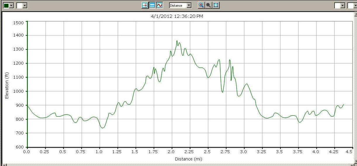
After pausing at the waterfall, the trail re-emerged from behind Pine Hill into the meadow, and by staying to the far left, I caught the short steep path returning me to the forest service gate, where it was an easy mile-long return to my car. The total length of this run was about 4.25 miles, with a climb of 500 ft – not bad for the beginning of April.
I also decided to have a little extra fun with this run – with the advent of routine access to portable GPS devices, a new pastime has emerged known as “geocaching“. Geocaching hobbyists leave hidden containers with logbooks, souvenirs, and sometimes even disposable cameras at locations of interest, and then post the GPS coordinates as well as other hints for others to find the site. If you take a look at www.geocaching.com, you will see that there are many geocache locations in Addison County. Since geocachers and trail runners both share an interest in discovering new places of interest, I thought it would be fun to set my first geocache on this run. My geocache, which contains a logbook and disposable camera for finders to share their experiences, as well as a small souvenir can be found without a lot of difficulty by someone completing this run. The actual GPS coordinates, which will also be posted soon on the aforementioned geocache website are N 43 degrees 57.934′, W 073 degrees 04.248′. Happy Hunting!
Note added 10/27/12 – I went up to check out the fate of my geocache, and found that it had been stolen. I guess the allure of a 10 buck fishing tackle box with a few toys in it was more than one of the visitors could resist. So – this is still a fun run, but not geocache, until I get around to replacing it.

