This winter, extraordinary high pressure sat over Greenland, matched by high pressure over Alaska. This caused a breakdown in the polar vortex, causing cold arctic air to dump southward, on top of us. This cold air spilling south is replaced by warmer continental air. A similar event happened last winter as well. Scientists are blaming our colder than normal temperatures and our increased precipitation on this unusual pattern. Much research is taking place now on this event, known as a Warm Arctic/ Cold Continent.
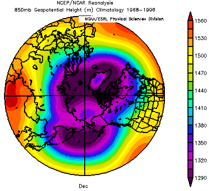
Average Pressure Pattern
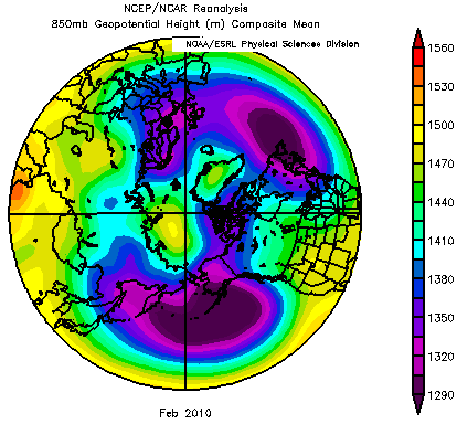
High Pressure, February 2010
The reason for this is a disturbing lack of arctic ice. In January, there was a record setting amount of missing ice in the Arctic, about twice the size of Texas. In the summer, more heat is absorbed by the ocean, which releases in the fall, warming the air above and causing the high pressure. Ocean temperatures are well documented to influence weather patterns, such as the El Nino events, or even hurricane patterns in the Atlantic ocean. And most weather researchers are laying the blame of the lack of arctic ice right at the feet of global warming.
This weather pattern has been breaking down the last couple of weeks, as low pressure is forming in the arctic, creating more sea ice, keeping the cold air locked in the polar vortex. It may be that the groundhog was correct, and our exceptionally snowy and cold winter may be coming to an end.