On yet another gorgeous Sunday afternoon, I decided to explore an area where I used to mountain bike regularly, but had not been to in a few years. While I used to be an avid mountain biker, a few summers in a row with crashes ending up with ribs which were “broken, sprained, strained, or tied up and twisted” (and it doesn’t make a difference which diagnosis you get, as the treatment is always “Ibuprofen, rest, and hurt for two months”) diminished my fervor for the sport, and actually led to my current focus on trail running. The area between Upper Plains Road and Lower Plains Road, which straddles the Middlebury-Salisbury town line is full of trails, which in the past seemed to be most heavily used by ATV’ers, but showed few signs of use on this run, at least not this early in the season.
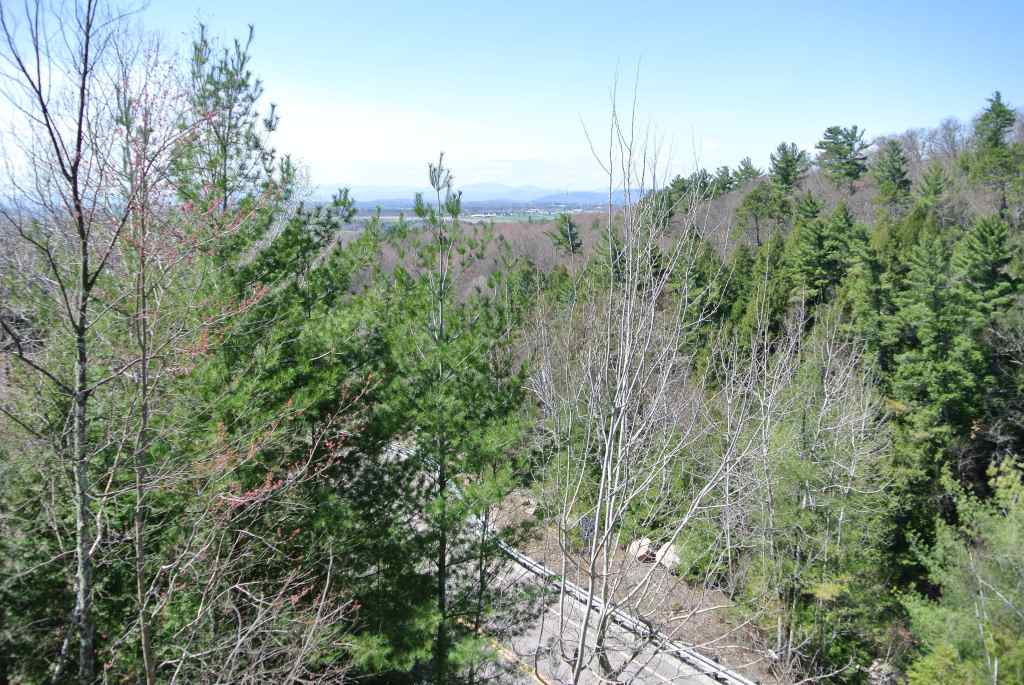
I started the run at the parking lot at the East Middlebury playground, and headed past the Waybury Inn on Rt 125. Younger readers may not remember this, but a photograph of the Waybury Inn was used in the credits for the 1980′s Bob Newhart Show, where it was referred to as the “Stratford Inn“. After passing by the Inn, I headed over the bridge, and up the short steep hill known as Sand Hill, and took the right turn on a dirt road serving the highway department Quonset hut before reaching the top of the hill. Shortly after turning onto the Quonset hut dirt road, I took the broad grassy path veering to the left, and followed this to the first left turn. Another left turn brought me up a short steeper climb on a trail which appeared to have been built and actively maintained at some point, and left me wondering for what purpose it was built? It was too narrow to have been a logging road, and there were no signs indicating that it was or had been an active snowmobile trail. Reaching the height of this climb, I did a short bushwhack in the direction of Rt 125, and found a nice overlook at the top of the rock outcropping alongside the road at this point.
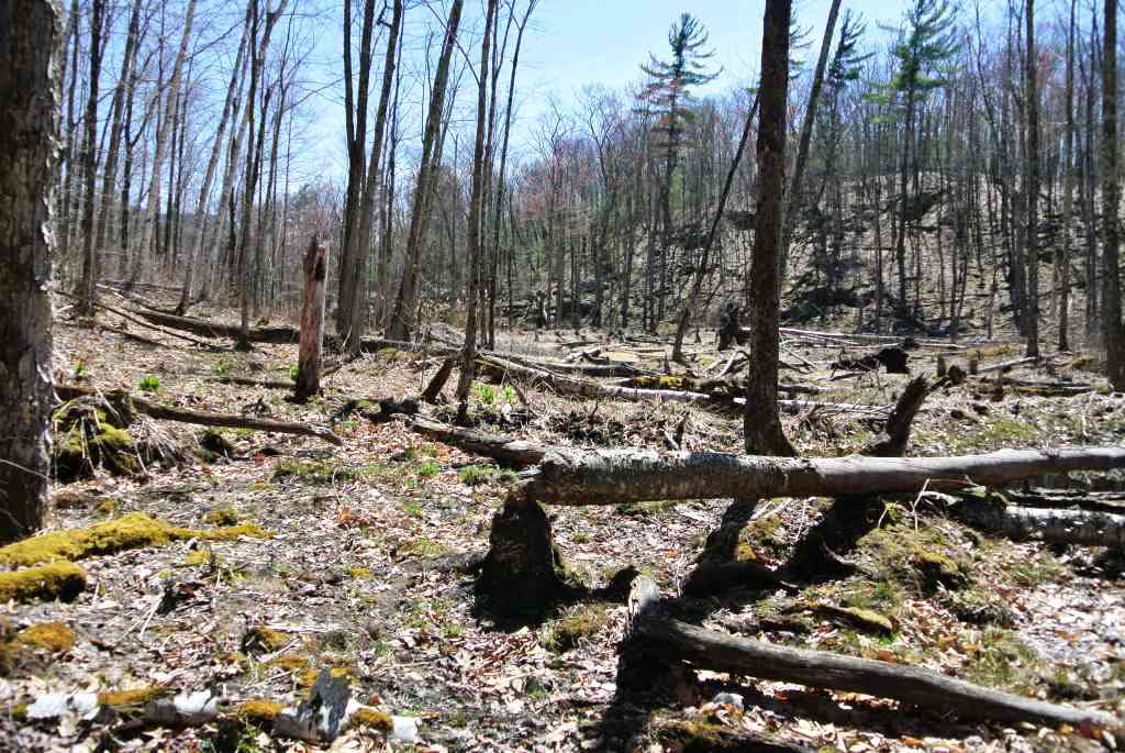
After this view, not entirely sure where I was going, I proceeded further uphill, until the path emerged from the woods, joining Upper Plains Rd near to the point where it empties into Rt 125. Not wanting to leave the trails just yet, I found a bear path (as in barely there) and went in a direction where I thought I might find some beaver ponds whose location was hinted at by Google Earth. Soon, the boggy terrain under my feet told me I was probably going to find what I was looking for, and sure enough, I came across an semi-open meadow with many fallen trees, and of course, a mound of sticks in the distance where the little engineers made their home.
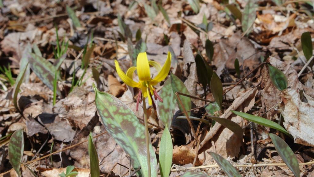
As I turned around and backtracked my way through the mud, I caught site of the first wildflowers of the year. I will have to send a note to my botanical colleague at “The Middlebury Landscape” to ID this flower for me.
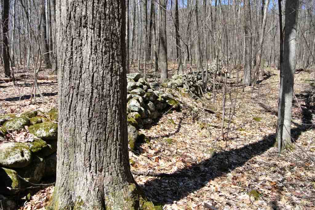
I also noted one of the more intact stone walls I have seen for some time. The woods in Addison County are full of these of course, but the mature state of the hardwood forest led me to guess that this is a rather old stone wall, and that the hill farm it probably served was long defunct, making the condition of the wall all the more remarkable.
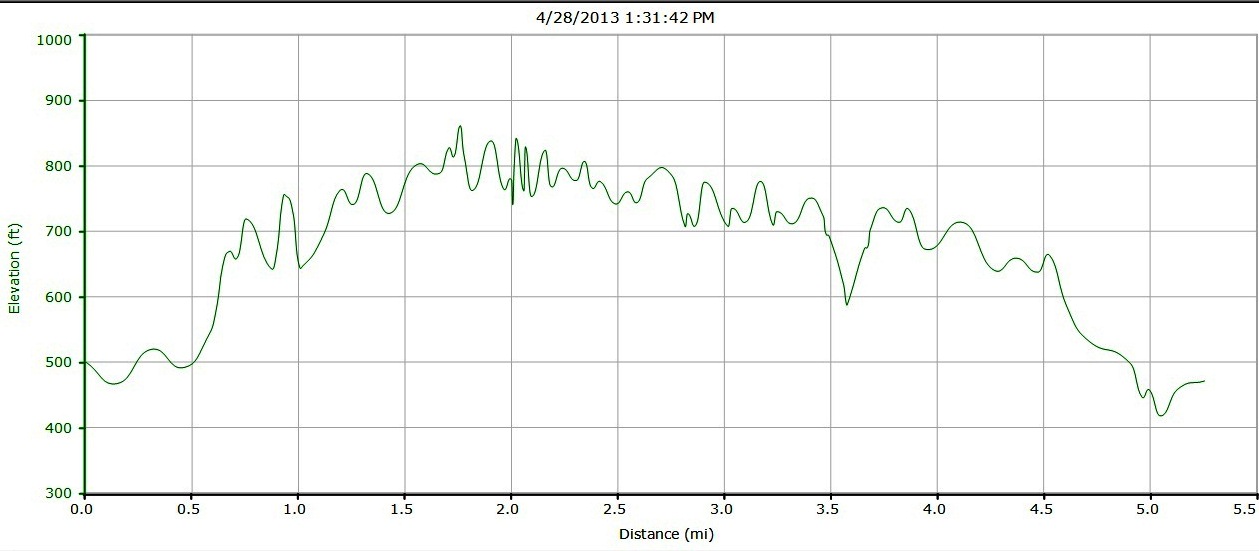
Up to this point, a lot of what I have been referring to as trail running was really a mix of jogging, exploring, and even a little bushwhacking, and I sought a better defined trail to stretch out my legs a little more. Fortunately, at this point, I found a strong trail heading south, and spent a solid mile on it before it bore downhill to the right, and curved back to the start of the run. I was just beginning to wonder who actually owned this land, as there were no forest service or “Posted” signs, but as I neared the Quonset hut, I noted that the land to my left was suddenly heavily posted. Guess I won’t be going that way! Once I returned to the Quonset hut, I simply retraced my steps back into East Middlebury and my waiting car, for a 5.25 mile, and surprisingly, 400 vertical feet of climbing run.
