Last Saturday, I was looking to go for a run out on the trails, but knew that an awful lot ice of my favorite terrain, and with a road marathon coming up in a few weeks, I didn’t want to risk injury. Compounding the challenge of where to run, I knew there had been some fresh snow at altitude the night before, as I discovered on particularly “white knuckle” drive over Rochester Gap and Middlebury Gap the night before. Thinking about things, the logical choice was to find one of the many VAST snowmobile trails. Past experience told me that these trails are almost always well-packed by recent snowmobile activities – and in some cases actually groomed, making for excellent “trail” running wearing my microspikes over my running shoes. With this in mind, I headed into deepest darkest Ripton, up the Natural Turnpike to where the plowed section of the road ended, and there was a small parking lot used mostly by skiers during the winter. This early in the spring, when there was still a veneer of snow on the upper reaches of the increasingly primitive dirt road, things were frozen enough for my low ground clearance VW Beetle to get up the road, but I suspect that very shortly, when we are in the depths of mud season, the road may require a higher clearance vehicle, or a 4WD.
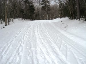
There was an informational kiosk at the trail head, and the snowmobile trail itself was perhaps 20 yards away, right under my nose, and I was surprised to see that no snowmobilers had been out, at least since the previous evening’s snow, which looked to only have accumulated about an inch. Beginning my run to the right, in about a minute, it joined up with the much wider Steam Mill Road, also known as Forest Road 59, the road whose other terminus is near the Rikert Ski Touring Center, and in fact bisects the area. This road, which is only open to traffic during the non-winter months showed plenty of signs of usage – by everyone but snowmobilers. The thin snow cover, however made it easily runable – but who knows what the conditions are like now, a week later. I also found it interesting how the different types of trail enthusiasts seemed to have chosen their respective lanes – foot travelers on the left, classic skiers in the middle, and a ski skater on the right!
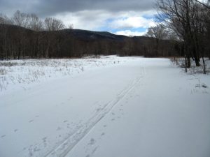
Continuing up the road, I came into the Steam Mill Clearing itself. The fact that this high in the mountains, there is still open meadow here I would suspect is the result of a once a year mowing, although I don’t know this for sure. There is also a big sign, indicating “Wildlife Viewing”, but I looked around and I seemed to be the only wild thing here – in fact, I was stunned by the near silence – a windless day, mid afternoon, and probably the only person for a mile or two. I also noted a sign indicating where the Catamount Trail joined in from the south. This section of the Catamount trail, connecting Rikert with the northern section was the result of a blog posting a few years ago.
At this point, I also noted that the thin cover of snow was getting deeper, making the running a little bit more challenging, and the ski tracks I saw were looking more and more enticing. At this point I realized that I may have forsaken my last chance to ski this season in order to do this run. Oh well- it was a good season! As the trail slowly climbed, I finally reached the height of land, which while only a few hundred feet higher than the trailhead, had about 6 inches of fresh snow! Tough running, but it would have been great skiing. As challenging as the running was for this short section of deeper snow, I didn’t feel sorry for myself, thinking of some friends who were competing in the Runamuck 50K on snowy and muddy trails, near Woodstock VT that same day.
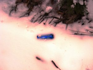
A short descent, brought me to the end of the snowy part of the road, reaching the point where Steam Mill Road is plowed, near the upper reaches of the Gilmore Trail at Rikert. I could tell I was near to “civilization” at this point, as evidenced by the most ubiquitous bit of litter – the inevitable Bud Light can, in this case half buried in the fresh snow at the side of the trail. Bud Light – the beer of champion litterbugs!
Heading back, I climbed back up to the high point, and in the course of the long, gradual descent back to my waiting car, I came across a skiing couple, with a few enthusiastic dogs. Stopping for a moment, one of the couple said “I thought that might be you”. I was puzzled, as I didn’t think I knew these people, but not wearing my glasses, I sometimes am a little weak on recognizing people. Embrarrassed, I asked her for her name, which she offered, and as I still had a look of confusion, she followed it up with the fact that she read my blog. That made my day – thanks!
All said, this is a nice stretch for running, especially midwinter when it is well packed, and ended up being a 7 mile run with a few hundred feet of climbing and descent. I think I am ready for the spring thaw, and some truly muddy trails!
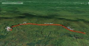
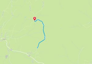
Since this run was on a road, at least in the summer, I thought it would be useful to show where it is on Google Maps as well.
