Given the recent loss of snowpack, my plans to do some cross country skiing turned into a running day. I wanted to find a run where there was enough snow to feel wintry, but didn’t want to find myself scrambling, rather than running, on icy single track. So, I thought that the run up to the Sugar Hill Reservoir, using groomed snowmobile trails, would make for a fun run, especially since I would be wearing my slip-on Microspikes. I had detailed this run many years ago, in my first year of blogging, albeit in the summer, so I thought it would be fun to rehash the run, with some winter photos.
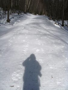
Arriving in the parking lot, found at the end of the plowed portion of the Brooks Road (the road on your right, just past Breadloaf heading towards the Snow Bowl), I saw a few other cars parked there, showing that the warmer than usual weather had inspired others to get outside! Parking my blue beetle, I started the run up Brooks Rd, where It had been recently groomed for snowmobile travelers by our friends at the Vermont Association of Snow Travelers, aka VAST. As an aside, VAST makes a detailed map of all the snowmobile trails in the state, which is an excellent source of trail running inspiration in the winter or summer. I purchased a copy of this map at Rosie’s Restaurant in Middlebury, although I assume it is available in other places. As I have noted in the past, the combination of groomed snowmobile trails and microspikes makes for excellent winter running. I never felt like I was going to slip, ascending or descending, and the spikes didn’t seem to appreciably slow me down. If was also fun seeing the mix of tracks – deer tracks, bird tracks, dog tracks, people tracks, and some skid marks that looked remarkably like sled tracks on the hard packed snow.
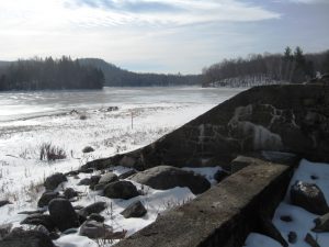
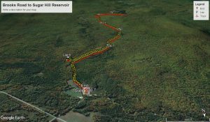
The run starts off easy enough, pretty flat for the first quarter mile, but the next mile after that is where the bulk of the climb takes place, ascending relentlessly up 400 vertical feet. I also have noted various side trails along the way, and once in a while make a mental note to explore them. A half mile up the hill, I noted an unmarked trail to the left, and decided to explore it during my descent. At about the 2.5 mile mark, the snowmobile trail makes a well marked right turn, with a short ascent, and a steep descent down to the Sugar Hill Reservoir – the body of water that is the highest altitude part of the water project funneling water down to the small hydroelectric plant on the shores of Lake Dunmore. Reaching the shores of the reservoir at a little over 3 miles, I looked completely frozen over, and I briefly considered running on the ice, around the periphery, but common sense prevailed, and I realized that this little adventure needed to wait until I wasn’t running alone. On a typical summer day, there are usually a few fishermen or kayakers playing in or by the water, made easily accessible via a dirt road from the Ripton-Goshen road, but today, I was the only person there enjoying the scenery. The lake looked cold and windswept, but it was such a warm day, that just hanging out for a short while on the shores was rather pleasant.
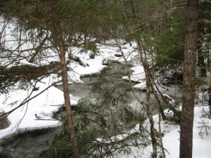
This was a straightforward run, so my return simply involved retracing my steps, with the addition of a little bit of exploration on the side trail, near the bottom, on my right while descending. It looked like a well- beaten trail, so I figured it had to lead somewhere, right? Well, it went all of a tenth of a mile, ending at a small stream, leading me to the conclusion that this trail served the needs of fishermen, not runners and hikers. It was a pretty little place, however.
Returning to the Brooks Road, I completed the descent for a 6.5 mile run, with about 600 total feet of climb and descent – a very modest run for a laid back weekend day.


