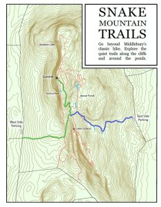
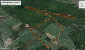
This weekend provided some more unnaturally warm fall afternoons, and I was thinking about a good place to run. While the leaves in the big mountains are falling quickly, there is still a lot of foliage left in the Champlain Valley, so the day called for a run up one of my favorites, Snake Mountain, the long ridge running north and south, just to the west of Middlebury. A few years ago, a Middlebury student, “Greg K.” who read of my interest in Snake Mt. from this blog, sent me a map including the major and minor trails on Snake. This map, included below, can be enlarged by clicking on it in most browsers. I was particularly interested in exploring a minor trail, which appeared to run along the south ridge of the mountain, and seemed to have at least one overlook. All the better for a busy day, when the main summit could have hundreds of hikers over the course of the day.
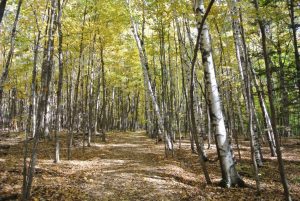
Setting off from the popular West Side parking lot, I saw a young couple I could commiserate with – they had two young children, one in a backpack, and the other hiking, and both were crying. I joked with them how I used to bribe my daughters with Tootsie Pops at the summit, and they joked about their Gummi Bears, as I wished them good luck and started off the run. The first section of the run went through young hardwood forest with a lot of birches and their yellow leaves, with small amounts of sun filtering through the thinning canopy.
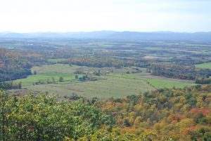
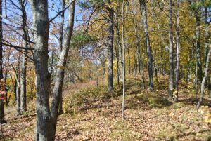
After about 10 minutes of gradual uphill running, I came to the first T in the trail, and took the obvious left turn for the steepest section of climbing until the trail bore right, arriving at the trail junction about halfway up the mountain. At this point, most of the hikers go left, following the old summit carriage road. Going straight would have brought me down to the lesser used parking lot on the east side of the mountain. The trail I was looking for, the weakest of the three was the right turn which I knew would bring me to the overlook on the southeastern flanks of the mountain. I was a little bit wary about taking a less frequently used trail during the fall, when the trail would be covered with leaves. I knew from experience, back in the days when I was working on my Adirondack 46’ers credentials (#5439!) that fainter herd paths, easy to follow during the summer months, are often obscured and more challenging after the leave fall. The first short section was easy to follow however, as it was wide, and got enough traffic to keep the path partially cleared. After about .3 miles, I got to the lookout, and had to to myself. Here, a very curious thing happened – I stopped to take this picture for the blog:
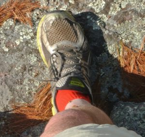
and as I was taking the picture, I felt what I assumed was a bug on my leg. I didn’t worry too much about it, assuming that I had just attracted a random cluster fly, and knew that there weren’t too many nasty biting insects out and about at this time of the year. As I was focusing the camera, I felt another little tickle, and then another…and starting to get concerned I snapped the picture and looked down – to see my shirt and legs crawling with ladybugs! I casually brushed them off, and as I did, more and more of them seemed to find me attractive – at one point I probably had 20 or 30 of them alighting on me! I have no idea what they found so attractive, and they weren’t bothersome, so I took a picture of a few of my visitors on my shin and decided to let them have their view to themselves!
Heading south beyond this viewpoint, the trail got fainter and more difficult to follow, as I suspected it would. I was not worried about finding my way back should the trail start to get erased by the leaves, as the topography of the mountain is pretty simple, and running along the southwest ridge, there were short intermittent views through the thin forest cover. But, to be honest, I have gotten myself in a little bit of trouble in the past in the mountains due to a simple fact – I don’t really like simply retracing my steps if there is another possible way back. Sometimes that other way back isn’t as easy to find as one might guess….
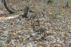
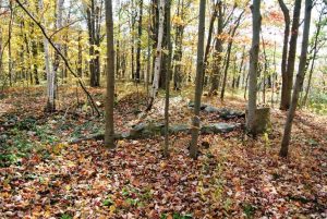
Sure enough after a little more than a mile on this ridge trail, which only showed occasional signs of recent use, like the easy to read indentation on logs across the trail where mountain bikers’ chain rings have dug in, the now very faint trail turned left, away from the edge of the mountain, and headed inward. After a short distance, the inevitable happened….the trail disappeared! I could have retraced my steps, but instead started bushwhacking towards some clearings I saw in the distance…and sure enough, here was a trail….but wait, it started turning around in the opposite direction from where I wanted to go. Puzzled for a moment, I decided to bushwhack my way back north again, and in a few minutes, I found another faint trail, and briefly thought that I had found my original trail, and would soon be back along the west rim of the mountain – after all, trails always look different when you are running the other way, right? I knew I was heading north, or at least was pretty sure of this, but as I found myself getting deeper and deeper into the mountain top ridge, I realized I had an entirely different trail, which sure enough, after about a third of a mile, also disappeared. At this point, I could see that the ridge that I had initially followed was a few hundred yards off to my west, and much higher than I was, so I continued to bushwhack north, or what I thought was north and was beginning to wonder if anyone had ever been there before, when I saw an old steel cable laying on the forest floor, still, with no obvious trail in sight!
Finally, surveying the woods around me, I spied something that looked like some switchbacks heading up the ridge to my left, which I followed – and this was clearly another little used trail, which brought me back to the original trail, a short distance from the viewpoint. Whew! Once again, one of my shortcuts ended up taking about 5 times as long as the original route. Some of my hiking friends will certainly appreciate that observation, as this was far from the first time that one of my shortcuts hasn’t worked out that well. Back at the original viewpoint, there was a young couple there – swatting away at the persistent ladybugs. After a few short comments, I headed on, until I finally got back to the main summit trail. A short way further, I passed the young family from the parking lot, presumably munching on Gummi Bears, until I got to the summit. As expected, the summit was very busy, and I heard some people talking about the concrete slab, and saying how it was the result of an old hotel. I resisted the temptation to correct them – I have been trying to find out about this slab, and it seems that the only printed source mentioning it – the 5th edition of “50 Hikes in Vermont” said it was the aborted home building project of a young man who died in a car crash in Europe at some point in the 20th Century, which matches the story I heard from a few other old-timers. One version of the story says that he was a race car driver, who died in a race in Europe. I knew, however, that the old summit hotel was actually back in the woods – a modest stone foundation all that remains. One of my old-timer friends told me that the hotel, while in ruins, was still standing in the early 1960’s until it’s wood was burned during the winters by snowmobilers seeking fuel for their bonfires.
At this point, I had covered more terrain on Snake Mountain than I had ever incorporated in one run or hike, so instead of descending the main trail, I took the right turn to the other viewpoint near the summit. This set of cliffs is less well known, as it is closed for much of the summer to allow nesting peregrine falcons to have their privacy. Right behind the overlook, there is a small, mucky pond full of cattails, called “Red Rock Pond” on some maps. Another piece of old-timer trivia – this pond was once the swimming hole for the guests at the summit hotel. If you look carefully, you can see that it has a man-made berm around it, now breached, which once held a far more appealing body of deeper water.
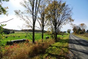
The descent from here is much steeper than the main trail, making it less appealing for running, although you can tell that it is really a trail, as opposed to the carriage road origins of the main trail. Finally, it rejoined the main trail, and I descended further until I got to the final right turn, which I decided not to take, instead opting to go straight, along what I suspect was the original course of the summit carriage road, following it first through a short stretch of forest, then wild meadows, and finally farmers fields before joining Mountain Rd. Extension, with its very limited parking, and ran the last mile or so on roads, enjoying the views of the hay rolls, with the Adirondacks in the distance.
This ended up as a nice 8 mile run, with some delays due to poor routefinding and bushwhacking! I will revisit some of this next summer, after the leaves are pushed off through use. I guess this is my way of warning you from following some of the GPS track for this one – I am sure I could not!
