With more great weather this weekend it was time to take to the trails again. I had yet to visit one of my favorite locations, Silver Lake, this season, but I prefer not to blog the same runs too frequently, unless there is some unique perspective to be presented. Last summer, while exploring the Chandler Ridge Trail, the trail traversing along the ridge separating Silver Lake and Lake Dunmore, I noticed the high-quality recent trail maintenance, and speculated that the formerly very rough and unrunnable trail circumnavigating Silver Lake might also have seen similar sprucing. So, I set out on this run with my camera and GPS, planning on running around Silver Lake, hoping that the lack of leaves on the trees might provide a unique perspective on this popular locale.
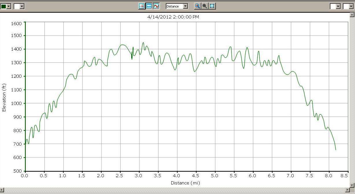
Arriving at the Silver Lake trailhead near Branbury State Park, I was surprised to see the parking lot almost full. Apparently, I was not the only person looking to get out in the woods on a warm early spring day! After about 1.6 miles of climbing this well worn trail (actually a dirt road, suitable for small 4-W-D vehicles, but closed to them) I arrived at the dam marking the outlet to Silver Lake, and took the trail leading over the dam to the west shore. The early going on this trail was fine as expected, but when I reached the point where the trail up to the Chandler Ridge diverged, and chose the lake shore trail as planned. It very quickly became obvious that this trail had not seen the tender loving care which I had hoped it had. In fact, as I was listening to that great old blues song, “Try a Little Tenderness” which happened to pop up on the day’s running mix, the song proved prophetic, as I stubbed my toe on an ill-placed rock. I don’t think that was the sort of “tenderness” that the songwriter had in mind – Ouch!
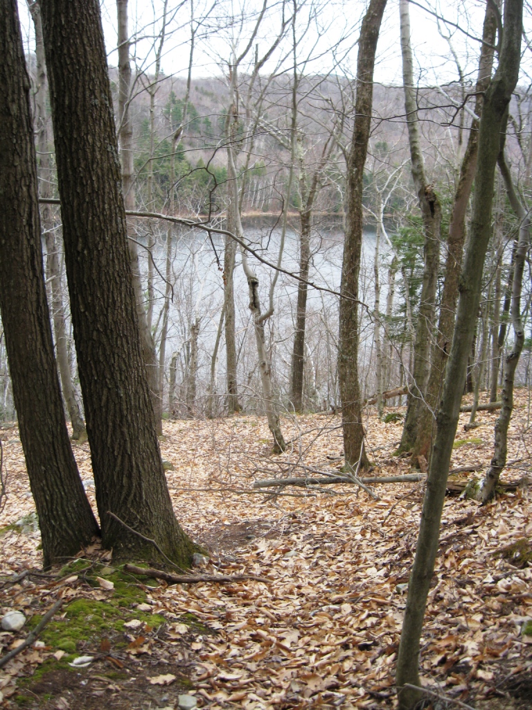
So, I decided that my planned route was not what I was looking for, but had my first inspiration, on my now improvised run. According to my memory of the Chandler Ridge from last summer, the views were limited by the deciduous forest cover. However, with the trees still totally bare, the views on both sides of the ridge should be spectacular, so I backtracked a few hundred yards, and took the trail leading up to the ridge, and was not disappointed by the views.
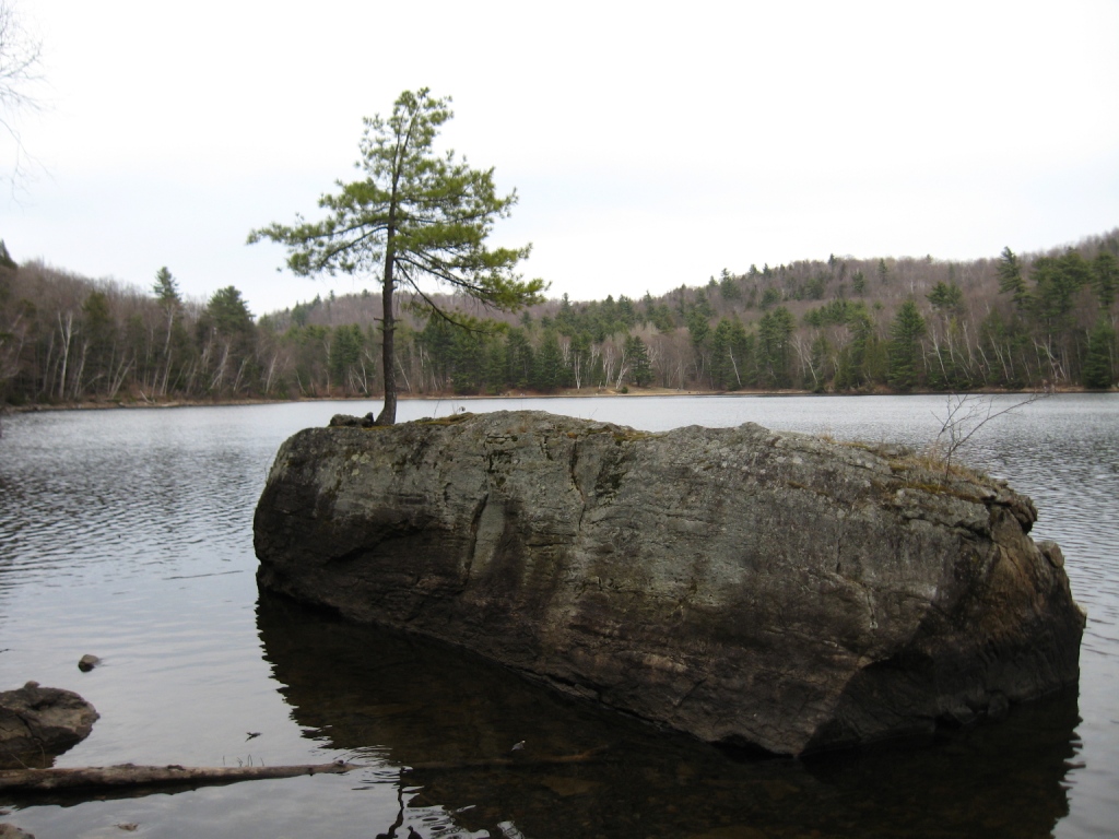
After enjoying the sights from this ridge for a while, I retraced my tracks back to the shore of the lake, where I came across a lone pine tree, sentinal-like, on a rock near the lake shore that I had never noticed before.
Returning back across the dam, I stayed along the shoreline until I reached the small beach, were I saw numerous families out fishing and enjoying the day. At this point, I had felt like I had explored enough, and was planning on heading down the trail back to my car. Shortly after beginning my descent, and still in sight of the lake, I saw a curious sight- I had been noticing the total absence of budding leaves on the trees at this higher elevation, but there was one small eager tree which was trying to get its leaves out in advance of its competitors.
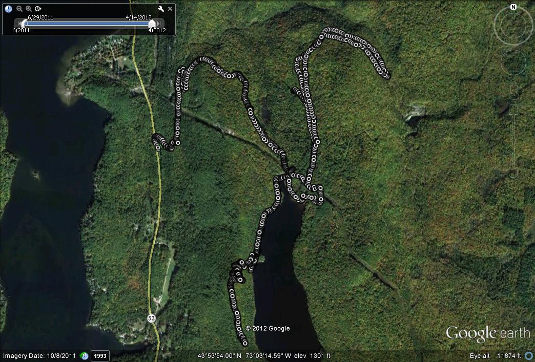
A few moments later along the trail, my next inspiration formed. In my many previous runs up to and near the lake,I had noticed a wide trail heading to the north, but had never taken the time to explore it – since it was not on any maps, I presumed it went a short way into the woods, and disappeared. My legs felt like the had a lot of energy left in them, so I decided to finally explore this trail. Much to my surprise, the trail kept going, and was soon joined by a high berm to my right, which I presumed was a pipeline coming from some other source, emptying into the spillway feeding Silver Lake from the north. After a short distance, the trail forked, and I randomly chose the left fork, which ended shortly in an open hillside meadow, which looked like it had been some sort of landfill once. I suspect that this may have been what remained of the dump for the long gone Silver Lake Hotel – and thanks to Gary Spaulding for putting together the short history of the hotel which I have linked to. After hitting this dead end, I doubled back and decided to explore the right fork of the trail to see where it might lead. I had long suspected that the source of the water for the Silver Lake spillway was the much smaller, and very rarely visited Sucker Brook Reservoir, shown on maps a little further uphill. After following this broad, easily discerned trail for some time (much of it bordered by the berm covering an occasionally obvious pipeline), I finally started to tire, and when the opportunity came for a trail which looked like it might take me home, a sharp turn climbing to the right, I took it, leaving the final discover of the trail’s final destination for another day. However, upon loading up my GPS track after the run, I discovered that I was probably only a few minutes from the Sucker Brook Reservoir, confirming my guess as to its role. My return trail actually followed right alongside the previous trail, surprising me that I had not noticed it on the way out. In the course of my return, I surprised a small flock of deer, who started as I grew near, proving far too Shy, lest I got too close.
Doubling back like this, I returned to the more developed campground and picnic area around the lake, and completed my final descent to my waiting vehicle below. Upon completion of a far longer run (over 8 miles) than I had planned, I had one last moment of inspiration – I treated myself to a Ben and Jerry’s Cherry Garcia Peace Pop purchased at one of the several general stores between the trailhead and my home – a great way to end a great run!


