This week’s post begins at what is by now, a fairly common trailhead for my runs, the Brooks Road parking lot. This trailhead, a mile or so downhill from the Middlebury College Snow Bowl, has been the starting point for several of my blogged runs over the last year, most recently a post entitled “A Tale of Two Weekends“. Nonetheless, there are many opportunities for unique runs emanating from this National Forest entry point, so I keep coming back to check out new variations. I have skied this route quite a few times over the years, but have only done limited exploring of most of this route during the summer months, so much of the scenery looked very different from the images in my memory.
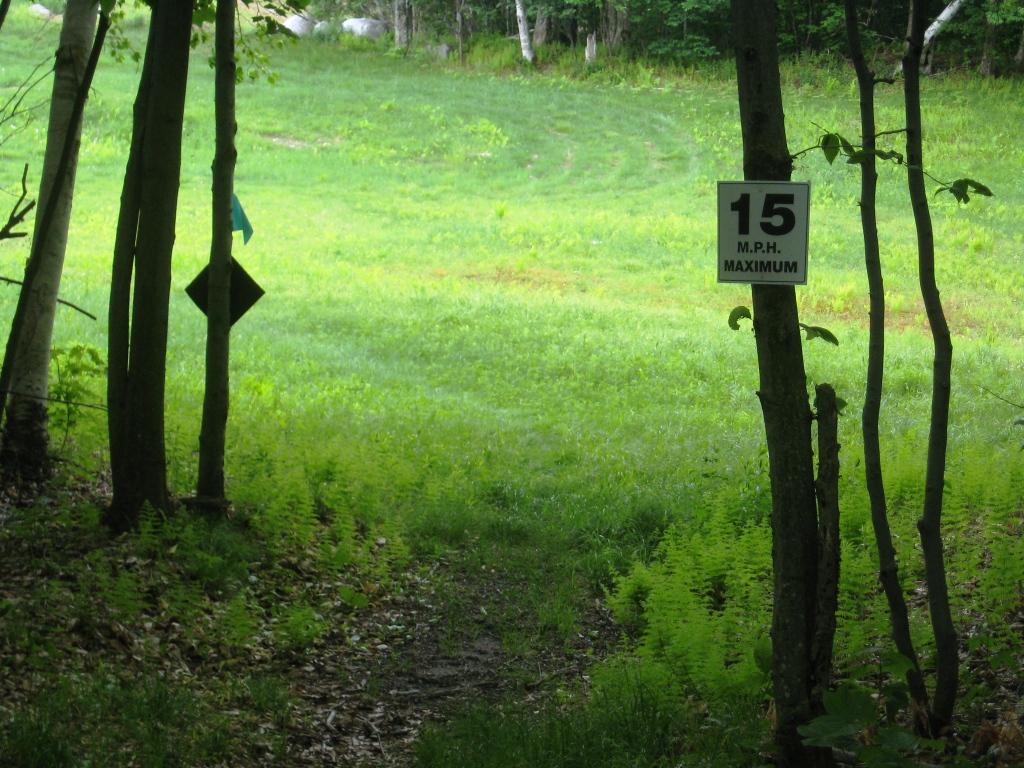
The start of this run, however, treads on familiar turf. I suspected (correctly) that some of the terrain would be a little rougher later on in the run, so I chose to complete the lion’s share of the climbing on the easy running surface of Brooks Rd., including the entirety of the “up and back” route described last summer in the Sugar Hill Reservoir post. The straightforward start to this run involved running up Brooks Rd. for 2.5 miles until joining the righthand side trail leading to the reservoir at the three mile mark. Entering the clearing below the reservoir dam, I noted a sign which was clearly aimed at runners who were far more fleet footed than I!
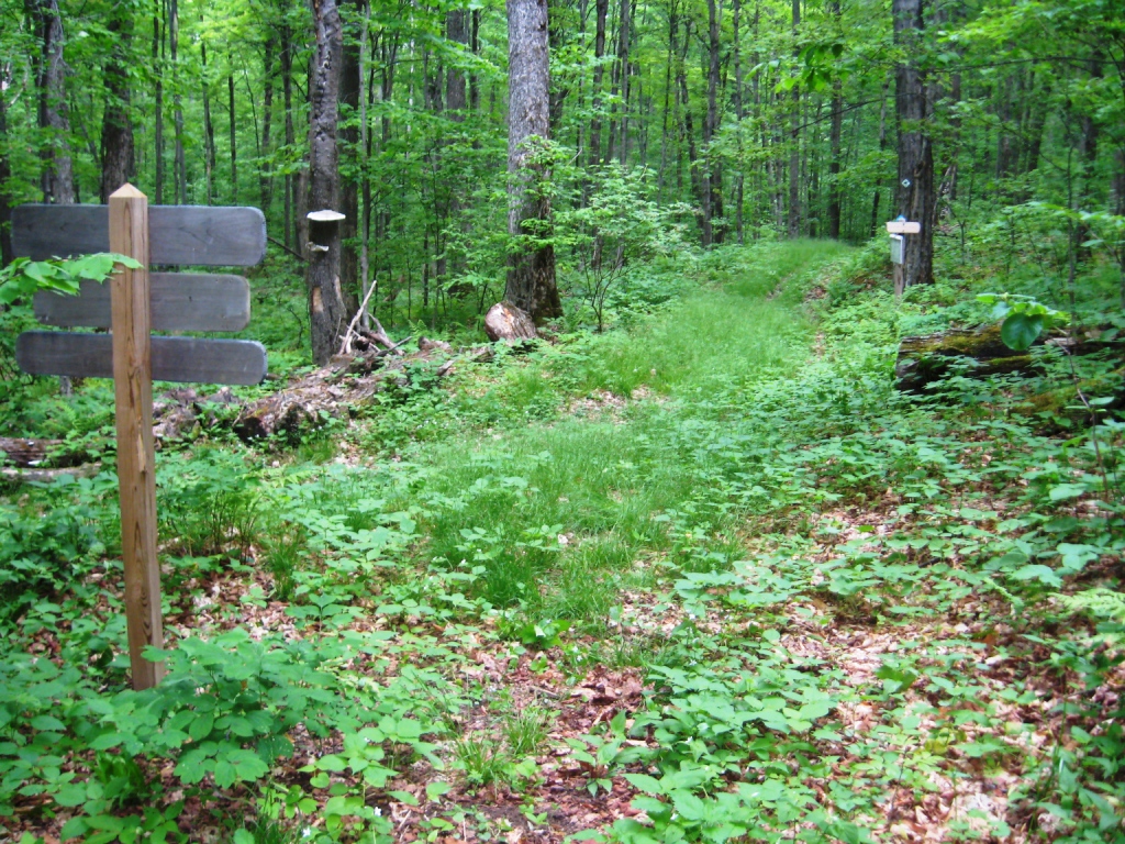
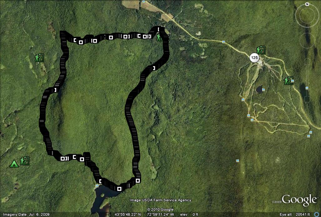
Rather than returning to my car by the same route, I chose to lengthen the run by delving deeper into the National Forest and trying out a loop run. Immediately after entering the dam clearing, take the trail veering downhill sharply to the right. At this point, the run seemed much more committed than other runs in the area, leaving me with the impression that I was heading into remote wilderness, despite the fact that civilized roads are never far away. The next 4 miles or so are on trails which are well-skied upon in the winter, but rarely travelled in the summer months, so there are some sections which are (surprise surprise) very muddy and/or slightly overgrown, but never difficult to follow. In order to find your way back to the parking lot, the simplest instruction is ALWAYS STAY RIGHT at each obvious trail junction. Since much of this trail parallels the Ripton-Goshen Road a “wrong turn” to the left will probably deposit you pretty quickly on this obvious dirt road, but you can be back on route by reversing your course for a few minutes. Finally, this segment of the route also coincides with The Catamount Trail, the state-long ski trail, so the unique Catamount Trail markers can be followed as well. This stretch of the Catamount Trail eventually joins up with the Widow’s Clearing Trail at a well marked intersection.
From this point on until the end of the run, the trail through mature hardwood forest following the Widow’s Clearing Trail. There is one last tricky intersection, a sharp turn climbing to the right which I would have overlooked if it wasn’t pretty well marked. About a half mile from the end of this loop I passed by large hillside clearing, which was clearly the remnants of a former homestead, as indicated by the ancient apple orchard at its edge. A small sign referring to this site as the Widow’s Clearing was also nailed into a trailside tree. A descent on well traveled trail returned me to the parking lot to complete this 7.6 mile loop.
Between numerous signs labeling the Widows Clearing trail, the Widow’s Clearing trailhead, and the Widow’s Clearing itself, upon my return to my vehicle, I began to wonder, who was the eponymous widow? I was not able to find any information on my own, so I emailed my favorite expert on local history, Jan at the Sheldon Museum. She was not familiar with this mysterious widow, but she did some research, and eventually connected me with William J. Powers, Jr. of Lake Dunmore and Rutland. All of the following information comes from Bill and is the result of his unpublished research on the topic. This is just a brief synopsis of a much larger body of his work. Bill has also authored a history book on another of my favorite running destinations, Silver Lake, and those who are interested in learning more about the history of the lake and its surroundings can purchase his book at the Sheldon Museum.
As it turns out, the widow of interest was one Lucina (Billings) Chatfield, 1818-1897. While Lucina was born in Tunbridge, she married Alonzo Chatfield in Middlebury in 1838. They moved up to his home in Ripton, and in 1859 they started farming the plot of land which we now call the Widow’s Clearing. Local records indicate that their farm was rather poor, even by Ripton hill farm standards. When this site became known as “Widow’s Clearing” is not in the information which I have at my disposal, but it is clear that Lucina was not widowed immediately – she was abandoned by her husband! In 1855 Alonzo left her and their four children, and moved to Michigan where he lived the rest of his life with his second wife. Accounts from that time also indicated that Lucina was not openly distraught about this. Whether this was stoicism on her part, or a case of “good riddance”, we can only speculate. She owned and operated the farm until 1882, in later years with her son Parsons and his family, although it is not clear if she actually lived there all those years. It must have been a challenging hardscrabble existence for Lucina and her family, as an 1871 map of Ripton shows “Mrs. Chatfield’s farm” as the most remote, and probably highest altitude farm in Ripton. Nonetheless, local records also show that by this time, the farm was more successful than it had been during the years of her marriage. In 1882, Lucina, Parsons, and his family relocated to Middlebury, and there is no record of anyone living at the clearing after that time. The widow passed away in East Bethel, VT in 1897 at the age of 79, and was buried in the Galvin Cemetery in Ripton alongside her parents. Kind of an interesting little story of the challenges of mountain life in Vermont!
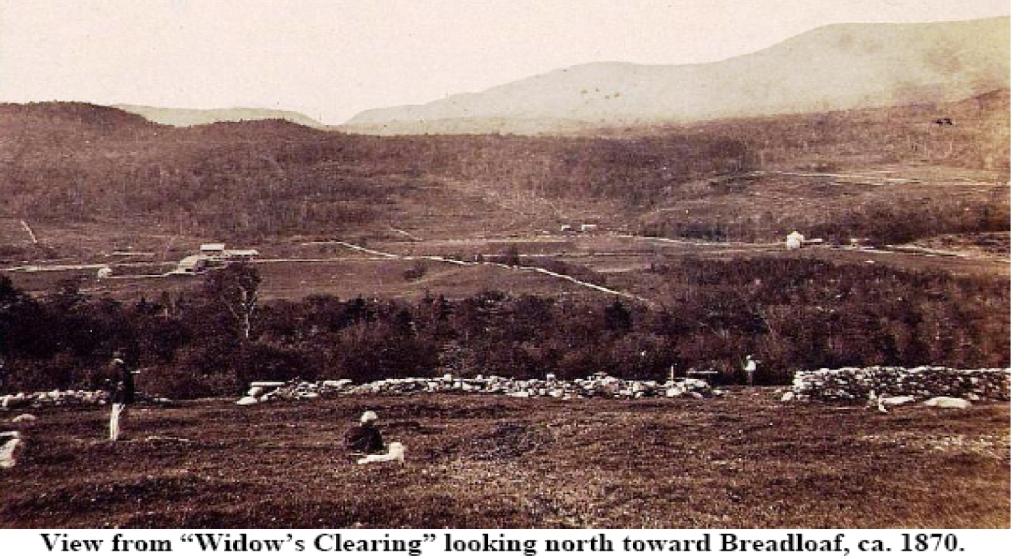
Finally, Bill’s research also uncovered a picture of the view from the Widow’s Clearing, circa 1870. The wide open land stands in sharp contrast to the fully recovered forest of modern times. This photo is included with his permission.


