There! Did that title grab your attention? I love running in September – the days are cooler, the skies are sunnier, and I am starting to reap the benefits of running through the hot, sticky days of midsummer. It is a great time to take on some longer runs, and with that in mind, I will be describing a 9+ mile run which very few people other than me know about. If you look to the east of Middlebury at the first ridge of the Green Mts. – thats where this one goes! This run, while easy to follow, passes deep into the national forest in sections which don’t see much foot traffic, except in hunting season.
This run starts in East Middlebury. To get to my starting point, head south of Middlebury on Rt. 7, take a left turn onto Rt. 125, and look for the left hand turn on Schoolhouse Hill Road shortly before the well-known Waybury Inn. Immediately after turning north on Schoolhouse Hill Road, turn into the playground parking lot on your right, loosen up, and start the run. The first mile and a half of warm up on this run are on pavement. Start your run up the short steep hill on Schoolhouse Hill Rd., and follow this quiet country road which runs behind Middlebury International Airport for a mile and a half. Run through the 4-way stop sign, and turn onto the obvious dirt track on your right shortly thereafter. You will be following this double track, which is maintained for winter use by VAST (Vermont Area Snow Travellers – aka snowmowbilers) for the next few miles. As you might guess, I don’t have a lot of interest in motorized sports, but I do enjoy skiing and running on the well-maintained trails which make up the VAST network, and have found snowmobilers courteous and friendly. This trail parallels a residential street for a short distance before angling to the north. At this point, the climbing gets pretty brutal – the trail climbs 1200 ft in the next 1.7 miles. Fortunately, the run is never so steep that you can’t at least jog up it, but one one particularly steep section I did note that the GPS showed me running at a 25 min/mile rate for a short section! Following the trail is pretty easy, except for one spot near the top, where the trail forks, and I took the right turn, rather than going straight. If you miss the turn, its not a big deal, as the trail will boomerang back to the right in a few hundred yards, meeting up with the track I am describing. I have frequently seen bear scat along this trail, and once saw “the scatter” himself, but fortunately, he was more scared of the sweaty plodding runner than the runner was of him.
Soon after the fork, the trail breaks out to a far more open semi-abandoned logging road. This logging road was still actively used when I first explored here in the mid-90’s, but there has been no sign of logging activity or traffic for many years. Take a right here and follow this undulating and partially overgrown forest service road for the next mile and a quarter, passing under a perpetually closed green gate shortly before joining into Dragon Road (dirt), which is open to, but little used by vehicular traffic. A left turn at this point will bring you to the Robert Frost Mt Trailhead, but that brings the day’s mileage up a little high for me, so I took the right turn. The next mile or so is gorgeous, passing first through deciduous forest punctuated by boggy clearings as is often seen in the Green Mts. at this altitude.
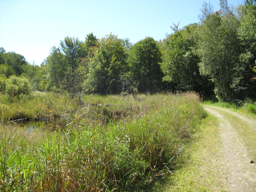
- Trailside Bog
This trail also passes by a glorious lone hilltop home with amazing views to the main ridge of the Green Mts. further to the east. I am not including a picture to protect the privacy of its inhabitants. The descending dirt road passes through dense forest, with occasional larger homes, smaller homes and hunting camps. Years ago there was one curious site along Dragon Road – a yard full of rusted cars, not an uncommon site in rural Vermont. What made this small dump noteworthy was that all of the vehicles appeared to be the remnants of Subaru “Brats”. This landmark, I am afraid, has been removed, but I kind of miss it. Dragon Road eventually joins the North Branch Road, another dirt road which sees a little more traffic, but still has a very woodsy feel to it. The curious system of guard rails used on one very steep dropoff at the edge of the road seems to indicate that this road is not likely to see significant “improvement” at any time in the near future.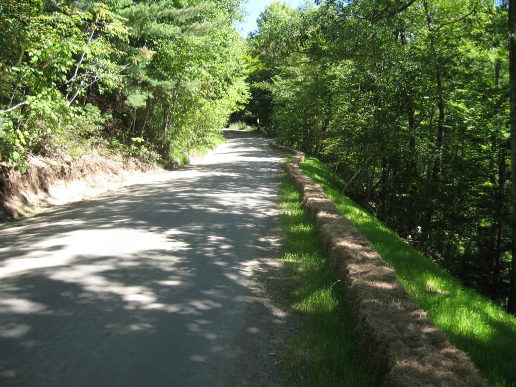
Hay Bale Guardrail
The very steep descent leads eventually to a short paved series of switchbacks indicating that you are coming into East Middlebury. When you get to the last switchback to the right, instead of sprinting to the finish (hah!) at your car , take a short detour on the trail heading into the woods to your left. This short spur trail will take you into the Middlebury Gorge where it is visited by the occasional fisherman or white water kayaker (in high water season)
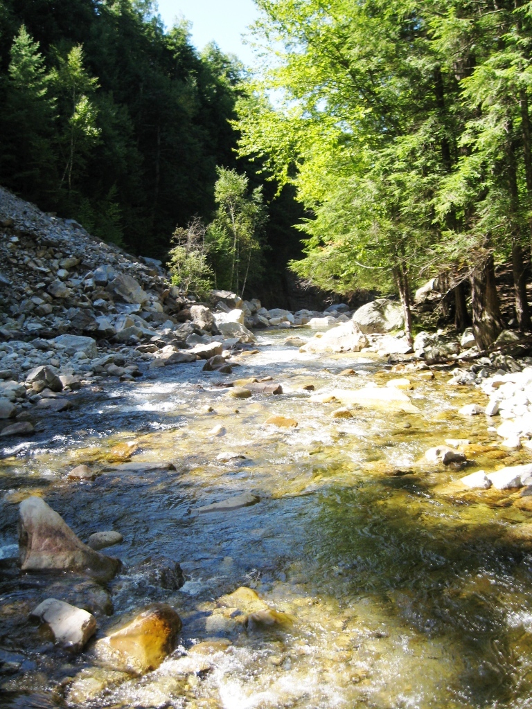
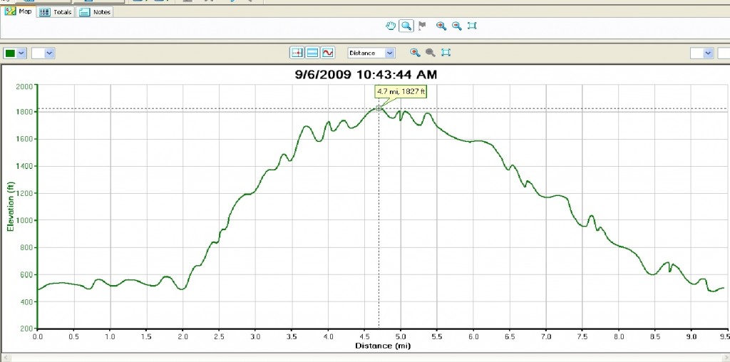
After taking second to enjoy the scenery, retrace your steps on this path back to the road, and continue on, rejoining Rt. 125 in a few yards at the bridge over the gorge, the site of a popular midsummer swimming hole. In another half mile or so you will return to your vehicle to complete this challenging loop. My quads are always complaining for a few days after this run, which covers 9.5 miles, and includes about 1500 ft of climbing, with the ups and downs.
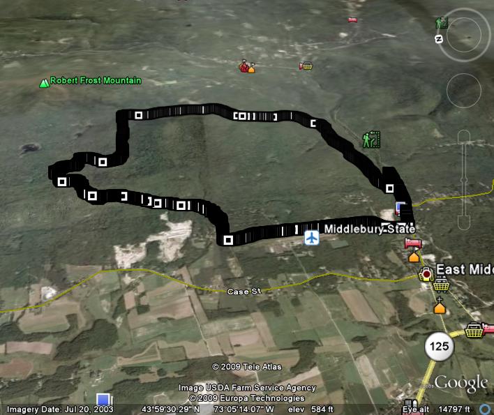
The perspective in this shot is that of an airplane to the west. Thus the left edge of the the Google Earth projection is north.