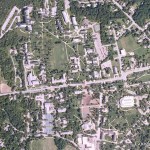
What: Campus Tree Map
Who: Tim Parsons, Horticulturalist
Technologies used: Hardware: Dell Axim Handheld PC with a Bluetooth GPS; Software: Handheld PC running ArcPad; Desktop: ArcEditor, ArcPad, ArcPad Application Builder, Microsoft Excel, Access, and Visual Studio, Google Earth and Picassa 3.
Assistance Received: Tim received assistance with ArcGIS from Bill Hegman, GIS Specialist; and Katie Clagett and Chris Rodgers, former GIS Interns at LIS. He also received some help from students in the Geography Department’s computer lab.
Courses: BIOL 1003, Trees and the Urban Forest, and other classes in the Biology Department.
Reasons for using the Technology: The tree map is used primarily as a management tool but it has been central to a number of curricular projects as well. The map is viewable in Google Earth. Many commercial software packages are available for urban forest management, but they cost thousands of dollars and are not open enough for sharing data.
All of the urban campus trees (trees managed as individuals) are mapped. In classes, the map is used by students interested in finding and/or analyzing tree species. In Facilities Management, the map is used to track tree maintenance and health issues, for example pruning and insect problems. See Campus Tree Map Updated in The Middlebury Landscape blog for details.
In Tim’s Urban Forest class, his students took the tree population and ran it through modeling software called iTree to look at carbon sequestration, pollution abatement, etc. Students in other classes have used the map for tree identification. For example, a student recently contacted Tim because she was looking for Cherry trees to evaluate for a plant community ecology class.
Learning Outcomes: The tree map, at least in the Urban Forest class, turned out to be a good introduction to mapping for students without any GIS or Geography experience. In addition, Tim considers ArcPad a valuable learning resource; he sees it as ArcMap Lite, with much less of a learning curve than ArcView.
Description: The tree map of the campus was started years ago as a student project (see the Geography Department’s Student Projects page). Tim picked up the project again in 2006. After successfully applying for an environmental grant for the hardware, Tim went out in the field to verify and correct the trees that had been identified and add more. With help from the Geography Department and LIS, Tim created a map in ArcGIS which included attributes such as sizes and health status of the trees.
Tim maintains and updates the map and accompanying file geodatabase as the campus landscape changes. Meanwhile, he also has exported the map from ArcView to Google Earth using a free ArcGIS add-on called Export to KML. He plans to revise his ArcPad data collection forms so that they are are more specific to plant care needs.
The project has evolved through time. Last fall, Tim worked with students in a Plant Biology class. They mapped about half of the Bread Loaf campus trees, and he hopes to finish that project next fall. Tim’s future plan is to establish a virtual tree tour online, either with Google Earth or a static map.
