One of the most impressive thunderstorms I’ve seen ripped through campus Wednesday night, starting about 8:00. From my house in Weybridge it was a continual light show; not just flashes of lightening here and there, but the sky constantly lit as bolt after bolt attacked the ground and sky. Torrential downpours accompanied the storm, with driving rain, straight down. No massive wind gusts in Weybridge, though, at least my end, so I was unprepared for the damage I saw on my drive to work on Thursday.
The Burlington Free Press has a very good explanation of the development of this storm. Thunderstorms build, using the heat at the surface, which rises and is full of potential energy, explaining why most thunderstorms happen later in the day. Wednesday had record breaking heat, in the low 90’s, but a cap of warm air prevented the hot surface air from rising too much. A rare cold front pushed down from the northeast, wiping out the cap of warm air that was sitting several thousand feet up, letting the storm build quickly, seemingly out of nowhere.
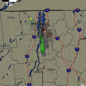
Weather obsessive that I am, the Weather Underground sends me emails for severe weather alerts, and when I got one late in the day I looked at the radar map, and saw nothing but clear skies, with a little storm near the Quebec border. Half an hour later or so, I see some impressive lightening to the north, so I run to the laptop, and glance at the radar again. (OK, very obsessive.) A huge storm was just north of us, and I was glad, and a little bummed, that it missed us. For kicks I set the radar to run a time lapse loop, to check the speed and direction of the storm. I didn’t know about the front pushing from the northeast, so was shocked to see this storm flying south from the north, as most storms have the common sense to go west to east. The radar was impressive enough I stuck a flashlight in my pocket, expecting to lose power.
Like I’d mentioned above, no wind in Weybridge. In town and on campus was a different story. As thunderstorms build, hot air at the surface rushes upward, creating an updraft. What goes up must come down, and downdrafts in thunderstorms are common. When severe enough, greater than 59 mph, they are called ‘straight line winds’, and can mimic tornadoes in the amount of damage. To differentiate them from tornadoes, one needs to look at the type of damage, and, sadly, an easy way to do this is with trees.
Middlebury’s weather station only recorded a peak gust of 41 mph, but that is down at the track. The Mead Chapel quad probably experienced straight line winds, based on the damage to some of the trees. Luther Tenny, fellow obsessive, noted how similar the tree damage was to an ice storm, with many branches hanging straight down, as if loaded with ice, broken from the weight. It was an astute observation, and a good indication of a staight line gust.
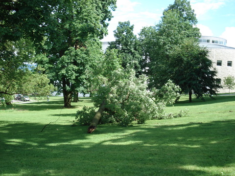
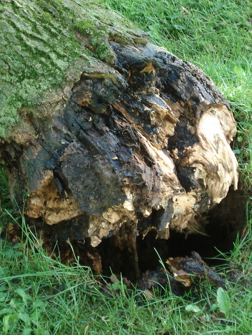
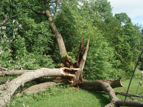
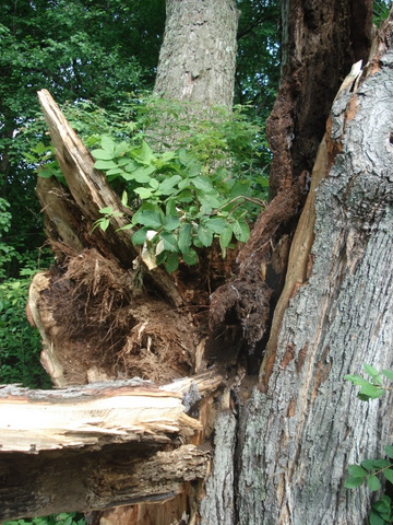
Some trees on campus lost some large branches, and many lost smaller ones. We spent most of the day picking them up, and we’ll be pruning trees for the next several. A large Norway spruce that was hollow fell across Porter Field Road, displacing a squirrel family that didn’t have the good sense to leave until we cut into the trunk to get rid of it, scaring the heck out of the chain saw operator. A huge Silver Maple, also hollow, fell behind 70 Hillcrest, missing everything in the yard. The tree had a 2-3″ band of living tissue holding it up-the remaining 4-5 feet (!) of trunk was hollow. Other large branches fell here and there, but no property damage or broken electric lines.
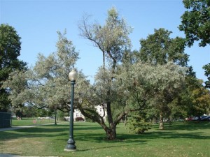
The tree that took the storm the worst, though, may be a large elm below Mead Chapel. This is the tree that looks like an ice storm hit it. Most of the crown seems to have snapped downward, like the downdraft was right above it. We’ll prune the broken branches out of the crown, and see how much of the tree remains. I’ll keep you posted.

You must be logged in to post a comment.