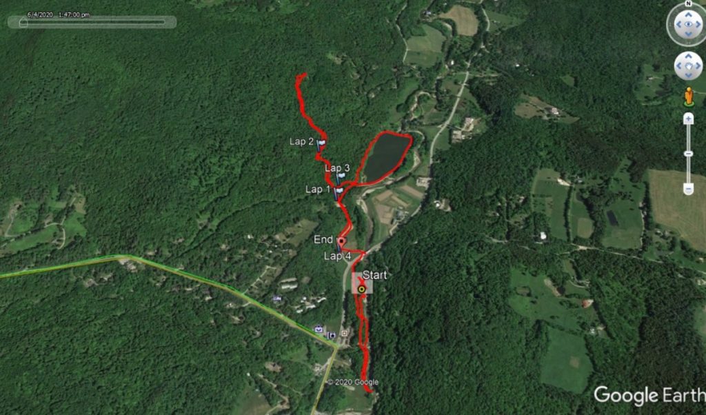
From time to time, I go for a trail run in the Mad River Valley, and over the years have blogged a few of my runs from this beautiful place on the other side of the mountains. A few cars parked alongside Rt 100, on the left, just a half mile or so north of the Sugarbush access road, caught my attention, and I decided to see if there were any fun runs emanating from that trailhead.
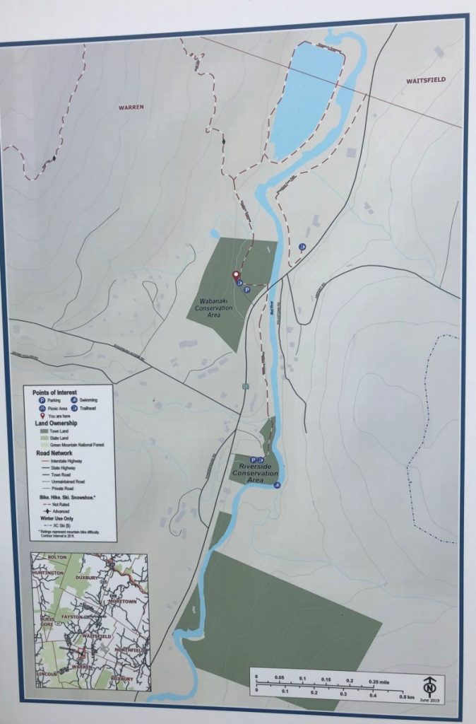
Pulling my car in, I was greeted with a kiosk telling me that the small group of trails nearby constituted the “Kingsbury Greenway” part of the non-contiguous Mad River Path. One short segment followed the Mad River for a short distance to the south, and a few more options branched to the north.
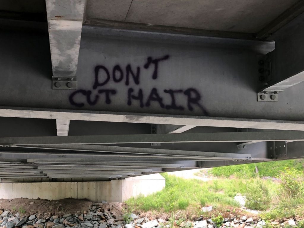
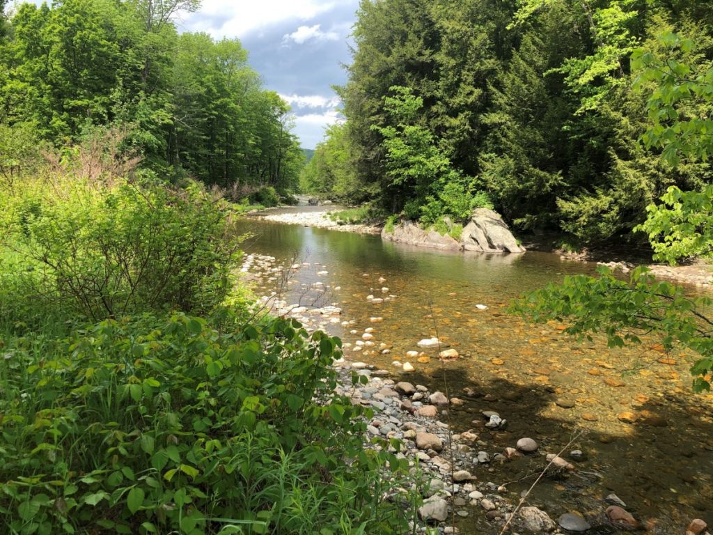
I chose to begin my run on the short southern section, which dipped first under the Rt 100 steel bridge, and was not surprised to see some graffiti under the bridge. One particular message looked almost like it was aimed at one of the more contentious aspects of our current social distancing requirements, and I was glad to see that it was actually punctuated correctly on the contraction. A true rarity among those armed with a spray can and something they care to say.
Continuing on, the trail passed down a series of stairs closer to the edge of the river, and passed behind one of the many inns in the valley before ending in a meadow affording a nice view down the river. At this point, I retraced my steps and returned to my car, making for about a mile of running.
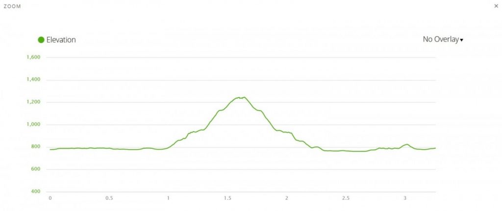
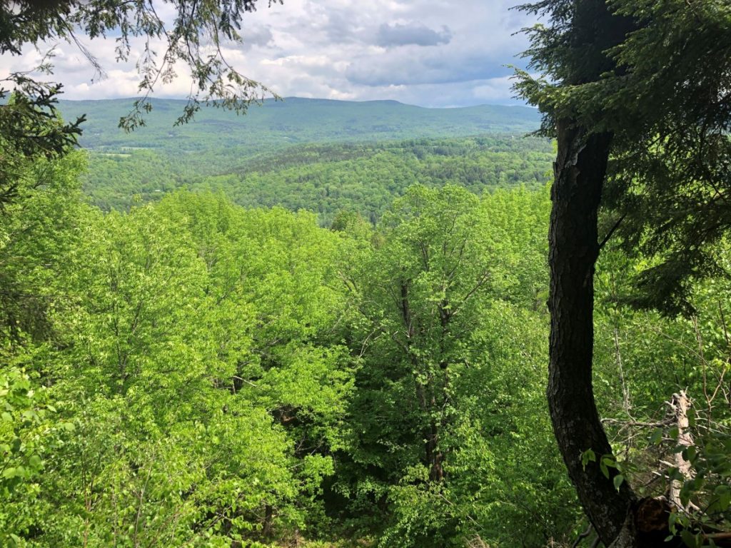
Stopping for a moment to look at the kiosk map, I noticed that the trails to the north had two sections – one section appeared to climb up the adjacent hillside to the left, continuing on past the end of the map, and the other better defined section circled around one of the Sugarbush snowmaking ponds. I first headed uphill, but soon found that the going was too steep for running. After about a half mile of climbing, I came to a nice little overlook with a decent view of this part of the valley. The trail continued its climb past this point, and I will have to return to find where it ends up!
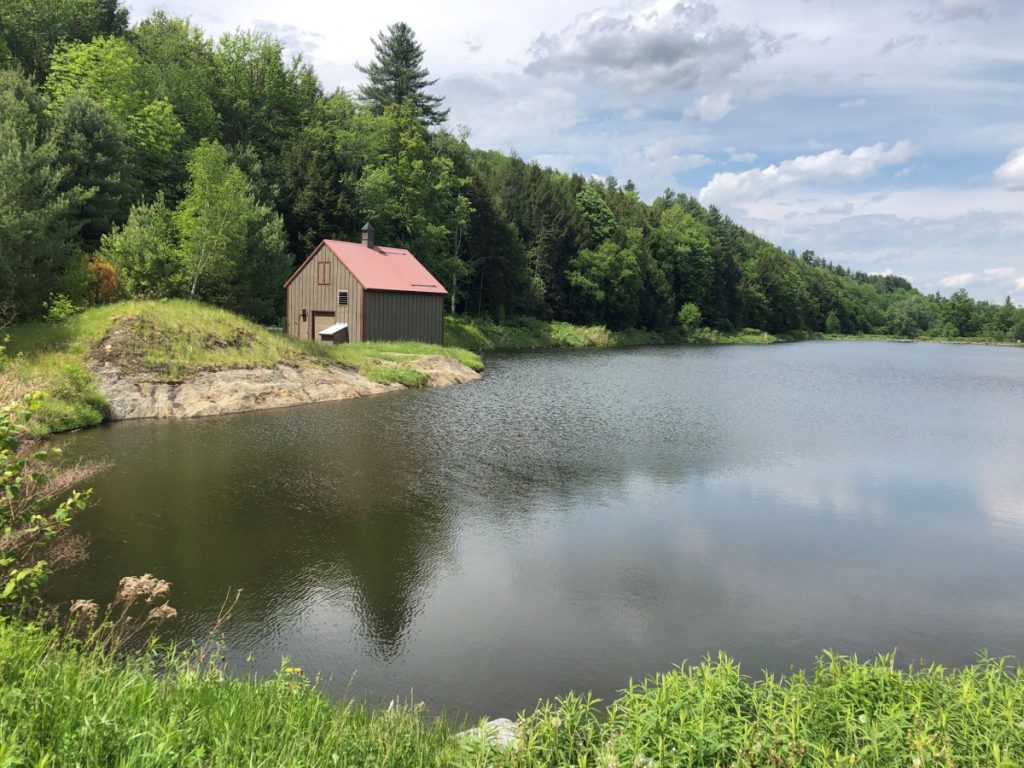
After snapping the required “view shot” I shuffled down the steep trail, and took the left down to the snowmaking pond shown on the map. This large pond, clearly filling several acres is separated from the Mad River by a thin strip of raised land, and is not far from Rt 100, but is curiously invisible from the highway and I never knew it was here despite having driven by hundreds of times.
As I rounded the north end of the pond, I saw a short path down to the river’s edge, so I went down to the water and noticed a well-kept swimming hole, replete with lawn chairs, and well made steps down to the water on the far side. I assumed it was some lucky landowner’s riverside private property, but there was nobody there to ask, so I continued my run around the pond. Only after the completion of the run, and noticing the access to this section of the river from Rt 100, did I realize that I had inadvertently stumbled into the Mad River clothing optional swimming area. Maybe that explains all the old men I noticed out walking their dogs around the pond? The return from the pond to my car was short and easy, although at this point the day was getting kind of hot, so I called it a day after a little more than 3 miles. This trail has some pleasant running close to the Mad River, and a climb worthy of future exploration.