We’re a little removed from Lake Champlain up in Middlebury, but probably not as far as you think. My own house sits above the Lemon Fair River, draining into the Otter Creek north of Middlebury, which empties into Lake Champlain just north of Vergennes. The lake itself also drains to the north, out the St. Laurence Seaway, which seems counter-intuitive. Everything is supposed to flow south and down, right? Wikipedia says the residence time (the amount of time the lake turns itself over) is 3.3 years. That’s some serious water flow.
The lake peaked a day or so ago at 103.25 feet, that’s the elevation above sea level. It is considered above flood stage at anything over 100′, and seems to spend most of the summer at about 95.5′ above sea level. That means the lake is 7 3/4 feet (!) higher than normal. The previous record, which I remember from a job being a caretaker on a lakefront property, was 101.88′. So all that snow we were cursing this winter? It’s still around.
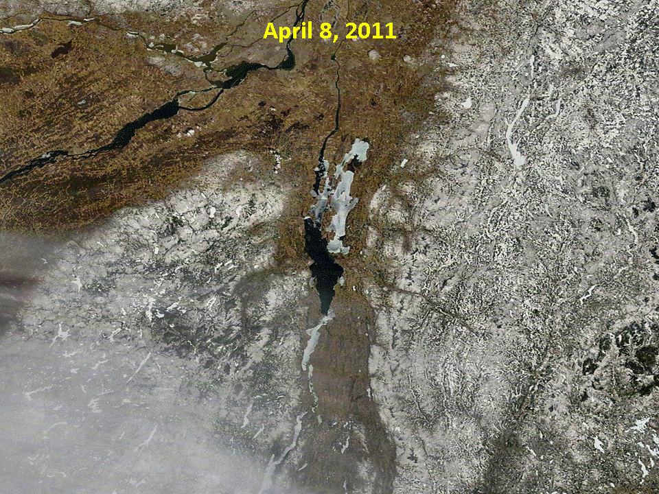
The Lake Champlain Basin Program has a picture gallery up of flooding and sediment flow that’s worth a look, and below is an animated GIF from the National Weather Service of Hi-Res satellite pictures of the snow melting off the Green Mountains.