Starting around 15 years ago, I began exploring the Mad River Valley while visiting family members who have a home in the area. One of my first discoveries was Scrag Mountain, the modest peak which is nonetheless the most prominent geographical feature on the east side of the valley. At that time, the main trail accessing the summit was at the end of Palmer Hill Road, and the first few times I ascended this moderately challenging peak, it seemed that the trail, while still easy to follow, was falling into some disuse. For one, the landowners in the vicinity made it very clear, through numerous threatening signs, that they would not abide any cars parked in the vicinity of the trailhead, which apparently did not have any public parking spaces available for hikers. Also, the summit had a fire tower for many years, giving an otherwise tree-enshrouded summit spectacular views, and with removal of the tower, the appeal of this pleasant hike was diminished. I am not sure when the fire tower was removed, but a sign alluding to its presence (incorrectly) was still in place when I first ascended the peak. Some of the history of the summit and the fire tower can be found online.
Fast forward to a year ago, when I set off to explore the summit, admittedly scouting out a potential trail run/blog post, from the location of the original trailhead, which I had not ascended in at least 10 years. While the trail was far more overgrown than my memories of it, as I neared the summit, I could see why this was no longer a commonly used trail – blowdown in the ensuing years had taken a pleasant half day hike, and turned it into a nightmare of climbing over, under and around a seemingly infinite number of downed trees, rendering the passage impossible to all but the most intrepid of hikers…..me! After a seeming eternity of route finding, climbing, and badly scratched arms and legs, the blowdown subsided, and I found the original trail, which seemed oddly easy to find – and I was puzzled as to the use it was receiving given the ordeal I had to go through to achieve its higher reaches. Nonetheless, once past the blowdown, the summit was easily achieved. I was pleasantly surprised that the ancient fire tower warden hut at the summit was still standing, and from the look of the log book there, was a frequent overnight place for the young stoner crowd, who indicated the herb of their choice in the graffiti on the walls, and their ramblings in the log book. I also noted that there were still a few limited views to the Roxbury (east) side visible from summit ledges through the trees. On my descent, however, following the trail, I realized that the in my ten year absence, the original trail had been re-routed, so I followed its descent not really sure where it would deposit me. In fact, upon reaching the East Warren Road after descending Sherman Road, I was relieved to realize that I was indeed on the correct side of the range, and not in Northfield, which would have necessitated a long drive by family members to recover me.
So, with these slightly confused memories only a year old, I thought I would try out this new trail as a run, on the late afternoon of Father’s day 2012. It was a rather hot afternoon, so I delayed my departure until the late afternoon in the hope of catching some cooling temperatures. Nonetheless, it was still in the low 80’s when I set off on my run, at least with a decent supply of water. The described section of this run begins well above the valley floor at the intersection of the East Warren Rd. and the Common Rd., on the far eastern edge of the Mad River Valley. There is a good parking lot here, with room for a few cars, and many runners, bikers, and walkers park their cars here to begin and end outdoor activities from this vantage with excellent views of the main ridge of the Green Mts, and the three ski areas in the area.
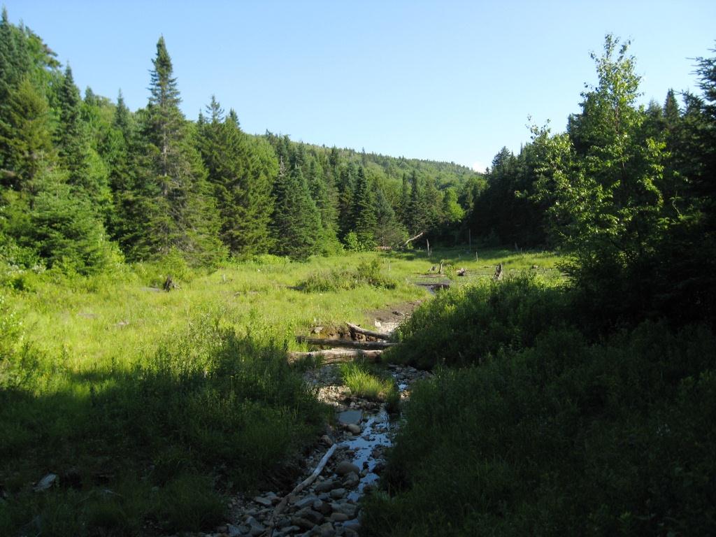
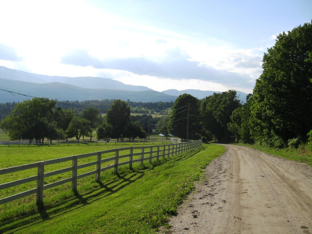
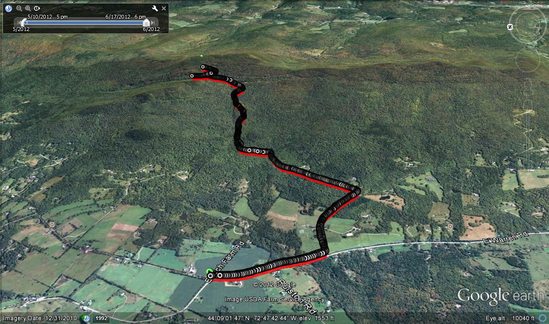
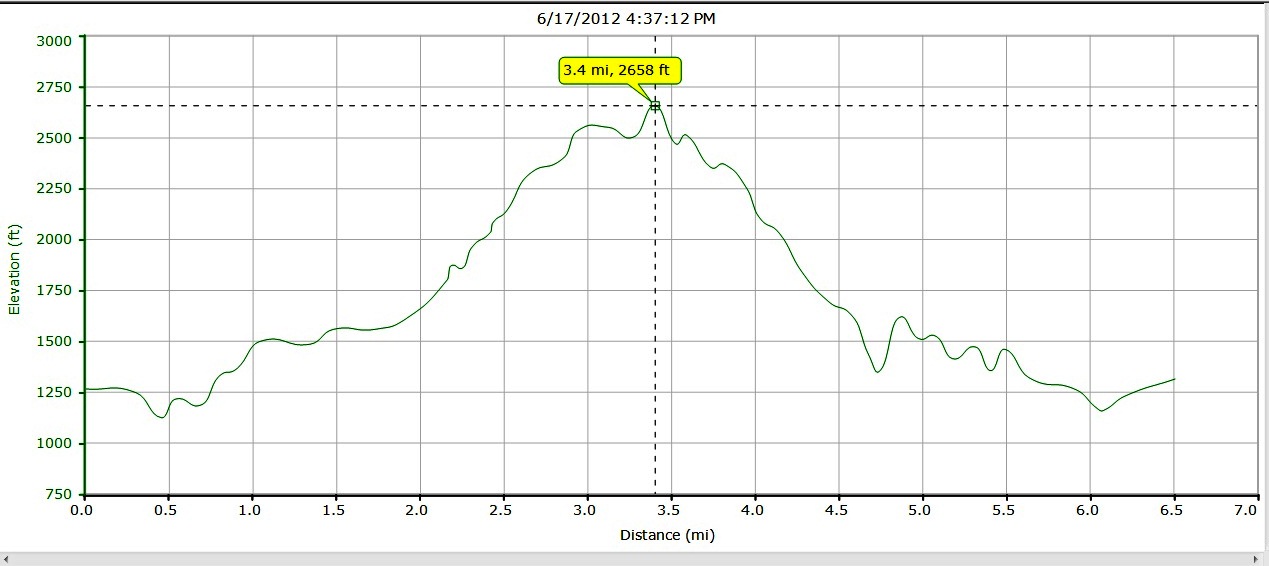
Heading south, the very first challenge was “The Dip” a sudden drop and climb of about 200 vertical feet, which is a blast on a bicycle (or a car in neutral, if I must confess) but a bit of a drag for runners on their approach to an already significant climb. At the top of the hill, take the left into the high rent district of Vermont, aka Sherman Road. The beautiful , expansive gentleman farms are reputed to have been the ski homes of members of the Kennedy clan back in the 60’s, when Sugarbush had much poorer skiing, but a much more evolved après ski and night life, leading to its “Mascara Mountain” nickname. After about a half mile of increasingly steep uphill running, I took a left turn onto Bowen Road, which gave me a breather as I traversed the hillside, enjoying the early summer patches of that friendliest of flowers, the daisy. After about another half mile, noticing the little brown jelly beans, indicative of a healthy deer population, the semi-developed road turned into a wide double track trail and headed into the woods, angling up the hillside in a northerly direction. After the first half mile or so, it became apparent to me that this was not the best choice for a “run” – the trail got steeper and rougher, forcing me to turn most of the rest of the trip into a fast hike rather than a run. About half way up, I came across a clearing with a beaver pond, and could see from the vantage point that I still had a fair amount of climbing to do!
Resuming my labored ascent, made all the worse by the heat, I came to a section of trail where my passage was further complicated by the undergrowth and debris hiding sections of the trail, necessitating some route finding, further slowing my progress. I knew I was near to the summit, as a look to my right showed mostly blue sky through the trees rather than hillside, but at this point, my increasing dehydration, and time limitations (not wanting to miss the upcoming Fathers’ Day feast!) after a few more minutes of messing around making slow upward progress, I decided to forego the summit, and return for the pleasant evening in front of me. Turning the corner back on to Sherman Road, I took a short pause to enjoy the sun starting to approach the ridgeline over the ski areas in the distance. I also met the funny, inquisitive looking musk ox hanging out at one of the gentleman farms previously alluded to. I suppose he looked somewhat like me, when a haircut is overdue, at least if you ignore the horns.
In the end, this hike/run/climb ended up covering about 6.5 miles, with1500 feet of climbing, counting the extra descent and climb in The Dip. While the distance sounds modest, I actually covered a few more miles and climbed more vertical feet, having begun my run farther away, and further down the valley, but chose not to include this considerable extra mileage on the roads in a trail running post.


