There are plenty of hikes with varying degrees of difficulty in Middlebury and the surrounding area. While the MMC often leads trips to many of these locations, you can also grab some friends and head out to any of these trailheads on your own (Chipman and the TAM are accessible on foot from campus, but the rest are accessible by car). Below is a list of the best hiking/walking trails we have to offer you! All of these hikes can be found online by looking up the bolded names below. AllTrails is an especially great resource.
Chipman Hill
While there are three access points, we recommend that you use the road up past the Swift House Inn, right before Route 7. Once you pass the Inn, take your first left and follow the road until you see the gated entrance to your right. According to the MMC, “At the end of the steepest ascent on this trail, is a clearing surrounded by towering white pines. And there is a conveniently placed picnic table and bench with excellent views of town and the college.” This is a great place for a winter hike without spikes because the ascent is gradual and the trail is wide. There are also some fun places to sled. A little known fun fact is that Middlebury College built a small ski facility on Chipman Hill where Winter Carnival races were hosted during WWII. The old ski jump hill is still there and is a great, albeit a bit steep, place to sled after a big snow!
Length: 2.0 mi
Elevation gain: 364 ft

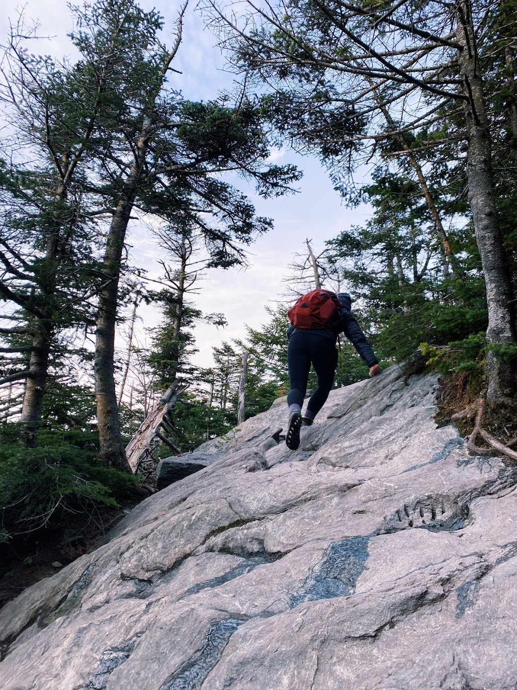
Snake Mountain
Snake Mountain is the most classic Midd hike. By the end of your time here if you do any hike I would recommend this one. It’s considered best June through October, but can be hiked at virtually any time, even peak winter. With spikes from the Gear Room you can hike without worrying about patches of ice that you’re guaranteed to come across, but if you’re careful they aren’t necessary. About a third of the way up you’ll come to a divide in the trail. Make sure you stay left and you’ll arrive at great views of the Champlain valley before you know it. If you hike it in late spring or summer, you’ll come across bright orange lizards that almost look like rubber toys, but they aren’t, so be careful not to step on them! If it’s warm enough, or even if it isn’t, we’d recommend a picnic with friends at the top. On the other hand, a less trafficked day, being alone on top of Snake can be a rather meditative experience. You can witness a beautiful sunrise if you’re an early riser, since the overlook is facing East, but sunsets are also great.
Length: 5.4 mi
Elevation gain: 1,062 ft


Skylight Pond Trail
Skylight Pond has no “view” at the top, per say, but there is (as the name suggests) a beautiful pond and a cabin with a porch where you can stop to have a picnic or spend the night. You can check out a sleeping bag, pack, and other essentials from the Gear Room and spend the night with a group in the cabin. There’s no way to book it, however, so you have to hope that nobody else gets there first! A safe way to ensure you have a sheltered place to spend the night is to bring tents from the Gear Room as well. Directions are here.
Length: 5 mi
Elevation gain: 1,480 ft


Silver Lake Trail
Silver Lake Trail is the perfect hike if you want the water view of Skylight Pond, but with a less strenuous, gradual ascent. It’s recommended to go between April and October, but similar to other hikes you can go outside of this time period. There are picnic tables at the campground upon arrival and in the summer you can swim in the lake if it’s not too cold. Alternatively, if you choose to go in the fall there’s incredible fall foliage surrounding the lake!
Length: 5.3 mi
Elevation gain: 711 ft

Mt. Abraham
Mt. Abraham, named after President Abraham Lincoln and affectionately nicknamed Mt. Abe, is probably the toughest hike that will be listed here, but it’s also one of the most worth it, as it’s the fifth highest peak in VT. It has a 1hr 15min round trip driving time and is rated hard on most trail sites. It is best hiked from May to October, but can be hiked outside these months with the suggestion of spikes. From the Long Trail access (the Lincoln Gap parking lot), the route is approximately 5.1 miles in total. In 1973, a plane crashed and landed at about 3,000 ft elevation on the mountain. The pilot survived the crash, but part of the plane remains and you can see it on the hike. It’s the last bit of the hike, however, that in my opinion, sets Mt. Abe apart from the rest: slabs of slanted rock require the hiker to stay vigilant as they scamper up to the top. The summit boasts a 360 degree view of three states’ mountains: the Green Mountains (specifically Killington Peak, the second highest peak in VT), the White Mountains and the Adirondacks, along with Lake Champlain. It can be quite windy, so make sure to bring layers. Camping is also available at the Battell Shelter about 1.1 miles up from the parking lot.
Length: 5.1 mi
Elevation gain: 1,765 ft


Robert Frost Interpretive Trail
(Taken from Go Take a Hike! An article in the Middlebury Campus.)
The Robert Frost Trail can be found along Route 125 between Middlebury and Breadloaf and is accessible year round. It’s an easy loop: about one mile, mainly flat and takes about 45 minutes to complete. Frost’s poems are mounted along the trail to contemplate, and the trail meanders across and alongside a stream. Plants such as birch trees and wild raisin are identified with wooden signs. During the summer, there are blueberries to pick and the forest is green and lush. In the winter, the trees may be bare, but they create a dramatic contrast with the sparkling white snow.
Length: 0.9 mi
Elevation gain: 49 ft
TAM Class of ‘97 trail
This section of the TAM is located on Middlebury’s campus and was designed and built by senior Environmental Studies students in conjunction with MALT. It begins right across from the athletic center off of Route 30 and is marked by a sign labeled “The Colin T. O’Neill Trail… dedicated by the class of ‘97.5.” You’ll find a beautiful reflection on the origin of this trail and namesake here: https://middkid.com/outdoor-guide/hiking/trails-around-middlebury/the-colin-t-oneill-trail/. The trail itself begins with a relatively steep decline with lots of rocks and roots on the path, so watch your footing. It then pops out onto a flatter trail where you can choose to take a right or a left. If you choose to take a left, you’ll find yourself in a big open field that you’ll run around the perimeter of to eventually reach Route 125 where you can cross over to reach the Knoll and choose to continue on or head back to campus from the path that ends with the solar panels. If you’re looking for a shorter hike/walk/run, head right and you’ll find yourself in the Ridgeline parking lot from which you can head back up to the center of campus.
Length: 3 mi
Elevation gain: 128 ft
Buck Mountain Trail
For how short this hike is, it has one of the best views. If you’re someone who always wants to do a sunrise hike but can’t get out of bed early enough to get to the summit by sunrise, Buck is for you! With relatively low elevation gain and a short length, it’s the perfect short hike with a view, specifically recommended between May and October. To avoid the muddy section at the beginning, especially in the spring, take the cut-off trail a bit farther down the road. While the sun actually rises behind you at the summit, you’ll find that the sun landing on the land below you and the Adirondacks in the distance are actually almost as beautiful as the sunrise itself. The summit itself is very spacious and I’d recommend exploring to the right once you pop out of the trail. Located close to Vergennes, the MMC recommends grabbing something to eat before or after your hike at the Vergennes Laundry, a popular bakery. Directions to the trailhead are here, but make sure you only park in the marked spots near the trailhead because there is a limit to the number of people on the trail at a time as it is on private property.
Length: 2.5 mi
Elevation gain: 554 ft

Snow Bowl to Worth Mountain
To access parking for this trail, head past the SnowBowl for about a mile and it’ll be on your right. Make sure to go slowly, especially if you’re driving in the dark, or there’s a good chance you’ll miss it. This trail is accessible year-round, but especially great for Fall sunrises during peak foliage. It’s pretty well-known and frequented by Middlebury students, so don’t be surprised if you run into other college-aged kids. The first break from the woods lands you in an open space that’s great to watch the sunrise from, but if you keep going through a shorter wooded continuation of the trail, you’ll reach the upper chairlift. It’s normally stopped just on top so that you can climb up onto the chair to watch the sunrise or you can walk down the hill below it. On your way back down try to find the detour that takes you to Pleiad Lake! Or, if you’re short on time, head here from the start and then straight back down for 1 mile out and back with a 219 ft elevation gain.
Length: 4.7 mi
Elevation gain: 1,407 ft


Check out this Middlebury Campus article from 2019 in which 4 students describe their experience with four of the hikes listed above! https://www.middleburycampus.com/article/2019/04/go-take-a-hike-hit-the-trails-this-spring


