Day 20: Goodbye, Costa Rica

Day 20, Friday, 1/26/18

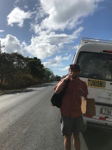
Today, GEOL 1035 says goodbye to Costa Rica. All that is left to do is pack and take one last ride to the airport on our trusty minibus, Weefy. Feelings are bittersweet. Although we are all looking forward to a hot shower and our own beds, we know that we will miss our life immersed in the geology and culture of Costa Rica.

Now, time for my last meal of rice and beans covered in Lizano sauce…

See you back at Midd!


Day 18: Our final field day in Costa Rica

Day 18, Wednesday, 1/24/18

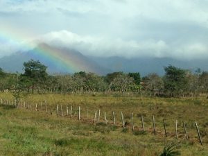
Returning to our ‘day-off beach’ near Caujiniquil, students spent their last day in the field observing and sampling conglomerates outcropping along the coast! To mark our final drive back to our lodging at Parque Nacional Santa Rosa, Costa Rica provided us with an amazing “volcano-bow” (a word created by the students to describe a rainbow above a volcano).

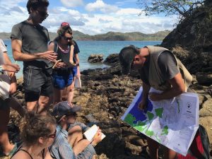
Prof. Pete Ryan describes our map location before the field exercise at Playa Islita, near Caujiniquil.

A beautiful volcano-bow over Volcano Cacao in Guanacaste.

Day 17: Cuidado gringo… we’re not done mapping.

Day 17, Tuesday 1/23/18

by Eli Orland (‘17.5) and Liesel Robbins (’18)

Andrew following the dentist’s orders.

Shiny teeth a must
Starting off a day with rocks
smiles and miles to go
With our trip coming to its last days (!!!!), our class took to the field for the penultimate time. Previously we had characterized the lithologies of pyroclastic flows and ash deposits from our time with Costa Rican Geologist Guillermo Alvarado. Combined, these rock units span a period of 5 million years across as many as 10 different members from the Liberia and Bagaces formations. Our previous day of mapping gave the now potentially false assumption that our units were nearly laid out in their original stratigraphic order. However on a new road with new outcrops, our confidence about the nature of our mapped units quickly turned into confusion, as what we observed slowly began to contradict our previous assumptions. After many observations, a creek crossing, and one casual warning about road safety later, we’re still confused—but excitement remains high as we slowly uncover the geologic treasures of an unmapped area!

Professors in the field, each in their own microclimate

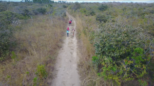
el grupo, mapeando (photo credits: Gabby Baeulieu, drone)

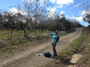
Wild Kristina indicating bedding orientations or playing charades? You decide.

Dusty and quite hot 
geological maps begot
cooling shade we sought
Today’s highlights additionally include:
Not getting sunburnt
Eating a second PB&J
Watching Liesel avoid a creek crossing by hanging onto a tree
Finding excellent outcrops
Realizing all outcrop are just the Cañas member
Having a guy on horseback offer Kristina a ride (that, somehow, she did not take)

Carbon neutral transportation

Looking forward, we are left with a final day on the beach looking at volcaniclastic conglomerates, but then the possibly daunting task of putting our field maps into greater geologic context. Are all units stratigraphically unaltered? If not, to what degree has our field area been under the influence of tectonics or local changes in stratigraphic order? Are some units simply not as far reaching as others? Will Andrew ever brush his teeth before leaving for the field?
Cuidado gringo
Banditos en la calle. 
We’re not done mapping.
             – final haiku by Matt Barr (17.5)

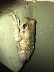
One of our non rock friends.

Day 15: Journey to the Mantle

Day 15, Sunday, 1/21/18

by Sam Kaelin (‘19.5) and Kye Moffat (’19)

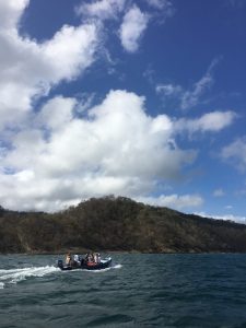
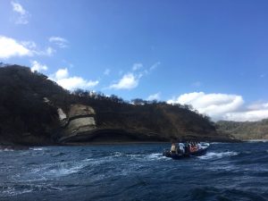
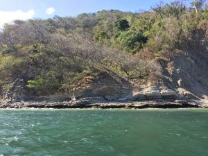
Today we left Santa Rosa early and headed out to Bahía Cuajiniquil where we chartered a couple of small boats and motored to the Bahia Santa Elena on the Parque peninsula. After meeting up with a local expert, Maria Marta, we made our way past some dramatic coastal sedimentary outcrops dipping 45 degrees into the ocean.

On the boat from Cauhiniquil to Bahia Santa Elena.

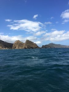
On the boat from Cauhiniquil to Bahia Santa Elena.

Ramped bedding planes of marine sediments dipping into the sea.

Getting to towards the end of the peninsula, we arrived at the famous Santa Elena ophiolite exposure.

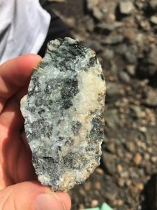
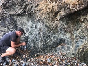
We spent about 2 hours investigating the rocks, seeing a great exposure of serpentinites and course-grained gabbro dikes.

Hand sample of a coarse-grained gabbro from Bahia Santa Elena.

Pete Ryan sampling serpentinites at Bahia Santa Elena.

Leaving the serpentinites, we boated off to a nearby beach for lunch under the mangroves and some swimming. After, we took a quick trip across the bay to an archeological site of shells and fragmented clay pots dating back 2.6ka. By the time we had to push off, the wind and waves had picked up. Passing back along the wall of angled beds the boat ride became a little turbulent and wet, but spirits stayed high through the roller coaster ride!  In all, it was an amazing day for those on the right side of the boat, and a very good one for those less fortunate who had picked the left side.


Folded marine sediments exposed at Bahia Santa Elena.

Day 13 & 14: A beach day and a mapping day in Guanacaste

Day 13, Friday 1/19/18

Yesterday, students were finally given a day off! After 12 days of hard field work, students enjoyed a relaxing beach hangout at Playa Islita, a beautiful sunset, and a fun dinner in Cuajiniquil.

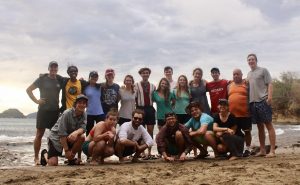
Sunset group photo + our minibus driver Elioth! PC Bryce Belanger.

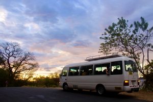
Our minibus, Weefy. PC Bryce Belanger.

Day 14, Saturday 1/20/18

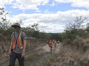
On day 14, students began their final mapping project in the pleasantly dry landscape of Guanacaste. On this first day of mapping, the students made observations and attempted to correlate a series of 1-2 Ma ignimbrite units of the Bagaces Formation to those observed at previous outcrops!

Mapping along dirt roads in Guanacaste.

Mapping ignimbrites!

The Rio Colorado member of the Bagaces Formation. Note the banded pumice clasts which represent a mingled magma!

Day 12: Sunshine, ignimbrites, super-volcanoes, and comida Americana

Day 12, Thursday, 1/18/18

by Kathryn  Van Artsdalen (‘19.5) and Gabby Baeulieu (’20)

Thursday January 18th was busy for GEOL 1035, serving as both a field and travel day. We left Yökö Termales – our scenic and windy home for the previous two days at the foot of Volcán Miravalles – and made our way northwest.

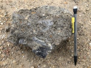
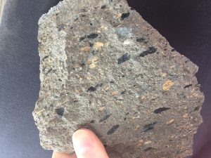
Guillermo Alvederez, a preeminent Costa Rican volcanologist, served as our guide for the day, leading us to seven sites of volcanic deposits and products, representing parts of Costa Rica’s Liberia and Begaces formations. Along the way, we learned about fiammé, a black, glassy lens found in highly welded ignimbrites. We also braved barbed wire to check out an unconsolidated pumice theorized to be the result of a pyroclastic density current. Another highlight was observing rhyolite deposits from the Rincón de la Vieja volcano that erupted about 1-1.6 million years ago and then cooled to form a hummocky landscape of small hills at the volcano’s base.

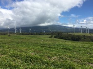
At one of the last stops of the day, we got up close and personal with one of Costa Rica’s renewable energy sources: wind. We visited a scenic array of wind turbines nestled in the valley between two volcanoes, Rincón de la Vieja and Cacao. Wind energy is an emerging power source for Costa Rica, which is striving for complete carbon neutrality. Currently, hydroelectric plants and geothermal fields provide 82% and 12% of the country’s energy, respectively.

In the evening we arrived at Parque Nacional Santa Rosa, only 25 miles south of the Nicaraguan border!! We are staying in the park’s bunkhouses, and will be doing field mapping in the area over the next week. Ciao!

A 2.1 million year old, welded ignimbrite with fiammé (the glassy, black shards).

A series of wind turbines at the base of Rincón de la Vieja. It was super windy!

Kristin Kimble (’19) hammers a rock from the Montenegro Formation (approximately 2.85 million years old).


Day 11: Volcanic Processes at Miravalles Volcano and Guayabo Caldera

Day 11: Wednesday, 1/17/2018

by Malia Barca (’19) and Kristin Kimble (’19)

We woke up to driving rain and wind whipping through the palm trees after our first night at the Yökö Termales hotel. We met our guide Guillermo for a day of touring the road cuts around Volcán Miravalles and the older Guayabo caldera. At our first stop, we (briefly) enjoyed the sunlight while we observed a pyroclastic density current of lapilli tuff dated to 1.6Ma, making it the oldest member of the Liberia Formation that we saw today.

Students closely observe and make notes on a road cut that belongs to the Liberia Formation. PC Gabby Davis

The rain and wind caught up to us at our next stop where we saw the remnants of a fluvial channel and delta, evidenced by crossbeds, reverse graded bedding, and diatomite (rock rich in fossils of feisty, mobile little plants found in aquatic environments).

Then we were treated to an amazing view of the 1.1Ma Guayabo caldera, the result of a massive collapsed magma chamber over 15km in diameter.

After a típico Costa Rican meal of casada, Guillermo led us to an innocent-looking creek at the foot of Volcán Miravalles where we were shocked to discover that just over a year ago, the stream had been transformed into a massive lahar. In November of 2016, hurricane downpours saturated loose volcanic material that had been sitting on the landscape since the 1500s, resulting in a destructive river of thick mud, trees, and car-sized boulders.

Lahar channel on the flanks of Miravalles.

Cautioned by Guillermo to follow his footsteps, we explored the hydrothermal activity on the south slope of Miravalles. These scalding hot fumaroles and hot springs supported extremophile green algae and supplied the nearby geothermal power plant with sustainable energy.

Students explore a Lamar deposit as Miravalles looms in the background.

We wrapped up our tour by driving through the hummocky (dotted with small conical hills) landscape, which formed through huge volcanic debris avalanches. Finally, we returned to the hotel to enjoy another aspect of the widespread hydrothermal activity: a relaxing dip in the resort’s hot springs!

Pura vida!

Day 9: “Silent Killer” – The crater lake at Chato Volcano + hotspring resort fun!

Day 9: Monday, 1/15/2018

After a few days of not-so-great Wi-Fi, we’re back on the blog (barely)!

January 15th was Tina Chen’s (’19) birthday and to say the least, we celebrated in style! In the morning, the group tromped their way through the jungle up the flank of Cerro Chato. Despite the muddy trail and the constant rain, everyone was eager to get a glimpse of the emerald summit crater lake.

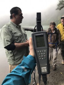
Although the last eruption of Chato Volcano was ~30 ka, making it an “inactive” volcano, Costa Rican researchers still monitor it closely for a different volcanic hazard – CO2 degassing and lake overturn. Similar to the effects of carbon monoxide poisoning due to a gas leak in your own home, if CO2 builds up at the depths in the crater lake and is released, anyone nearby the volcano can be at risk of asphyxiation. At present, the lake is not dangerous (we tested the temperature and pH of the water ourselves!), providing the students with an exciting learning experience!

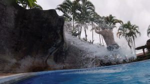
After our crater lake adventure, the students were awarded a well-deserved afternoon at a local hotspring resort where the pools and slides are heated naturally by Arenal Volcano! … and Tina got a cake!

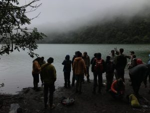
The crater lake at Chato Volcano.

Carlos explains how water at volcanic lakes is tested using various devices, such as the ‘multi-parameter’ pictured here.

Hot spring fun!!!

Day 8: Volcán Arenal

Day 8: Sunday, 1/14/2018

by Matt Barr (17.5′) and Bryce Belanger (19′)

Following a glorious Saturday of playoff football (en Español), we set out to Volcano Arenal Sunday morning from our Airbnb in La Fortuna. Linking back up with Carlos, and his colleague Gino (a volcanologist), we drove to the base of the volcano, donned our hard hats, and hopped the fence to begin the hike up the now closed road. Carlos lead the way, slashing through biological distractions and trying to keep us on the right path.

In 1968 Arenal began its most recent eruptive phase, producing some sort of eruption every day for 42 years. Although still active, the 7,000 year volcano hasn’t produced any eruptive material since 2010.

We scaled the western slope, between a 1968 lava flow and a 1993 lava flow, until the volcano was too steep to go any further. On our way back down we climbed on top of the 1993 flow, a blocky basaltic andesite, only a few years older than we are. We busted out the rock hammers and smashed the hell out of it, exposing some clean faces and beautiful clinopyroxene and plagioclase crystals. After some discussion, some photos, and some jokes, we trekked back down the volcano to have some lunch.

Stop 2 was a dam (daaammmnnnn!). Unlike the last hydroelectric project we visited, this one was made of gravel and boulders, and it trapped runoff instead of blocking a river. The reservoir is actually called Lake Arenal, and it’s a popular tourist destination.

Following the hydrological excursion, we pulled off on the side of the road, slashed through some plants and cleaned off the face of a road cut, exposing layers of lapilli, paleosols, ash, and debris flow. We sampled the lapilli for some future analyses back in the  laboratory in Middlebury, Vermont—the land of winter.

Our final stop of the day was another Arenal lava flow, some 500 years old, with clinopyroxene the size of my pinky nail. We smashed it into bitesize pieces and everyone got some. People pulled over to see what all the commotion was and we told them we found cool rocks and they didn’t care.

Tomorrow we’re headed to a crater lake. J-Term is pretty fun.
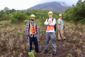
The two handsome authors in front of Volcano Arenal (ft. Carlos).
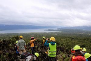
View of Lake Arenal from on top of the 1993 lava flow.
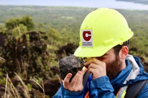
Geologist Matt Barr looks at basaltic andesite on the west flank of Volcano Arenal.
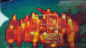
Infrared shot of the group on Volcano Arenal.
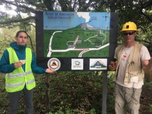
Professors Pete Ryan and Kristina Walowski pose with sandwiches next to an evacuation sign.
Day 6: Mapping and monkeys in Parque Nacional Manuel Antonio

Day 6: Friday, 1/12/2018

by Andrew Hollyday (18′) and Joel Wilner (18′)

It may be possible that we were the first-ever visitors to Parque Nacional Manuel Antonio who attempted to ignore the park’s world-famous biodiversity. Instead, our focus was on the enigmatic rocks flanking one of the park’s heavenly beaches. We inched along the crashing Pacific surf, inspecting and interpreting the lithology and structural geology of the coastal outcrops. The rocks revealed curious remnants of the past: cemented layers of angular pebbles giving way to fine-grained sands, extensional fault structures, bulbous basalts. With trusty Brunton compasses and field notebooks in hand, we measured layer orientations and took meticulous notes on each of the many distinct layers.
In the afternoon, the class worked in groups of four to distill our field notes into stratigraphic columns, descriptions, and two-dimensional schematic sketches of the rocks we had mapped along the coast.  Referencing the rocks we had studied in Vermont and through close examination of stratigraphic and deformational logic, we presented and challenged various hypotheses about how these Costa Rican coastal rocks were first deposited and later deformed.  Ultimately, we interpreted these meta-sedimentary rocks to have been originally deposited in submarine landslides, which were later tectonically upwarped. A complex of normal faults in the bedrock indicated these rocks underwent later extensional strain—much like the Basin in Range Western United States.  These fractures and faults may have allowed magma to ascend through the oceanic crust and erupt pillow basalts (lavas that crystallize underwater in pillow-shaped forms) that we observed on the opposite side of the beach.

We ended the day with a discussion on methods of geologic dating and presentations from Matt, Bryce, and Eli on the geophysics of tectonic plate subduction, earthquake sensing, and an “incoherent stratigraphy” in the Nicoya Peninsula. After an intense, challenging, and intellectually stimulating day of geology in Manuel Antonio (and a delicious ‘típico’ dinner cooked by Pete and Kristina), we head north to the interior.

Making observations on Manuel Antonio Beach.

The rocks exposed at the Manuel Antonio beach outcrops.

Pete highlighting a small fault exposed in the Manuel Antonio beach outcrop.

Observations at the ‘raccoon rocks,’ an outcrop named for the pesky little critter who tried to steal Pete’s backpack.

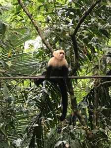
Despite our best efforts, we couldn’t ignore the amazing wildlife completely! Here, a capuchin monkey poses for the camera.