Colonizing Visions in Cartographic Visualizations
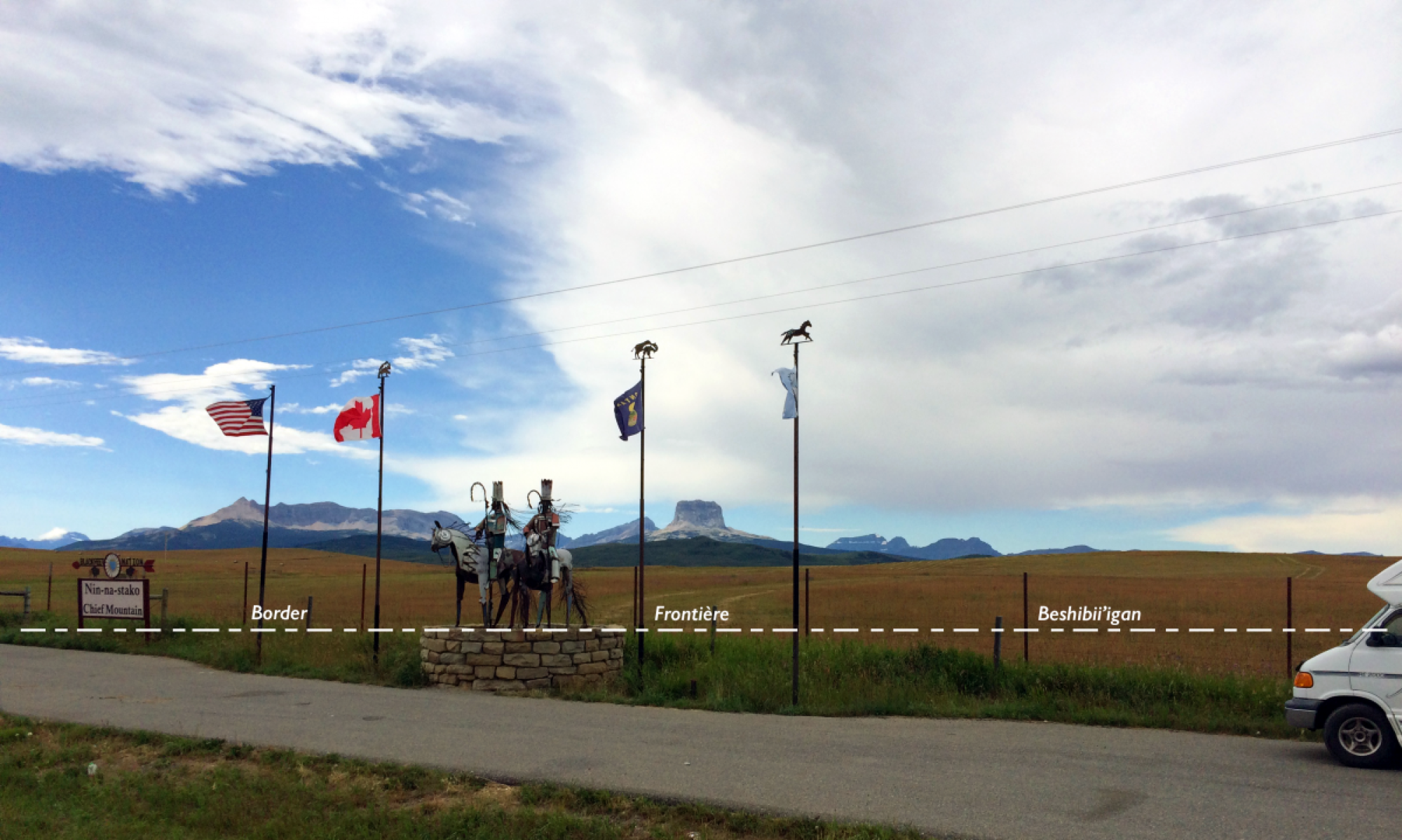
Maps are powerful tools of persuasion and hegemonic control. They are an integral part of colonization because they allow governments to exert control form a distance. Drawing lines on a map turns land into territory: the abstract, rational, and detached notion of ‘land as a commodity’ that can be owned, divided into parcels, and sold. Drawing these territorial border does not even require knowledge of the land. When Europeans “discovered” the Americas, lines of latitude and longitude sufficed to determine ownership of vast areas they had not even set foot in. It is no surprise then that the 49th parallel functions as the demarcation for much of the international boundary between the US and Canada.
Maps have an aura of objectivity and authority. Their construction is guided by scientific principles of cartographic visualization and they are generally authored by government institutions or respected publishing houses. But, as the old dictum goes, “all maps lie flat, all flat maps lie”. The very nature of their design necessitates distortions because of the need to (1) convert the 3-D world into a 2-D image, (2) select a limited number of elements to fit into a reduced representation size, (3) use symbols to organize related features into a coherent system of signs. On top of these limitations are the values and biases of the map makers that invariable enter the creative process.
There are hardly any maps of indigenous borderlands that show how native lands are divided by international boundaries. For indigenous peoples, the most problematic aspect is “the primacy of the nation-state”, that is, the unquestioned belief that each of the 200 or so existing modern states is the sole owner of its lands. The colorful patches of state territories we see on a world political map represent separate sovereign territories or claims of exclusive ownership. So it is not surprising that when governments map indigenous lands, they map them within their own territories. They do not include lands of the same group in adjacent countries or even when it is bisected by the border, as, for example, in the case of the Mohawk, the Blackfoot Confederation in the US-Canada borderlands. To do so, would invite questions about sovereignty.
Respected popular scientific publishing houses or cultural organizations also fall into the trap of restricting maps of indigenous peoples to existing state territories.
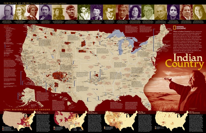
The “Indian country” in the wall map of that title by National Geographic, curiously ends exactly at the borders of the United States.
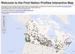
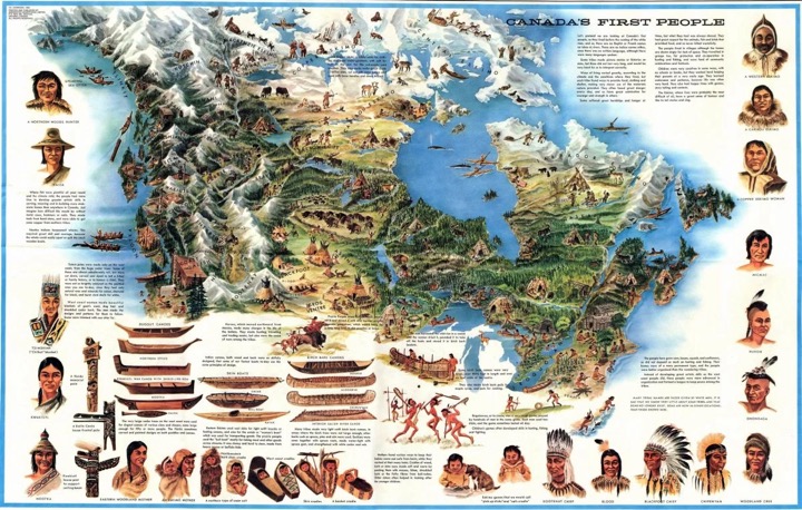
The map of Canada’s First Peoples that is listed as a teacher resource on the FNER – Indigenous Perspectives on Education website ends at the southern Canadian border with the United States and fills the empty spaces with canoes. Eerily reminiscent of the maps of early explorers that covered unknown lands with monsters and mythical creatures.
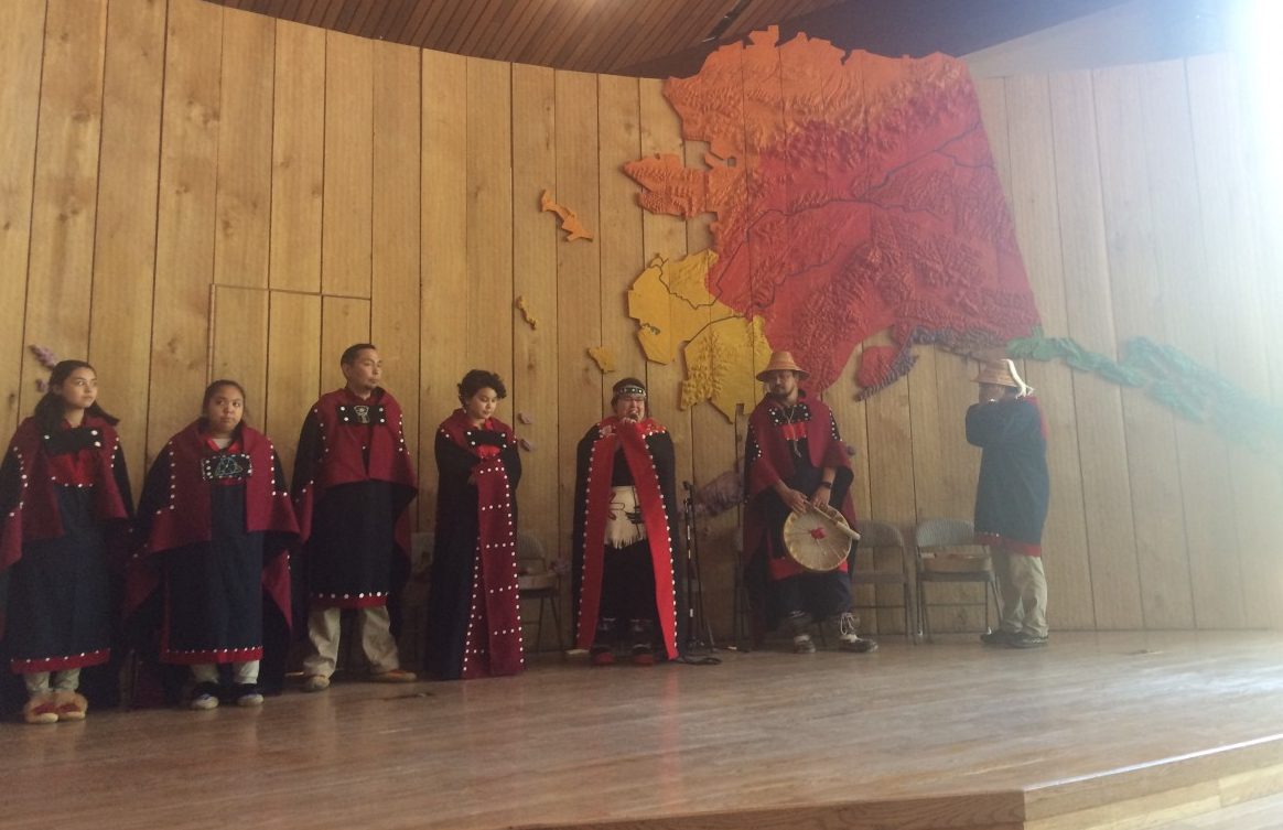
The wall map of First Alaskans in the performance space of the Alaska Native Heritage Center clearly shows how their homelands cover the entire state, but at the same time gives the false impression that these homelands magically end at the border with Canada.