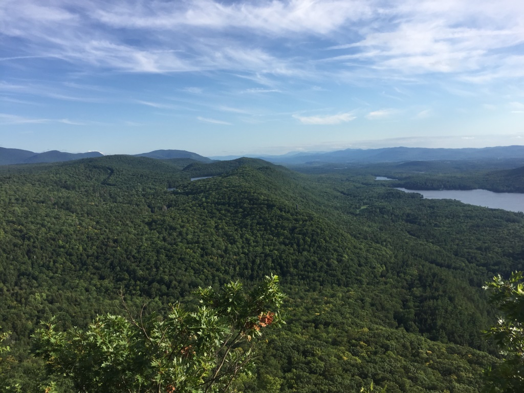
One of the most popular “hikes to a view” in Addison County, is the hike up to the Rattlesnake Cliffs on the lower slopes of Mt Moosalamoo, where there are spectacular views of Lake Dunmore to the east, Silver Lake to the north, and the main ridge of the Green Mountains to the west. Over the last decade or so, this viewpoint has become a little bit more challenging to access, as the return of nesting peregrine falcons has necessitated closure of this popular viewpoint from early spring to the beginning of August, limiting this lovely overlook to late summer and fall (except for the hardy winter hikers and skiers) so that the falcons can have their babies in peace.
Hiking up to the Rattlesnake Cliffs from the popular Falls of Lana/Silver Lake trailhead, just south of Branbury State Park leads to two possible ascending trails. The longer, but gentler Rattlesnake Cliff Trail, described in an earlier blog, and the more direct, steeper Aunt Jennie Trail. Based on a few conversations with old-timers in the area, I became interested in who the eponymous Aunt Jennie was, and what her connection to the trail or area was. And I am not an old-timer yet – not quite. A little bit of easy googling came up with the answer – Aunt Jennie was a woman who ran a popular eatery on flat lot, formerly the site of the old Falls of Lana trailhead, a quarter mile closer to the falls than the current location. A short writeup mentioning Aunt Jennie, as well as her teahouse (the picture of the teahouse provided by Bill Powers, a local historian) can be found on the Lake Dunmore Association blog, from a few years ago.
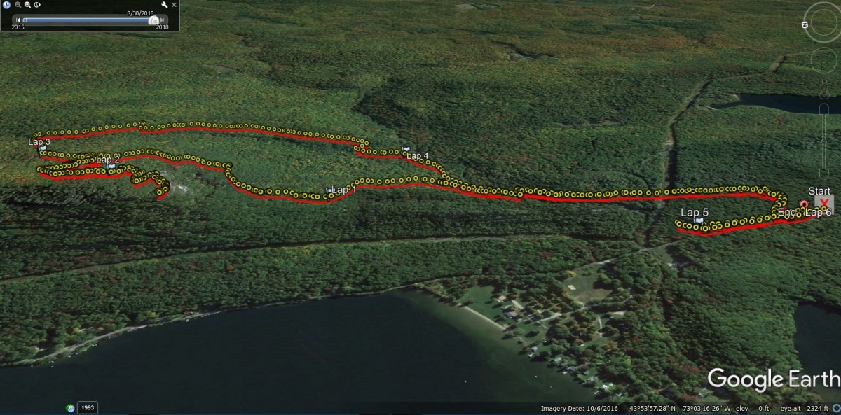
The run up to the Aunt Jennie Trail begins much like many of my other runs in the region, from aforementioned Falls of Lana trailhead. After the first short climb, the trail up to Silver Lake takes a sharp hairpin turn to the right, but to head up to the Rattlesnake Cliffs, one goes straight, taking a turn to the left over a footbridge put in place after the 2008 flooding which took out an older bridge. After crossing the Sucker Brook, turn right, and after a short run, the well-labeled Aunt Jennie trailhead appears to the left. I hadn’t hiked up this trail in many years, but as expected, it was significantly steeper than the longer Rattlesnake Cliffs trail. While the longer trail is gradual enough to be good uphill running over much of its length, I would have to say that, at least at my current climbing ability, less than a quarter of the Aunt Jennie trail is actually runnable, so most of this rapid ascent is more a power hike, with a few faster footsteps when it levels off in a few places. After about ¾ of a mile, the Aunt Jennie Trail ends, and a left turn, joining the Rattlesnake Cliff Trail will take one to the left turn, well signed, leading to the Rattlesnake Cliffs for the great views.
Heading towards the cliffs, I noticed something was different. In the past, there were two separate cutoffs to cliff overlooks. The first cutoff led to the prominent ledges on the East face, and somewhat to the north. When I found myself on the south facing cliffs, I wondered how I missed the first turnoff. Further exploration, led to another short trail that I didn’t think had been there in the past, leading to the great views of Lake Dunmore to the east.
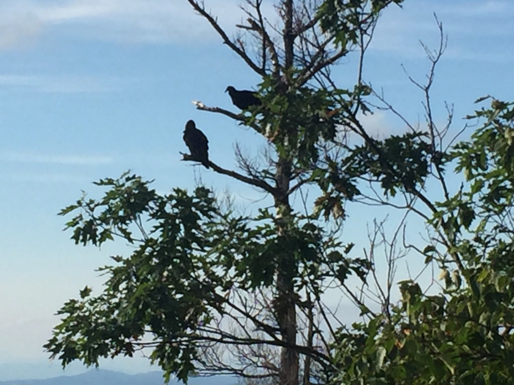
At this overlook, I was treated to a dozen or so huge birds sailing around me, often very close, and landing on nearby ledges. Were these peregrine falcons? Were these some other proud raptor, like red tail hawks? Nope – they were plain old turkey vultures, but watching them, I developed an appreciation for some birds that would be considered lovely, if not for their tiny heads, and carrion-eating habits. Who knew we had so much food for them here? If they are attracted by the scent of rotting carcasses, what does that say about the scent of a very sweaty trail runner?
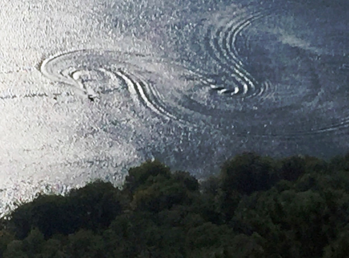
Looking down at the lake, getting increasingly empty as the summer season winds down, I saw a lone speedboat, tugging a lucky waterskier, leaving patterns in the water that reminded me of old Spirograph artistry.
On my return, I stopped for a few moments at the overlook, facing to the south, including Silver Lake, Lake Dunmore, and in the distance, Fern Lake. Is it my imagination or colorblindness, or are the first little bits of orange starting to creep into the foliage?
Looking more carefully on my return, I did manage to see the trail to the “old” Lake Dunmore overlook. It no longer had any signage, and it looked as if trail maintenance crews had tried to obscure its presence. My suspicion is that this overlook is being discouraged to keep hikers away from the main falcon-roosting area, but I don’t know the full story here – anyone with something to add to this, please feel free to post your comments!
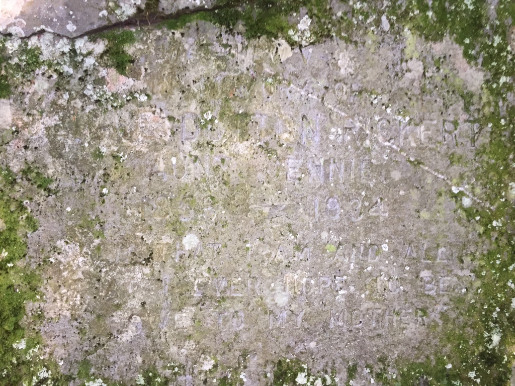
For the descent, after realizing that the Aunt Jennie Trail was fine for fast hiking, but not running, I chose to descend the longer Rattlesnake Cliffs trail, which, while longer, made for a faster descent due to its runnability over most of its length. When I reached the bottom of the trail, I added in one last short section, in order to include some other “Aunt Jennie” history. Instead of turning left at the bottom of the trail to return to my parked car, I turned right for about a quarter of a mile, to explore the site of Aunt Jennie’s teahouse. I had recently learned of an inscription in the rock facing this flat section, honoring Jennie. It was easy to find – when you hit the rock ring, continue to the nearby rock face, and if you look carefully, you can see where the moss was recently removed, leading to the professional inscription. It is a little bit hard to read in my picture, but it states:
In Memory of
Jennie Dutton Rickert
Aunt Jennie
1866-1932
All that I am and all
I ever hope to be I owe to my mother
A little bit of further research shows that this is nearly identical to a quote made by Abraham Lincoln about his own mother!
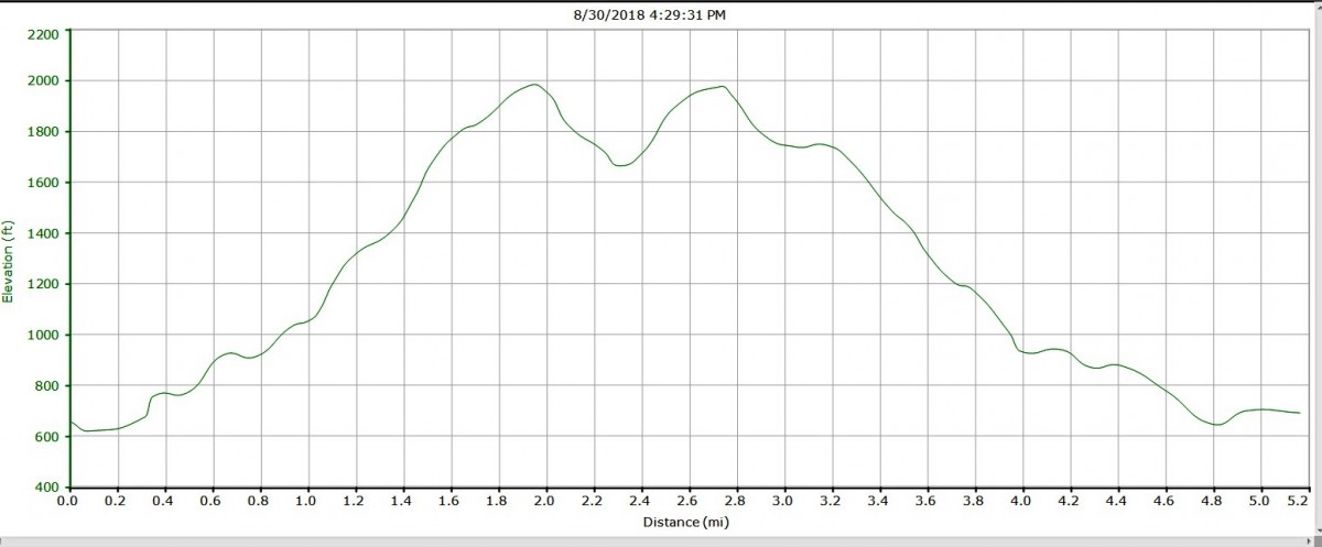
A short trot back to my car made this run/climb a little bit more than 5 miles long, with a challenging 1500 ft of climb and descent!