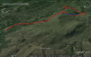
In this blog, I have often sung the praises of the trail runs accessible from the Brooks Road trailhead, reached after a few hundred yards on the forest service road on the right between the Rikert ski touring area and the Snow Bowl. The easiest run from here, terrain-wise is a roughly 9 mile run which I have described in the past, albeit six years ago. A good chunk of this run actually takes place on Brooks Road itself, a forest service road which is open to cars during the summer months, although rarely driven, and is used by snowmobilers and cross-country skiers in the winter. In late March? Since it has no snow anymore, and probably never had much this winter, it is closed to snowmobiles, but has not yet been opened to other motor vehicles, making it even better for running.
The run starts off with the most challenging climbing of the route in the first mile and a half on the dirt surface, until it levels off for another mile, reaching the point where the snowmobile trail up from the Sugar Hill Reservoir joins from the right. Those looking for a shorter run or hike can just take a right turn here, for a 6 mile out and back! On this run, however, I will be returning by this side trail.
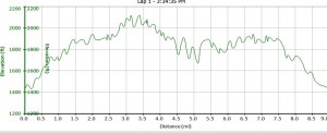
Another mile on the dirt road, and another climb, not as long and steep as the climb at the start of the road, brought me to the high point of the run, with the total vertical climb a modest 700 ft. One of the big hurdles for road runners transitioning to the trails, especially competitively in Vermont, is the challenge of getting used to long, sometimes relentless climbs. I have found that this section of dirt road makes for a good place to time trial to measure one’s progress in the hills. Since it is on a dirt road, the footing is consistent, eliminating the variable of trail condition, so I will run this quite a few times each season, making a mental note of my time on the ascent, watching how my times get faster as the season progresses.
After crossing the pedestrian bridge over the upper reaches of the Sucker Brook, I headed on the trail into the woods, taking a right turn onto a ski and mountain bike trail which is part of the Blueberry Hill network. This particular trail used to be a regularly groomed part of the Inn’s system, but has not been groomed in the last few years due to the destruction of several small, but critical bridges along the trail by Hurricane Irene. The Moosalamoo Association, a non-profit, is currently raising funds for their repair, but fortunately the bridge washouts do not affect the use of these trails for running once the snow is gone.
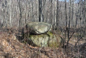
Staying on this trail for a little over a mile, and veering gradually to the right, this route took me to the dirt road access connecting the Goshen-Ripton road to the reservoir, and I took the right turn towards the reservoir. This road provides easy access for boaters and fishermen who need the convenience of driving to haul their gear to the lakeside. I have enjoyed noticing quirky rock cairns, built and left alongside trails and streams, and commented on them in past blog entries. On this run, I noticed a few rounded rocks, far too large to have been placed there by humans, neatly stacked alongside the road. Perhaps the glaciers didn’t want us to get lost?
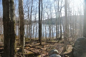
A few minutes on the dirt road finally took me to the shores of the Sugar Hill Reservoir. This body of water was created exactly 100 years ago as the highest altitude component of the Silver Lake hydroelectric project, which culminates far below on the shores of Lake Dunmore. While this scenic lake is open to recreational use, it’s primary function is to store water for the hydroelectric project downstream, as well as flood control, and as a result its depth fluctuates tremendously, season to season and year to year. This spring, with our weak snowfall, the water level is particularly low, although it was interesting to see that it was still almost entirely frozen over still despite our warm late winter.
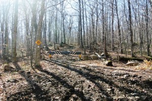
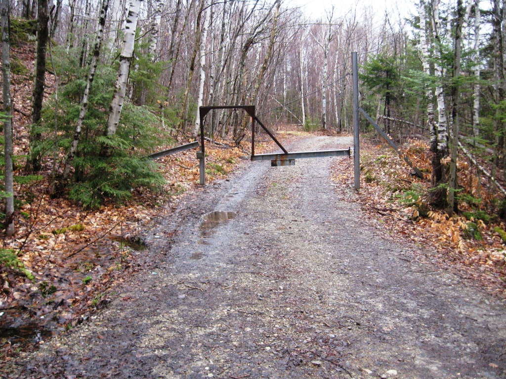
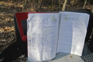
I also noticed a fair number of “improvements” since my last description of a run here. There used to be a quirky looking gate across the section of trail heading over the reservoir dam, clearly built to as not to behead errant mountain bikers, but this has been replaced by a more decorative forest service gate, and to my surprise, a mailbox. You’ve got mail? Out of curiosity, I opened the mailbox and saw that it held a logbook to be filled out by those passing through, and I couldn’t resist the temptation to sign it with my blog moniker. A little later down the trail, I realized that I should have added some sort of comment along the lines of “Happy Easter Egg Hunting”, since it was the day before Easter.
The next short section involved crossing the reservoir dam, and locating the trail on the far side, offering a snowmobile connection between the water and Brooks Road, and this involves a short climb of a little over a half mile, with one final view of the reservoir through the trees, which will soon be obscured as the season leafs out.
Returning to the Brooks Road in this way, I took the left turn for the easy descent back to my car, and the conclusion of this scenic, and despite the mileage, not terribly challenging run.