For direct, easily accessible mountain runs, ski areas are hard to beat. While most of the ski trails are far to steep to run, almost all ski areas offer one easier route down the mountain. In part, trails of this sort can be motivational for less skilled skiers, giving them a chance to experience the top of the mountain, and see the sort of trails they might aspire to. More practically, they offer a drivable route to the summit, at least with 4WD vehicles, allowing for access and maintenance during the summer months. At the Middlebury College Snow Bowl, the trail that fits this description is the Voter Trail. I described a run up this trail a few years ago, hoping to describe a run to the top of Worth Mountain, whose summit is slightly south of the top of the Snow Bowl. Alas, I turned around too soon, as I discovered when I loaded my GPS track into Google Earth – the point where I turned around was actually a false peak, slightly to the north of the true peak. It was time to rectify this mistake!
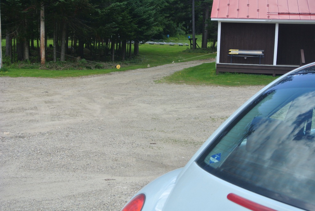
I pulled into the Snow Bowl Parking lot on a pleasant, cool Sunday afternoon, and saw a lot of construction going on. There were huge piles of fill up near the exit, presumable for the ongoing road improvement on Rt 125, and a substantial stack of rusty pipes – from the look of things, they are in the process of replacing some of the plumbing required for snowmaking this summer. I also found it curious, that with all this open terrain in front of me, there was a random “trail closed” sign hanging in front of the entrance to the Voter trail, to the left of the Ski Patrol Hut. I assumed, of course, that this was there to deter motor vehicles, rather than runners.
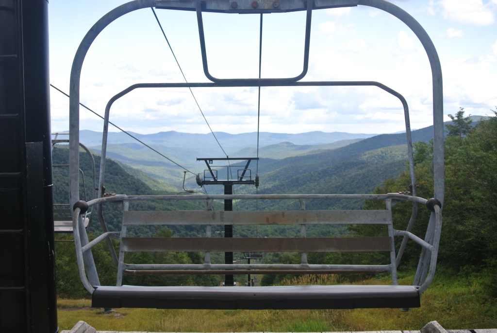
Stepping over the sign, I began the day’s ascent. While I have been on this trail a few times in the summer, noting the broken up asphalt beneath my feet that somebody went to the bother of actually paving the first part of this trail – I have never noticed this on any of the ski area service roads I have run before. The ascent via the Voter trail is not as easy as one might assume for a “green circle” trail. Things are a lot steeper running up than they are skiing down! I could maintain a running gait for most of the ascent, with only a few short walking sections due to poor footing and increased steepness in a few pitches. Running at the pace of “1.0 Jeffs” (whatever speed I am running at the time corresponds to 1.0 Jeffs) I got to the top of the Bowl in about 20 min. Of course, I had to take the obligatory picture of the views to the east – these constitute the best views on the day’s run!
From here, I chose to continue uphill to reach the true summit of Worth Mountain, by continuing south on the Long Trail. In my previously described run, I assumed, incorrectly, that the first summit was indeed the summit of Worth. As it turns out, I learned the hard way after my previous run that I had a little further to go – so remember – THE FIRST SUMMIT IS NOT THE SUMMIT! THE SECOND SUMMIT IS! Oh – and did I mention that neither of them has any decent views? The trail run itself isn’t bad, however – most of the Long Trail is very “scrambly” and this section, with its modest ascents and descents is actually run-worthy in places, albeit slowly and with careful attention to one’s footfalls. reaching the summit, I retraced my steps back to the top of the Bailey Falls chairlift, and continued down Voter, at least part way.
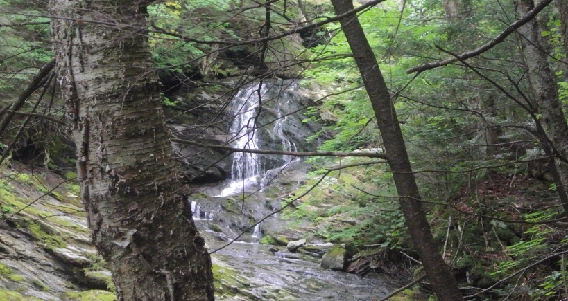
I had another goal for this run, however, so rather than simply retrace my steps to my car, when I reached the Meredith Trail, the first gentle trail to the right, about half way down the mountain, I saw a set of recent 4WD tracks, which had beaten down the increasingly dense and high ground cover, and used them for my descent. I have known about the existence of a waterfall, known, not surprisingly, as Bailey Falls” (hence the name of the Bailey Falls Chair lift!) for several years, but had never actually seen them, nor have I met anyone who has, either! According to the scant descriptions online, this waterfall is kind of hidden in plain sight – it is probably 100 yards from the Youngman Trail at the Snow Bowl, and maybe a quarter mile from the small parking lot along the east side of Rt 125, across from the Bailey ski lift. I followed one of the online descriptions of how to find this hidden gem, heading uphill from the chair lift for 30-40 yards before bushwhacking into the woods, but within a few moments I could see it, quite obviously, a 100 yards or so upstream. The challenge was getting to it, as the hillside where I was standing was rather steep, and did not provide for firm footing. Hanging onto appropriately spaced trees, I was able to lower myself to the point where I could catch a picture of it, although the picture does not do the falls justice. This shot is of only the lowest 1/3 of the falls – I could catch glimpses of higher cascades through the trees. I will need to return, trying to get at it from the other side of the stream, where access appeared easier, to get a fuller glimpse of this rarely seen treasure. I have a hunch it is about as high as the well known Falls of Lana, and certainly dwarfs the well known Texas Falls roadside attraction.
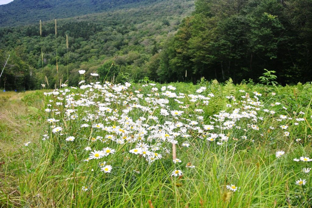
Now, only a short section of running remained – the climb back up, and over to the east side of Middlebury Gap where my car awaited me. I could have chosen to move to the road at this point, given the wooden bridge which allowed for passage over bogs and streams from the bottom or the Bailey Falls lift to Rt. 125, but chose instead to run up the trail, furthermost to my right looking uphill, the Wissler Trail, named after a legendary and long-deceased Middlebury College Physics professor Ben Wissler. After a few minutes of chugging up this grassy slope on my tiring legs, I reached the top of the Sheehan Chair, where I was pleasantly surprised by a large clump of daisies on the Lang Trail. The daisies seem to be starting to wither down in the valley, but apparently this patch in the cooler higher altitude climes is doing quite well.
From this point, a short descent on the service road following the Lang Trail, which is after all the bunny slope of the Snow Bowl, led me back to my car for a challenging but scenic and interesting 5.5 mile run, with about 1800 feet total of climbing and descents.


Jeff,
Sounds like great adventure. I’ve said it before and I’ll say it again…NOTHING beats cross-country !!
And this one had some serious country!