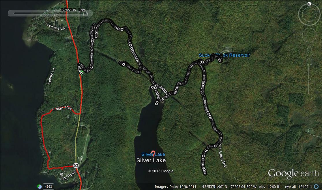
Once again, it is a beautiful Saturday, so I thought it would be a great day for a ski or trail run. A few days ago, I was talking to my colleague Joe the Geographer, and he mentioned how nice the running up to Silver Lake had been recently, and I realized then that despite the fact that I run there during most of the year (and blog about routes near the lake regularly), I had never been there before in the winter! I also knew that my spiked shoes probably wouldn’t provide quite enough traction, so I went to the Middlebury Mountaineer and picked up a set of “Microspikes” which are basically slip on mini-crampons designed to be worn over running shoes or lighter hiking boots.
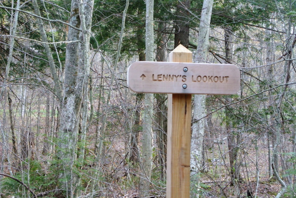
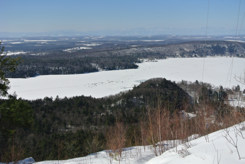
I started this run, in the usual place, the Falls of Lana trailhead, and started up the steeper early sections of trail, which had been well groomed by and for snowmobiles, making for easy running with my spikes on. While the beaten down section of trail proved to be easy running, if I stepped off the trail, I quickly sank in, close to up to my knees, so there would be no trailbreaking for me today! Chugging up towards Silver Lake, I noticed that some snowshoers had beaten a trail to Lenny’s Lookout, the high point of the powerline clearing overlooking Lake Dunmore, so I headed up that way to enjoy the view after a short climb. I could see lots of ice fisherman down below, and it was curious that they were mostly clustered in one small part of the lake. Was the fishing better there? Or did someone bring the beer?
Returning to the main snowmobile trail, I continued up to the lake shore. I must confess, I was kind of hoping that some ambitious snowshoer had traipsed around the lake, making for easy passage in running shoes, but I could find no such tracks, so I had to content myself with a short slog through the snow, out on the ice, to get the sort of perspective that requires swimming in the summer. In addition to shoreline views, I also saw a few snowmobilers, off of their sleds and walking along the shore. With those big helmets on their heads, I kind of thought they looked like popular music artists “Daft Punk“, a duo reknowned for wearing face-obscuring helmets as they play.
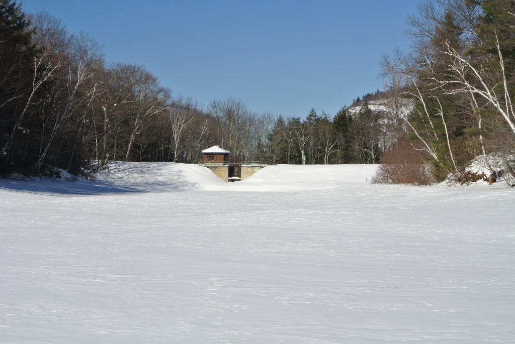
Continuing on, I thought it might be nice to head down the Leicester Hollow trail, but was disappointed to see that trail had barely been broken on this, so I continued up the main route above Silver Lake. When I reached the trail split, half going right towards Goshen, the other half going straight towards Moosalamoo, I though I would head straight for a little while to check out the rarely-visited Sucker Brook Reservoir. Somewhat surprisingly, when I split off of the snowmobile trail to go to this small body of water, there was one set 4WD tire tracks heading down the steep road for me to run in. Somebody whose job it is to inspect the dam in the winter has one heck of a big set of snow tires, and a vehicle which does really well in deep snow! When I got to the reservoir, it was……empty. Apparently they drain it in the fall, probably to leave room for spring snowmelt?
Heading back up the hill to the trail junction, and not quite ready to return down to my car, I headed up the road further to the Goshen/Silver Lake trailhead parking lot, which was empty due to the fact that the road it lied at the end of was not plowed in the winter. I did notice that the snowmobile continued on however, and was surprised to learn that it followed the course of the Ridge Trail, up on the hillside above Leicester Hollow. I previously described the Ridge Trail in a summer running post, and found that there was nothing particularly remarkable about it, and had never run it again since. It took on a whole different look in the winter, so I am now eager to-re-explore it in the upcoming weeks while everything is still under deep snow. This time, however, I was not prepared for a longer run (no food or water), so after going a short distance on the well-packed Ridge Trail, I returned to the Goshen parking lot. From this point on, it was about 2.5 miles all downhill, and my Microspikes made it so that I could run fast, and confident in my footing for the duration of the descent.
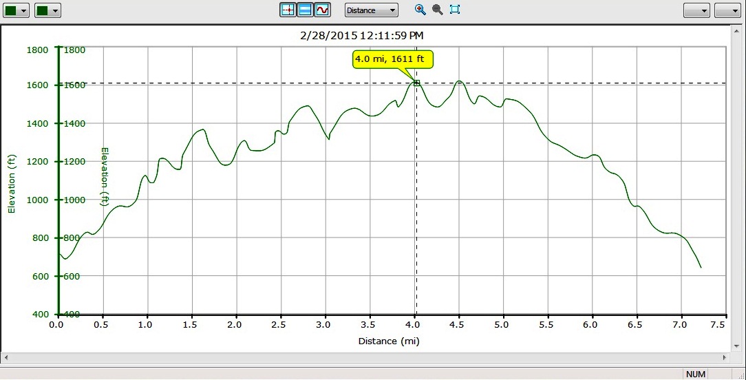
Returning to my car, this made for a slightly longer than 7 mile run, with about 900 feet of climbing and descent. The day was so nice, that after I got home and had a light lunch, I managed to get out for an hour of cross-country skiing as well!
An unrelated but trail-related story about running in the snow! Not quite a month ago, I think it was April 11, I took the snowmobile trail that comes out on Dragon Brook Road. I was expecting snow on the trail and there was quite a bit of it. What I did not expect was coming out on the Forest Service road and realizing that they did not actually plow it all winter! I ended up post-holing several miles through knee-deep snow till I reached the plowed road, which was certainly a “character building experience” but then got the fun of hauling ass down North Branch road! Today (May 4) I learned that there is also still snow at the Snow Bowl, but it’s melted enough to have some rather boggy areas to run in and some dry areas. Then I came out on 125 and decided to run down to Texas Falls where there is no snow at all. Then I ran back over the gap and I should have got on the long trail but I was pretty tired and just ran down 125 instead. Next adventure is on the Goshen trails but I’m going to give it a few more days of nice weather! From another trail runner who goes on random and sometimes stupid adventures around Addison County 🙂
Did you know the Dragon Brook Road Snowmobile connects all the way down to the Airport? It makes for a great climb and descent. It also goes over the top of Robert Frost Mt, and supposedly connects on a series of Forest service roads all the way to the Long trail via Burnt Rock Trail. Doing that whole stretch as a descent is on my bucket list.