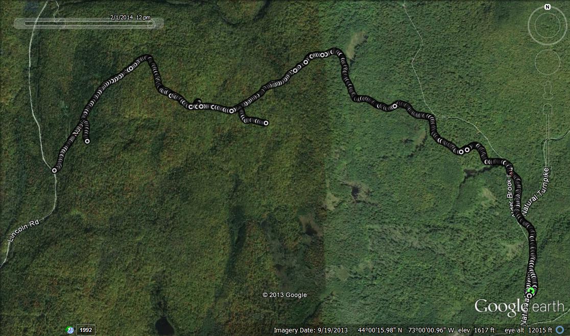
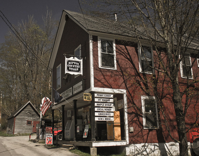
Last winter, while recovering from injuries, I snowshoed a route along a VAST trail at the higher altitudes of Ripton. This route, which begins at the end of the plowed section of the Natural Turnpike in Ripton heads south along the snowmobile trail marked as “7A” towards Robert Frost Mountain. My trip along this route was limited by the slower pace of snowshoe travel, and I have been looking forward to returning to explore it a little further on ski or on foot. The limited amount of snow on the ground made a run the obvious choice for now. To get to the trailhead, I drove up to Ripton, then took a left turn on the road across from the Ripton Country Store. A short while later a right turn up the hill on Robins Cross Road and a left turn on the Natural Turnpike followed by a few minutes’ drive brought me to the trailhead parking lot near its confluence with FS 59. In every previous winter trip to this spot, the Natural Turnpike was blocked at this point by a forest service gate, but this year, with the meager snow, the gate beyond this point was open, and the road was freshly plowed.
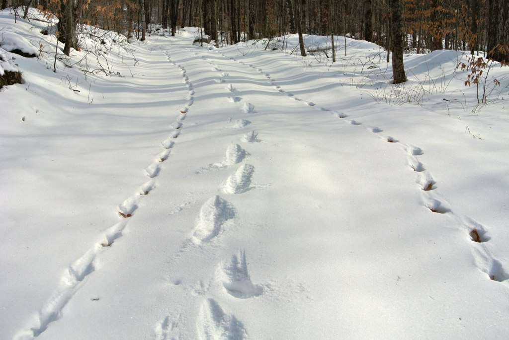
Setting off on the trail heading to the left (north in absolute coordinates) I could see that the snowmobilers had been faring about as well as the skiers this year, as the trail had been virtually stripped of its snow cover by previous snow travelers. I set off, as in my previous exploration, following the marked snowmobile trail, which crisscrossed a few Forest Service Roads over the course of the first mile. Between the thin snow cover, and my Asics Gel Arctic running shoes, equipped with short spikes making them the “studded snow tires of the running world”, I had very solid footing all the way, except for two easily traversed frozen-over waterbars. As I proceeded further into the woods, snow had covered over the most recent snowmobile tracks, and not much later, I could see where the trail had been bereft of human travelers all season, leaving the tracks of animals as the only sign of previous passage. One set of tracks were particularly interesting – I could see that what at first looked like one set of old tracks, soon diverged into two sets, which looked to be about the same age. Following them, I could see that the parallel sets of tracks stayed apart, as if the two animals which set them were going about their travels as partners, perhaps even mates? They seemed too big and deep for a squirrel, and squirrels never seem to travel as if they are actually going somewhere. I am going to guess that they were foxes, although they had faded enough that I could not have made out the fine print in them, even if I were a more knowledgeable animal tracker. I like to think that these two nocturnal animals had shared a long moment in the moonlight together on the way to whatever their final destination might have been. As I followed their tracks, I made sure not to step in them, leaving my record of passage between theirs.
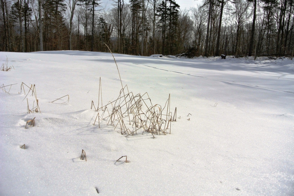
Eventually, I reached a point where the animal tracks became more complex, and their unique trail became difficult to discern from other animals who had passed through. Not long after, I came to an open meadow which had been my turnaround last winter when I passed this way. Last winter, this quiet spot had the equipment of an active logging site, but this winter, the snow surface was unblemished, except for my footprints and a few tufts of grass poking up through the snow. It looked almost like I would envision beach grass poking out of the fine white sand of the Gulf Coast, although I have never been there.
At this point, continuing on, I was into new territory, and about a mile later my trail reached the Lincoln-Ripton road, a few miles north of the Ripton School. I could discern that the trail recommenced across the road, heading uphill along the eastern flanks of Robert Frost Mountain. I could see that I had found another short section of trail to connect a run on my bucket list – I had heard that is was possible to connect trails from the top of Middlebury Gap, to East Middlebury by a route which included the snowmobile trail up and over Robert Frost Mountain, which I have ascended from the west. The point at which my trail (which merged with a plowed road over the last few hundred yards) met up with the Lincoln- Ripton Road, was labelled as the “Norton Farm Road”.
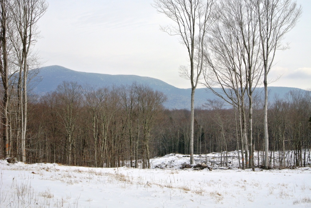
Turning to return, my attention turned two the many crossing paths and abandoned logging roads I came across. One, which looked sort of interesting, and was labeled as “Rd 235A”. This one ended in about a hundred yards at a small clearing, so returning to the main snowmobile trail, I checked out another side trail about a mile further along. This right turn led to a huge clear cut in about a quarter mile, with outstanding views of Worth Mountain, and the rest of the nearby ridge of the Green Mts. I found it curious that a small stand of mature hardwoods had been left behind by the timber cutters, but they added to the beauty of the views.
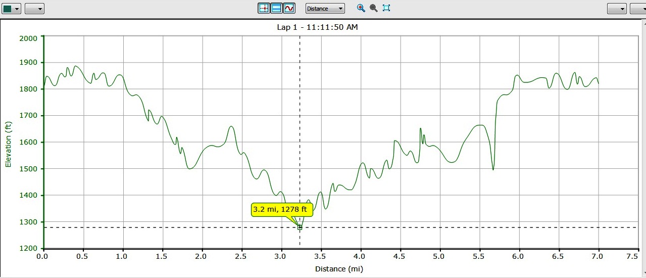
Closing in on my parked car, I could hear that I was getting closer and closer to a “sportsman” who was blasting away at something with what sounded like a semiautomatic weapon. While I never actually saw this person, I felt like shouting something along the lines of “Is there ANYTHING left of that squirrel?”. Reaching my car, my GPS indicated that I had traveled 7 miles on this run, and had dropped about 500 vertical feet on the way out, and gained it on my return.