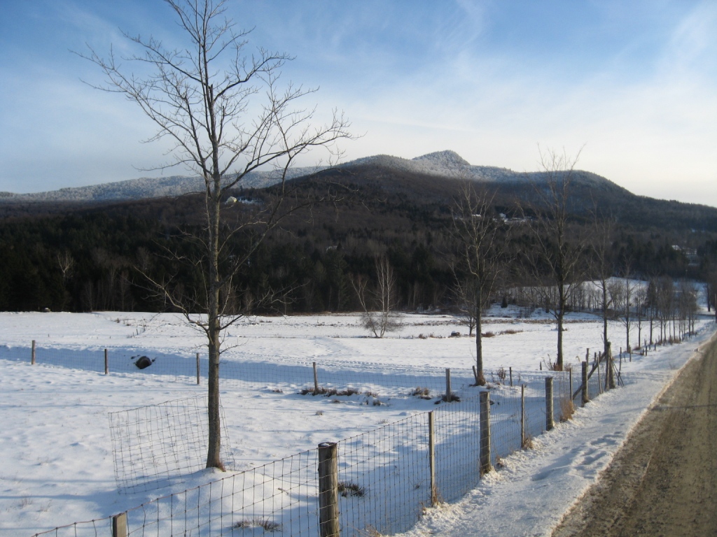
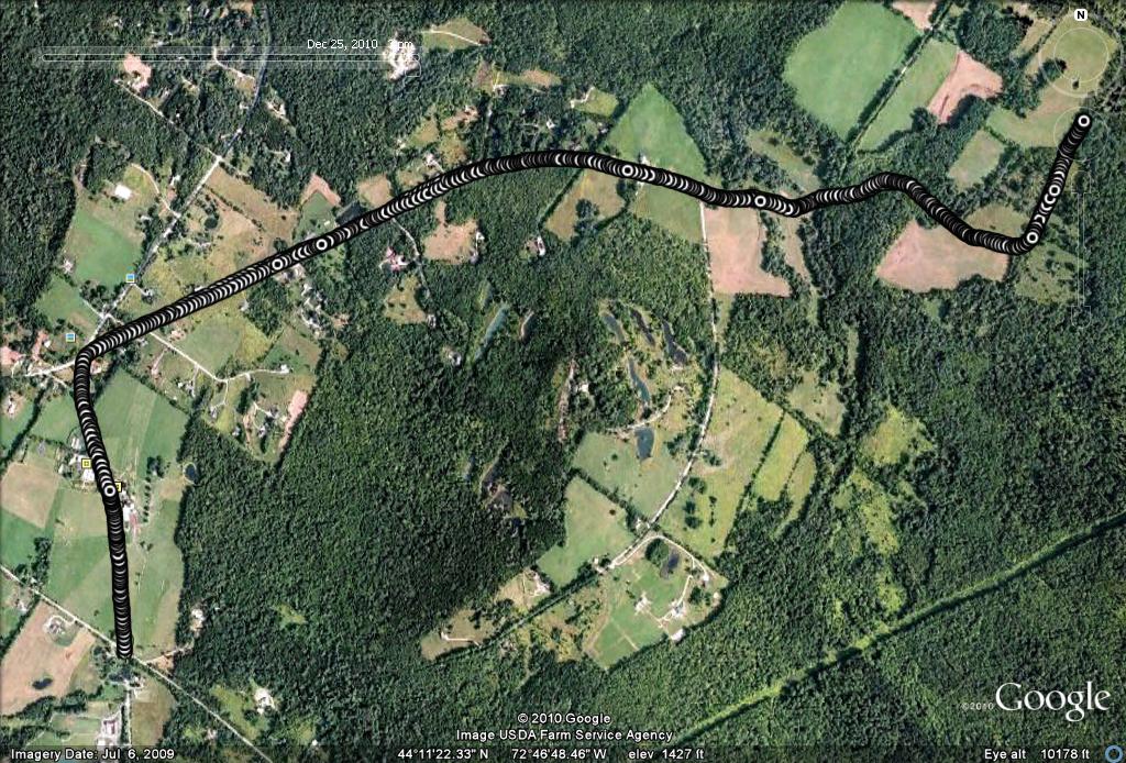
Over the years I have had the pleasure of spending a considerable amount of time just over the mountains in the Mad River Valley. While I was visiting family in Waitsfield over the holidays, I thought it would be fun describe a short run over there, especially since it is such a pleasant little community with a lot to offer the outdoor enthusiast, and is only about an hour from Middlebury by car. My previous running in this area has been mostly on the far side of the valley, on the smaller range east of the main ridge of the Green Mts., so I thought I would share a route which begins up on the ridge just to the east of Rt. 100 on the valley floor. The additional allure to running on this side of the valley is the great view it offers of the three major ski areas, Sugarbush, Mt. Ellen (technically part of Sugarbush) and Mad River Glen. The rather arbitrary starting point for this run can be reached by turning off of Rt. 100, through the Waitsfield covered bridge, followed by a left turn onto Joslyn Hill Road, and a right turn onto the Cross Road. There is ample room along the shoulder of the Cross Road near its intersection with the Common Road (the main N-S road on the hillside on this side of the valley) to park your car.
Heading north on The Common Road (the mountains should be on your right) brought me past the von Trapp farm and greenhouse. Yes, this is owned by a member of THAT von Trapp family – think about how many kids Maria and the Captain had, and then envision how many kids their kids must have had……and you get the picture why the von Trapp name is so common in the Mad River Valley and Stowe! That said, their farm has one of the best views in the state from accessible from a car or bike.
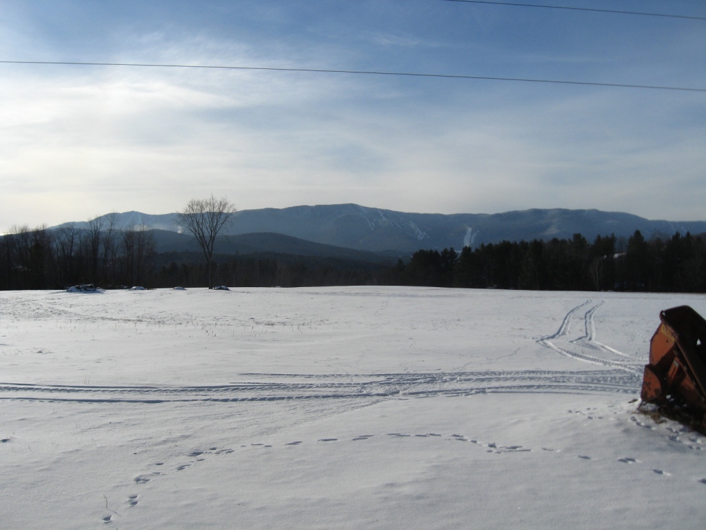
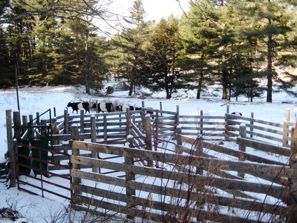
Shortly after passing the greenhouses, I arrived at the former site of the Waitsfield Common village, with its characteristic village green, older homes, and hillside graveyard. I refer to this as the “former” site of Waitsfield Common due to the fact that all of the commercial activity in the town has moved down to Waitsfield proper, a mile or so down the hill. Immediately after the common, I took a right turn towards the mountains on East Road, another easy-on-the-knees dirt road. A gradual climb of about a mile, past small hillside farm led to a point where the main road goes to the right, and a rarely travelled dirt road continues straight towards the mountains, albeit with a short steep dip in elevation. At the bottom of this dip is a pretty little valley which is another favorite mountain spot – its coniferous forest open meadow, and meandering stream normally looks more like a Colorado than Vermont, but a small herd of cows (heading north, of course) juxtaposed a little bit of New England on the pastoral scene.
Climbing back into the forest after crossing a small bridge, and taking the right fork in the now derelict road led me up a steeper incline, past a series of higher meadows, each with its own uniquely spectacular vistas, As the road bore left to the north, I could see the wreckage of a few derelict homes and cellar holes. After about a half mile along this segment, I chose to return, but past explorations following this trail further have led me to the top of the mountain ridge between Scrag Mt. and Mt. Waitsfield along what appears to be an abandoned stage road (which might be a VAST snowmobile trail at present) leading to Northfield. Perhaps I will have to come back to describe that continuation of this route next summer!
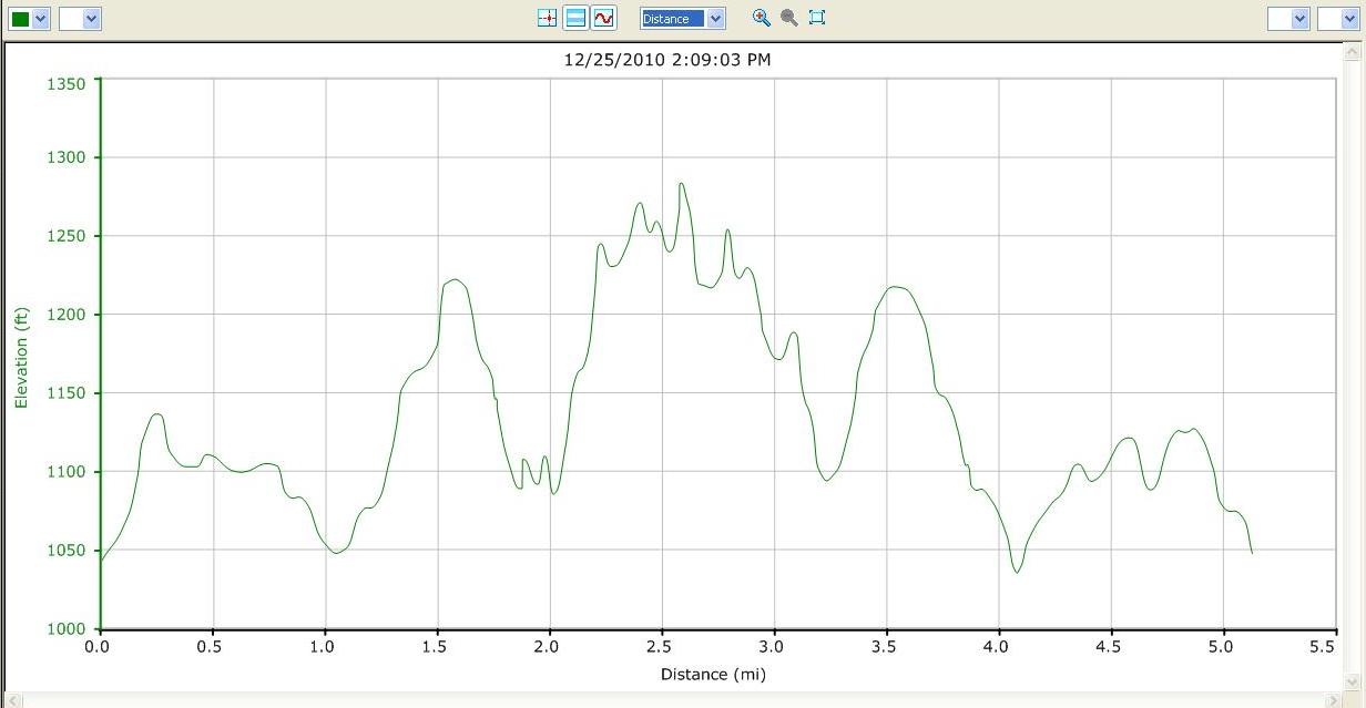
Returning by the same route brought me back to my car after a five mile run which was easier than expected due to the still thin Christmas Day snow cover. There were a few modest ups and downs, but not enough to really call this a hill climb route.
Happy New Year everyone, and THINK SNOW!
Do you know about the Mad Marathon on July 11, as part of the Festival of the Great Outdoors? http://www.madmarathon.com
I did not, but I do now, and am happy to share this info with my readers. Best regards, Jeff
Hi Jeff
I am heading to the Mad River Valley next week for mini vacation. It is my first time there and super excited! I am currently training for a marathon in October and I need to do a long 20 mile run while I am there to stick with my training plan. Do you know of any good routes? I am happy to make a couple loops to get the distance in. Or is there a run group in the area that goes out on weekends? Also, I’m from Chicago…so the flatter the better if possible! Thanks for any help you could offer me!
Mo-
About the only truly flat place to run in the Mad River Valley is Rt 100, which tends to have narrow shoulders and heavy traffic, but on the plus side, frequent swimming holes. There is a path alongside the river, which has been under development for some time – I don’t know how far it goes continuously yet. Probably the best bet for a longer “out and back” run with (by Vermont standards at least) moderate ups and downs might be something connecting the North Road (shown as N road on google maps) which runs parallel to Rt 100 on the east side of the river to the north of town. Heading south,this will climb up to the Common Road, which connects to the East Warren Road. While this route has a few “dip and climbs”, it pretty continuously follows the side of the hill with great views west, and has light traffic – let me know if you like it.
Thanks for the help Jeff. I will let you know what I think!