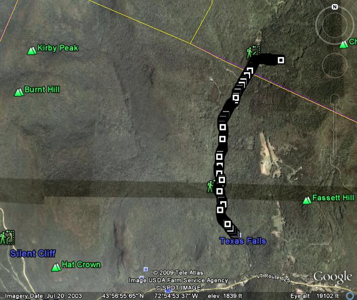
I travel fairly frequently between Middlebury and the Mad River Valley, which brings me by the side road leading to Texas Falls on the descent from the top of Middlebury Gap on the Hancock side. On the way to Hancock, you can’t miss this left turn, which is a well-labeled Green Mt. National Forest roadside attraction. Most people in the area have stopped by this pretty little grotto and waterfall at some point in their travels, but few have explored beyond this well known attraction on the forest service roads and trails which continue above it far into the mountains.
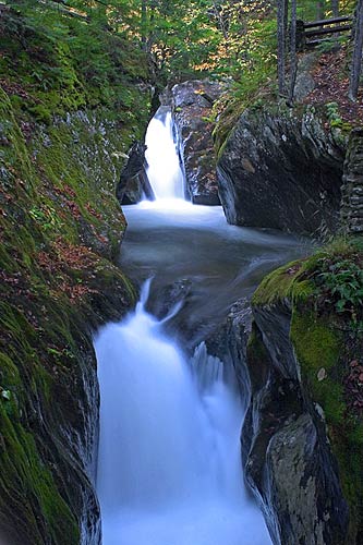
Photo courtesy of northeastwaterfalls.com
After taking a look at this pretty little site, you can loosen up for the uphill run which awaits you. Head up the road a short distance past the picnic area until you get to the forest service gate, where the surface goes from a mix of paved and well maintained dirt, to a far more primitive dirt road. This road was passable to 2WD vehicles for many years, and people took advantage of it to access some primitive campsites up the road. The flash floods of 2008, however, have badly washed the roads out, making them unsuitable for even 4WD vehicles – in places the road narrows to a width of a footpath. Bad for the cars, good for the runners! The trail/road runs parallel to the stream for a while as it stairsteps uphill through the national forest. In previous runs I have seen coyote and wild turkeys up here, but there was no wildlife of note on this run. The run has a few short steep sections, but nothing too overwhelmingly difficult. After around 2 miles of climbing, there is a plastic mesh fence across road requesting that you proceed no further, but looking at it more closely, I could see that it was aimed at the snowmobilers who must find this area an appealing place in the winter. I have no idea why they are being discouraged, but it is simple for those on foot to step around the sign to continue on up. Immediately after this fence, the forest opens up to some spectacular meadows.
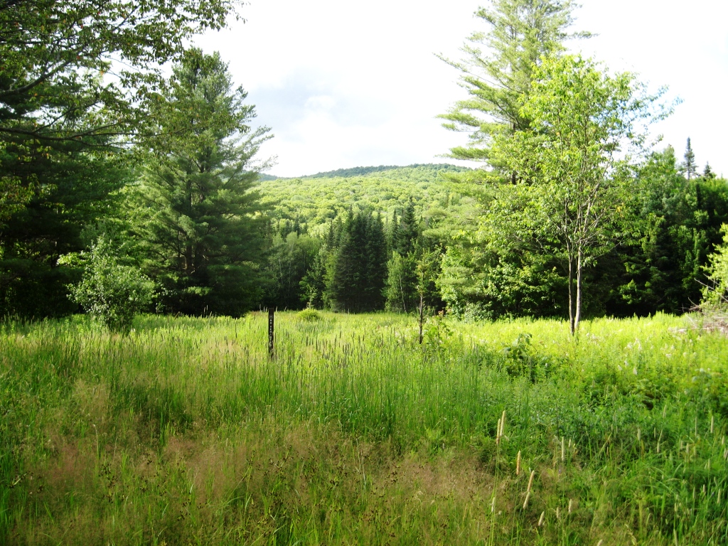
Texas Clearing
The low hills behind the meadow are actually high points on the ridge of the Green Mountains, further evidence that you have done just a little climbing. The road makes one last turn to the right for a final climb to what was once the auto turnaround, for a total climb of about 750 vertical feet and a round trip distance of 4.8 miles. I turned around and headed back to my car, but if you look at Forest Service maps, a few of the only slightly overgrown trails along the way look like they have some potential for interesting looking extensions to this run, or maybe even loops.
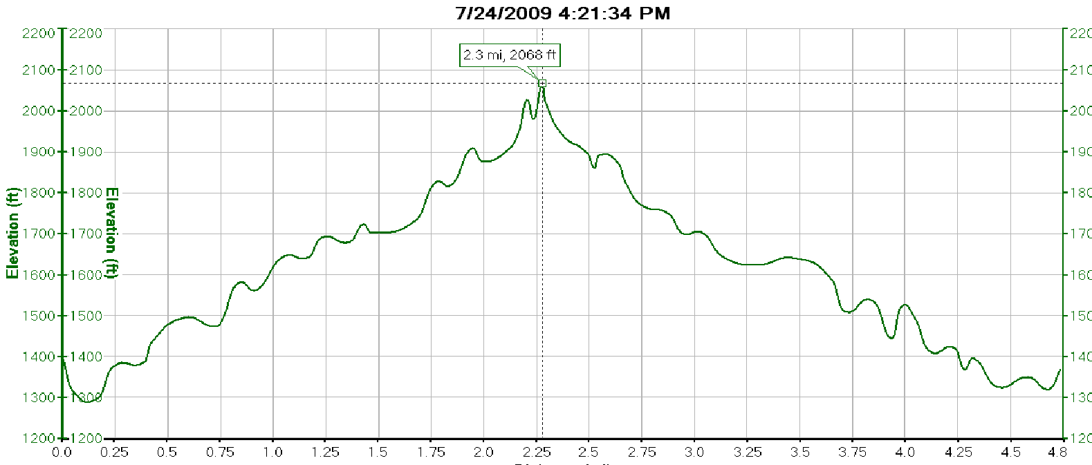 Altitude Profile