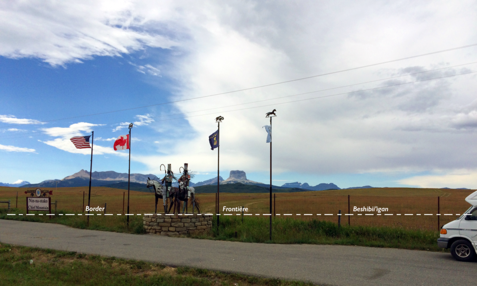
Many border crossings are not open 24 hours, which effectively locks native peoples in (or out) during certain times. This can pose significant hardships for example when participating in ceremonies on the other side of the border. Native ceremonies do not follow a rigid schedule, they take the time needed to complete the rites and may end late at night. Participants who missed the opening hours are then forced to either wait until the next morning or drive a long detour to get to the next 24 hour port of entry. The interactive map below shows all ports of entries, including opening times and detailed information on annual numbers of crossings by different modes of transportation. The graph below includes data on port of entry opening times.
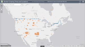 Click on the map to open the interactive version of the Ports of Entry map in which you can zoom and click on items for more information.
The top left-hand corner of the map will show several icons which can be used to navigate. The ‘plus’ and ‘minus’ buttons may be used to zoom in and out. The home button will return you to the map’s initial extent. The layer list button will open a menu that displays all the layers that are on the map; these may be turned off and on. Finally, the legend button displays a legend with symbols and labels that correspond to those on the map.
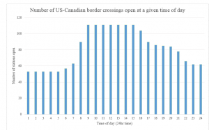
The histogram at the left shows the number of US-Canadian border crossings that are open at any given hour of the day. The horizontal axis shows the hours of the day in 24-hour time, and the vertical axis shows the number of crossings that are open at that time. Naturally most are open during regular business hours, but only about half are open through the night.